Day 9: Slept beautifully. Had to adjust from no sleeping bag (and a personal cooling fan), to a 60 degree bag, then to a 30 degree bag, and finally added a blanket at the end.
Got about 10 hours, which is a rarity, then stayed in bed for an extra hour which absolutely never happens. But feeling a lot better even if I’m not 100%.
Stopped off at campsite registration desk around 8:15 to ask directions for the 9am Pueblo cliff dwellings tour I had booked and was told it was 45 minute drive. Cool, no problem at all. Barely made it over in time after a transit van with a trailer refused to use one of the turnouts to let the line of cars behind him pass. I guess he was running late too.
Made it just in time for the tour. I was still a little sick on the tour and probably a little more impatient. After setting my own pace for the past week it was hard to slow down as we bottle necked at a few ladders and crawl spaces.
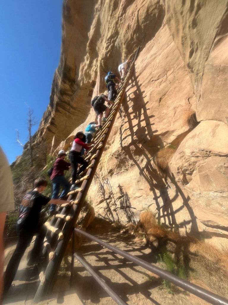
Nonetheless, the dwellings were awe inspiring. It’s so impressive that a civilization could flourish here for hundreds of years, and that some of their structures would still be standing 800 years after they left.

After the tour I drove back to the campground and was able to take a shower for the first time this week. There was even hot water!
Made another peanut butter and banana sandwich that may need a straw to eat next time, but at least there were no children around to take pity on me.
Started the drive to Black Canyon of the Gunnison National Park and took the scenic route to drive through the town of Ouray, which had been recommended by Alex at Sky Pond. Like most of the drives in Colorado, the were plenty of great views from the highway. But not many gas stations, or any for about 30 miles. And I needed gas. My range finder went from 40 miles left to “low” and I still had about 15 miles to go. Unsure if I’d get down to town or not all I could do was hope and pray. But the good news was that we were in fact headed down into the valley. I barely had to touch the gas pedal the last 10 miles as we descended into the charming town with a bustling main street. I coasted through town and made it to a gas station that charged like it was the only one for 50 miles.
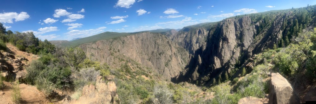
After refueling I only had less than an hour to get to Black Canyon. The campground was before the canyon, so I set up camp then headed out to see the park. This place is overshadowed by the canyon in Arizona, but it is breathtaking.
Only stayed out for about an hour so I could eat dinner and get to bed early again. Trying to kick this illness in Colorado before heading to Arches National Park in Utah tomorrow.
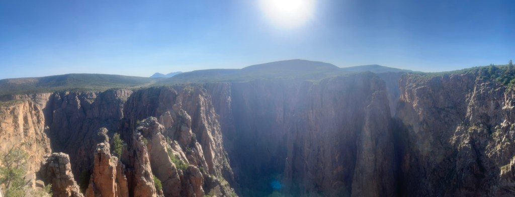
Day 10: Woke up unsure of the time, and couldn’t fall back asleep. The sounds of birds chirping told me sunrise was approaching, so I may as well get up. It was shortly before 5, and I decided to pack up my stuff and try to check out the canyon at sunrise. I ate breakfast in the car and was on my way before 6.
I made it to the first lookout point and pulled over. Although there were a few cars, there was no one else in sight, they must have been farther down in the canyon. Got to take in a solo sunrise, that was much prettier than my amateur photographer skills would have you believe.

Continued down to the end of the park and hiked Watchman’s Trail, which was a short 1.5 mile out and back with the best view of the canyon at the end.
Drove to Moab from Black Canyon of the Gunnison. I caught up with my good friend and former coworker, Mason, on the drive and was in Moab in no time. I got to the private campground I had booked in Moab around 11:30 and hastily set-up my tent so I could get to Arches National Park by 12 for my 1-hour timed entry.
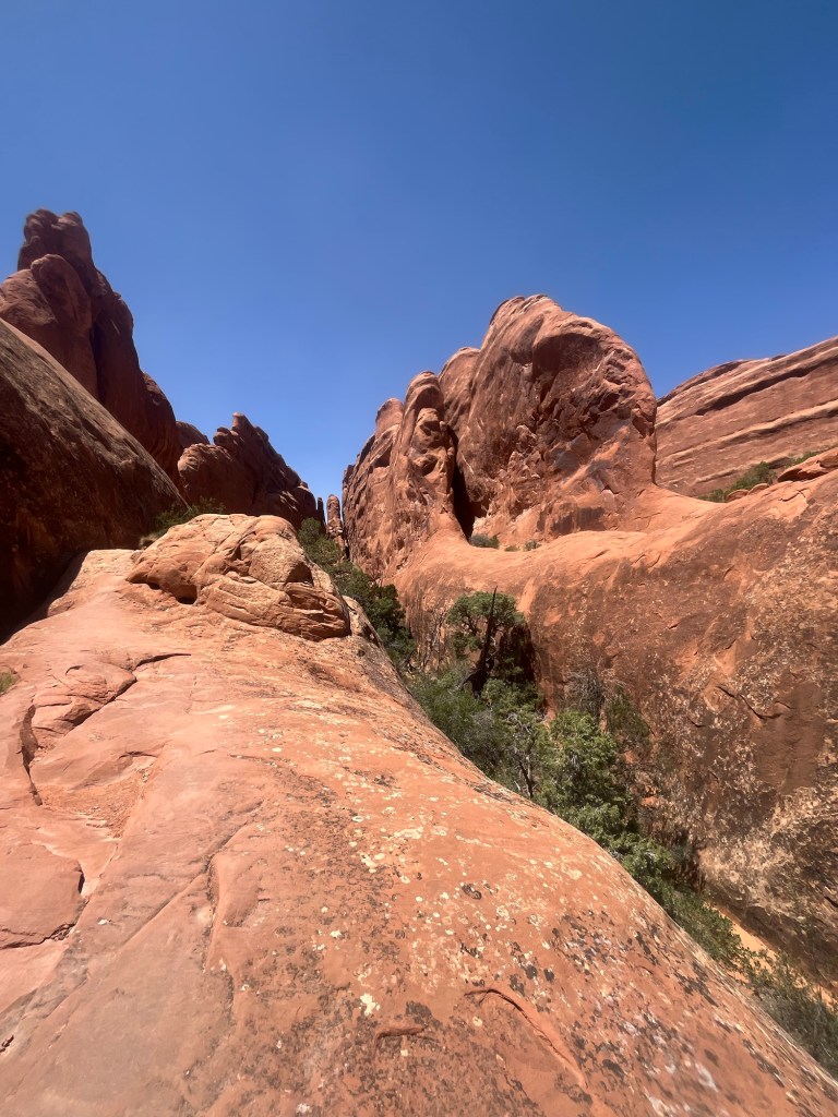
Made it to Arches and the line to get in was not even 10 minutes. My plan was to hike Devil’s Garden, and the trailhead was near the back of the park, so I got to enjoy the scenic drive through what essentially felt like Mars.
Made it to the trailhead around 1 and started packing some water, Body Armor, and snacks. I decided to bring an extra liter of water at the last second, so that I would have some margin for error.

This is one of the highest rated hikes in Arches, but it is not well traveled in the summer, especially the afternoon. From mile 1 to 2, I did not see anyone else, but when I did it was my friends from Great Sand Dunes National Park. I was hiking counter-clockwise on the loop and they were moving clockwise, and were near the end of their day.
Shortly after we bid adieu, I noticed what looked like a sightseeing helicopter in the sky above. I guess that’s how the 1% tours the park. Around the next turn, there was a young lady staring up and waving at the helicopter. That’s strange, why would she wave at a sightseeing helicopter. I said hello, but she didn’t even acknowledge I was there. I continued down the next hill and noticed another lady, who was similar age to the first, hunched over underneath one of the few trees. Oh shoot, that’s not a sightseeing helicopter.
I stopped to ask if she needed any help, which seemed more than a little obvious. She relayed that she had a bout of food poisoning occur on the trail and would not have the energy to complete the hike, even though she had plenty of water left under normal circumstances. We changed the subject for a few minutes and discussed where we were from, and what we did for a living. She, “Lisa”, is a doctor in Baltimore and her friend, “Mary”, is an ICU nurse.
Mary came back down from the hill and told us the helicopter had spotted her and was currently looking for a spot to land. I asked if she needed any water and she drank almost a liter of water in a matter of seconds (good thing I wanted some margin for error). Apparently, she had run ahead on the trail several miles to alert search and rescue, then run back to make sure they found Lisa. I offered to stay and wait, but they both insisted they did not need anymore help from me and I got back on the trail knowing that Lisa was in more capable hands with Mary, than if I had stayed.
Shortly after I left Lisa and Mary, I reached the primitive section of the trail, that included a lot of hiking on and over large rocks. I had never hiked long sections on this type of terrain before and the trail could be difficult to follow, but whenever I wandered off a little I could find my way back thanks to AllTrails.
There was over an hour stretch near the out and back to Dark Angel, when I did not see another hiker.
Although, it was over 90 degrees, there was a steady 20 mph wind with gusts up to 30 or 40 mph, that kept me cool, and maybe a little off balance at times. It also kicked up a good bit of dust that got in my eyes despite wearing sunglasses.
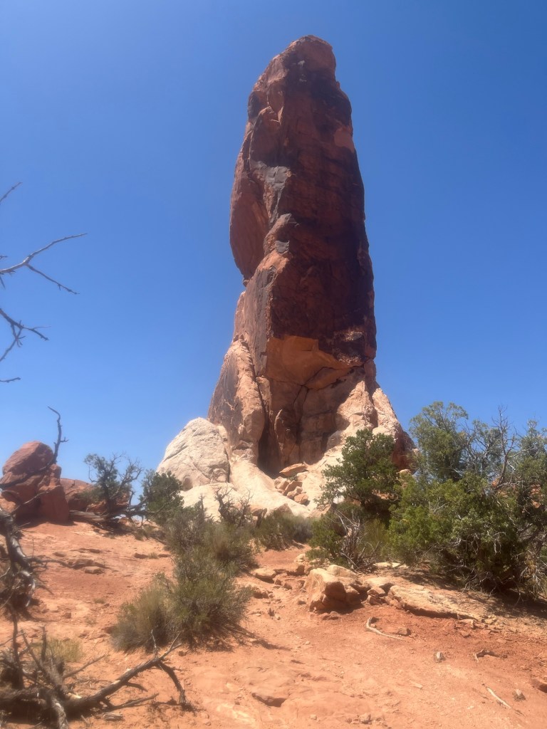
I got to see quite a few arches on the back section of the trail, all of which by myself, as there were only a couple other hikers this far out. I enjoyed getting to take in these impressive rock features without distraction, as if I was the only one to know of their existence.
As I got off the primitive loop there were a lot more people doing the out and back sections to a few of the closer arches and I was able to get an older lady to take a picture for me, well, really for my mother (you’re welcome mom!).
There was about a mile left, and it was very manageable compared to the primitive section of trail. Near the end I could see search and rescue vehicles in the parking lot. As I got closer, I could see Mary sitting near the trailhead. I stopped to ask how Lisa was doing and was told the helicopter was eventually able to land, and that she had been airlifted to a hospital.
Happy to confirm she was doing well, I got in the car and headed back into the main part of the park to see some of the sights that required less of a walk.
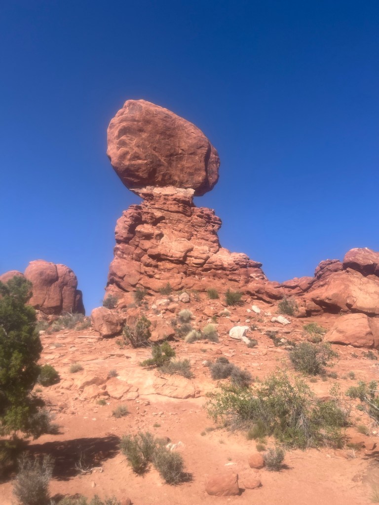
I stopped first, at Balancing Rock, and lingered for about 30 minutes admiring its resilience.
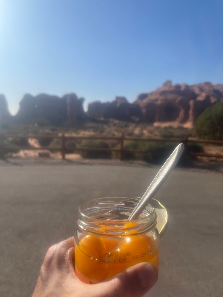
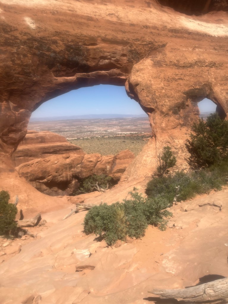
Next, I went to Double Arch and and the Windows, where I downed a 24oz jar of sliced peaches, which was the most satisfying snack/meal of the trip so far (shoutout Costco).

As I was nearing the end of the hike around Windows my eyes started bothering me, so much so that it was tough to look into the light. Not good timing considering I had about a 45 minute drive and the sun was yet to set. I pulled over several times, my eyes bloodshot and burning. Thinking it may be sunscreen that had ran into my eyes from perspiration, I wiped my face down with baby wipes, and flushed my eyes with water at the Visitor Center. All to no avail.
While I was driving back, I received a call from a Utah number. Because I am actually in Utah, I answered. It was “Terry”, the owner/manager of the campground I am staying at. Apparently, he had found my tent on top of the roof of the bath house. It was blown there by the strong winds I had experienced in the park. By this point he had already returned it to the ground and only found one small hole in the bottom. Frustrated with myself for not properly staking it down, I thanked Terry and continued my tearful drive back to camp.
After safely returning to the campsite, I headed straight for the bathroom and continued flushing my eyes with cold water. About five minutes later one of the other campers entered and we began discussing possible causes and remedies. He grabbed some eye drops and as I clumsily applied them he introduced himself as Nathan, an intern with the US Forrest Service based in Colorado, but originally from the Cleveland area. Waiting to see if the eye drops would work, he insisted that I see Delicate Arch in Arches National Park before leaving and I agreed to go in the morning, if I was feeling better. At this point Nathan had offered to take me to a clinic to make sure that it was not something more serious, but to proud to seek medical attention, I decided to hop in the shower and see if that would flush my eyes better than splashing water in them from the sink. Whether this worked, or simply that it had gotten dark, and I no longer had to look into the light, my eyes felt better.
I crawled into my tent, which was now firmly staked, and fell asleep quickly, even though it was still close to 80 degrees, ending what had been the longest day of the trip.
Day 11: I am awake, not for the first time. My eyes feel better, but it is warm, and I can’t cool down by getting out of the sleeping bag, because I did not use on to begin with. I feel alert, hopefully, it’s not that early. Shoot, not even 4am. I need a reverse alarm clock. One that keeps me asleep until at least a designated time.
I waited about 30 minutes before getting up and finally shaving, which I had intended to do the night before. It had been over three days, and my facial hair, while still barely noticeable had never been so long. It felt better than a long bath would.
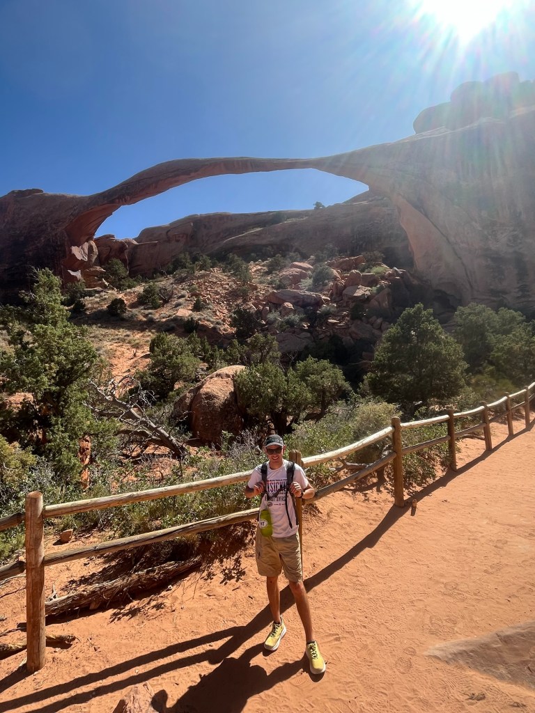
Unsure whether my eyes genuinely felt better or were just doing well in the absence of light, I decided to head to Delicate Arch for sunrise and find out there instead of wallowing in my tent.
It was about a 30 minute drive, plus the 1.5 mile hike and I had a little less than an hour to sunrise. Good thing there’s no one else on the road at 5am.
I made it to the parking lot at 5:30am. With 25 minutes to go I bounded up the trail reeling in a handful of hikers who had started before me. My racing instincts never turn off.
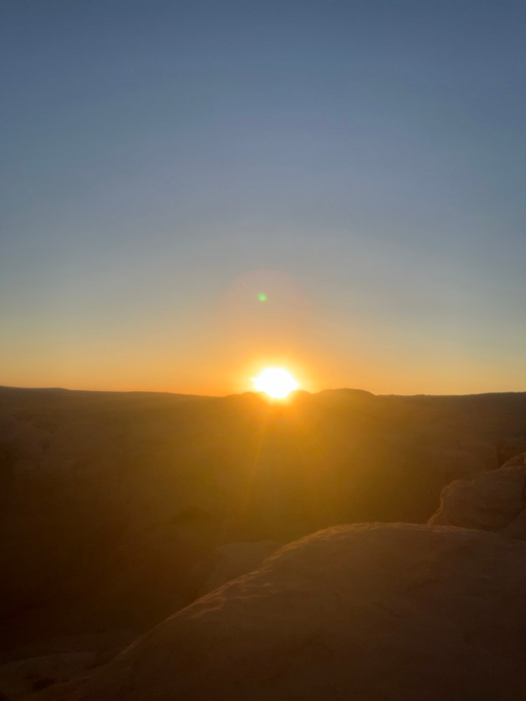
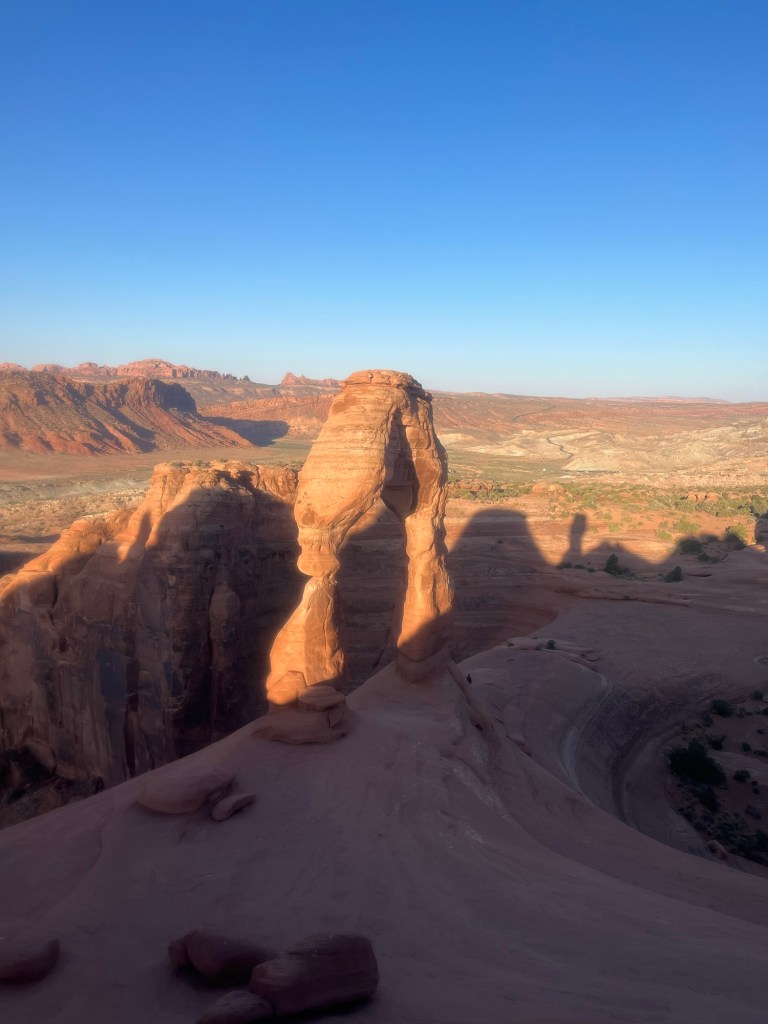
I made it with minutes to spare and witnessed one of my favorite sunrises. The viewing area for Delicate Arch faces west, so the assembled crowd all faced east to watch the sun crest over a distant rock formation, then turned west to watch the shadow disappear from the arch, with light slowly taking its place.

For the first 45 minutes, no one moved closer to the arch to take a picture underneath it. There was a silent agreement that to do so would break the serenity of the moment. It was beautiful.
But, was not to last. New hikers showed up, and headed straight down to the arch, as if they were the first to ever have the idea. Slowly other followed and a crowd formed beneath it. I stayed until the light was almost to the bottom of Delicate Arch, then headed back down the trail, smiling at how lucky I was to start my day in such a magical place.
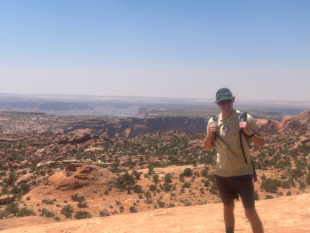
While planning the trip, I selected at least one potential hike for almost every place I would visit. This time, it was Syncline Loop in Canyonlands National Park, which is adjacent to Arches National Park. Without checking the details of the hike I plugged the trailhead into the GPS, and only had an hour drive.
I was so focused on making it to sunrise, that I had yet to eat anything. Eager to start the hike earlier to avoid the worst of the heat, I concentrated more on the road and only ate a Cliff Bar before making it to the parking lot. Knowing that I should stop and eat more, I instead packed some extra food telling myself I would eat on the move.

At the start of the hike there was a sign emphasizing the difficulty of the Syncline Loop. Thanks for the extra motivation, sign gods.

The first mile, was pretty flat and the trail was not difficult to follow, then I got to the side of the cliff and saw that it was rocky switch backs all the way down.
Here’s where the hike really began. Still fresh, and aided by gravity, I scrambled down, navigating the trail with all four limbs as the terrain required. About halfway down, I saw a group of four other hikers who were headed up. I encouraged them that the end was near, and kept following the cairns (small rocks piled on each other, that serve as trail markers) down to the bottom.
For the next few miles the trail was mostly in or around the riverbed. There were a few spots where I lost it, but was always able to pick it up or double back.

Eventually the trail started meandering up, but it would always level off for stretch following a steep scramble up some rocks.
It had warmed up to nearly 90 at this point with intermittent gusts of wind. My plan to stop and eat on the trail had never materialized. I had decided not to stop for longer than it took to take a picture or adjust my pack, fearing I would only slow down after an extended break. Including the three mile round trip to Delicate Arch, I had nearly 10 miles on the day and my stomach let me know. In my mind I started counting down the miles until the end of the trail.
As my GPS hit 8.3 (the length of the trail), the end was still not in sight. Not a huge problem, I had tacked on extra mileage when I had veered off trail. Finally, to my left, I saw the road, then the parking lot. While still not the end of the trail, I knew I had made it and a triumphant smile crept across my face.
Seeing others coming down from Upheaval Dome overlook, which is either a 1/4 mile or mile out and back, that shares the same start point as Syncline, I decided to take a victory lap.
The trail was smoother and easier to follow, so I grabbed an apple out of my bag and munched on it all the way up the trail. A gentleman coming down, warned me to be careful on the top because of strong winds. I thanked him for his concern, fully confident that nothing on the trail ahead would be as challenging as the trail behind.
While it was windy, the footing was sure, and the lookout point wide. I took in the view and felt like the king of the canyon.
Not wanting to break out the stove when I returned to my car, I made the large bowl of oatmeal I should have had at the start of the day (afternoon oats), then did a driving tour of the rest of the park.
Made it back to camp and took the rest of the day to catch up on journaling and chatted with Nathan before heading to bed.

Leave a comment