Day 58: I wake up around 4:50 before my alarm goes off. Taking advantage of the head start I make a tea that Josh and Megan left out for me.
I’m out of the house at 5:20 to head down to the Lady Bird Lake hiking trail, which runs on both sides of the Colorado River.
I get started around 6, while it was still dark, but there are dozens of other runners and I feel very safe.
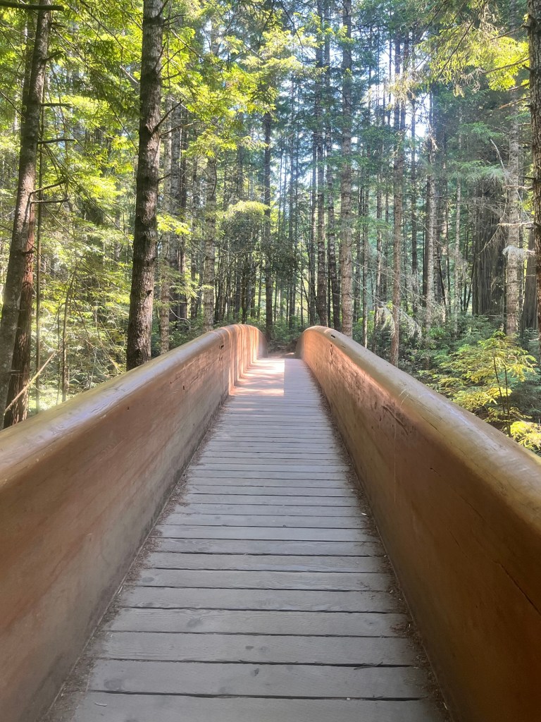
After a mile I take a pedestrian bridge to the south side of the river for a better view of downtown Austin.
The sun starts to come up as I’m out and I take the bridge back to the north side of the river and turn back to get to my car.
I only run 6 miles, but it is a fun reintroduction to running and start to the final day of the trip.
I’m on the road by 7 to begin the drive back home. It’s pretty easy going until Houston. It takes an hour to get through the city, but I finally make it through.
There are no issues until late afternoon when it starts to rain really hard. I need gas anyway and pull over at a Buc-ees for about 15 minutes to wait out the rain.
Following my visit to America’s most famous beaver themed store, drive over to Pensacola to get dinner with David and Megan. It’s good catching up and the trip has now come full circle as this was the place I stayed my first night.
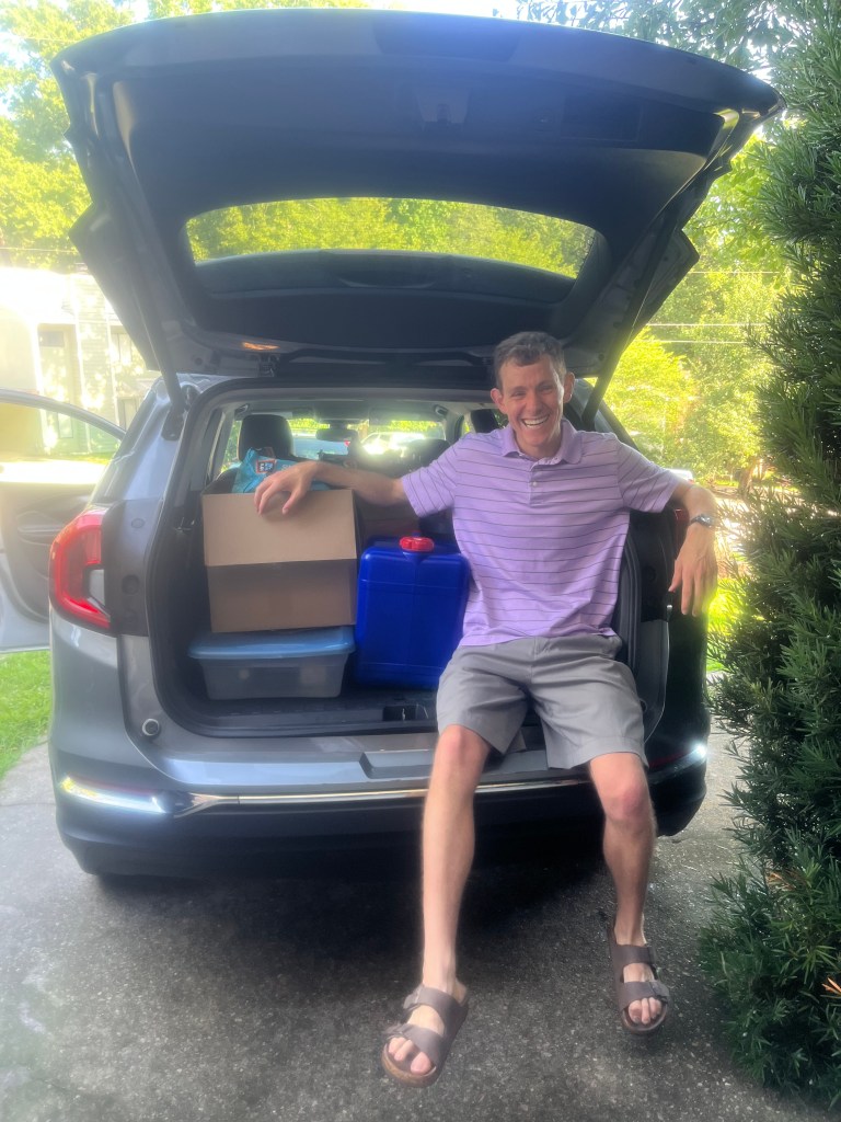
I don’t get back on the road until nearly 7:45CDT and power through the final stretch of I-10. I get home around 11:40EDT and Justin helped me unload the rental car before dropping it off at Avis. Finally home and in bed around 12:30 to complete the odyssey of a trip.
Day 59: Up a little before 5:30 for a 6am run.
Just kidding. No lengthy entry for today. Just want to say how thankful I am to have visited so many amazing places, meet some incredible people, and share so many memories with close friends.
Excited to see my Tallahassee friends and family now that I’m back.
Also, the countdown to the start of school can officially begin now!
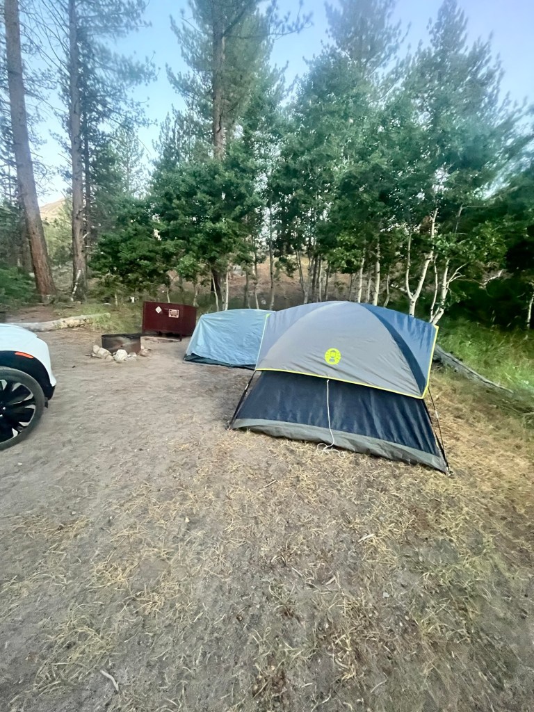
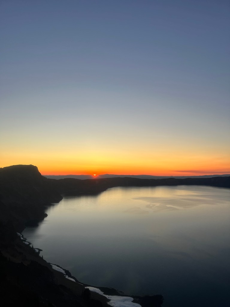
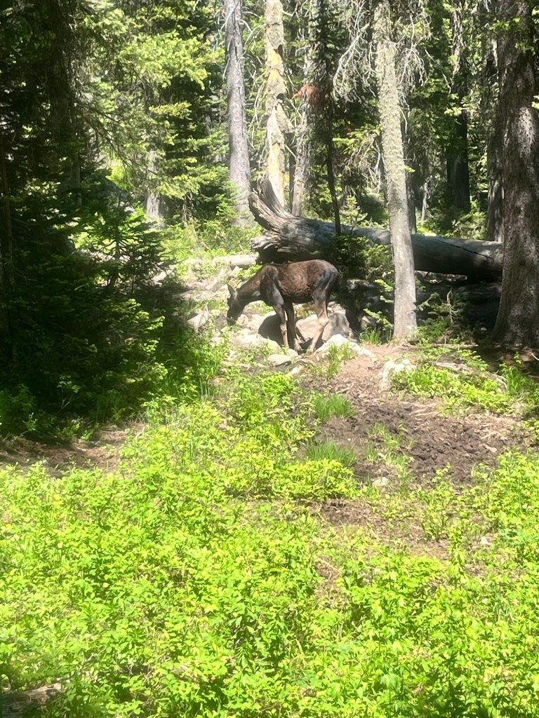
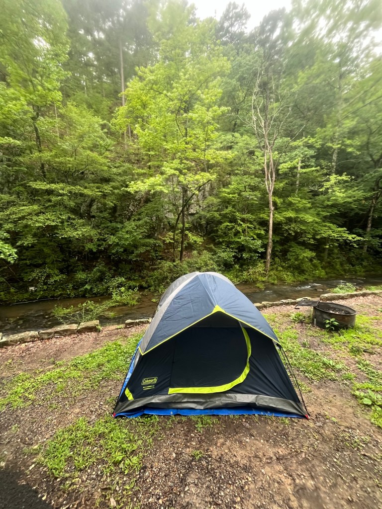
Day 55: Didn’t sleep well last night. Mix of heat, wind shaking the tent, and some unidentified animal grunting almost all night.
Finally got up around 4:30 and broke down camp before getting in the car to drive to the trailhead. I reserved the site for two nights, but there is another campground by the trailhead and closer to the park exit, so it will be a better option for tonight.
I’m on my way around 5 for a drive that takes about 45 minutes. It’s still very dark out. The park is barely in the Central Time Zone, so the sun comes up pretty late. Once I get to the trailhead I take my time making and eating breakfast as well as packing some snacks for the hike. If I had a hiking partner I’d put on my headlight and start in the dark, but don’t want to take the risk of encountering wildlife solo, so I impatiently wait until nearly 7 to begin.
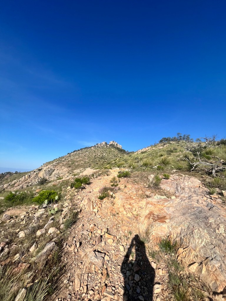
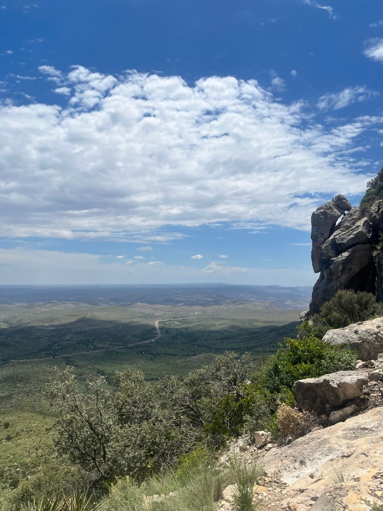
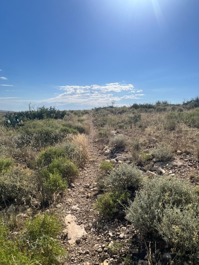
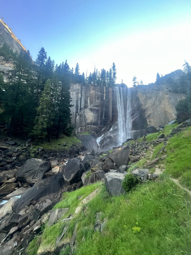
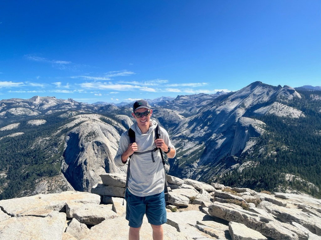
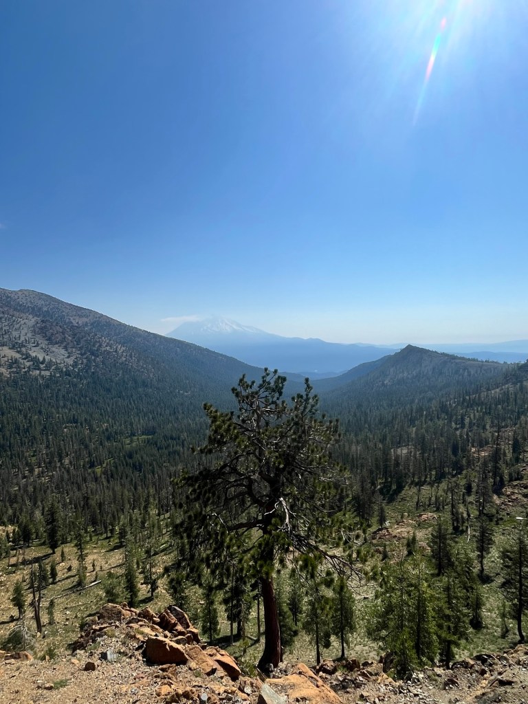
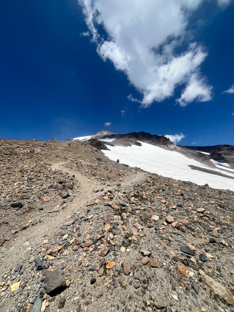
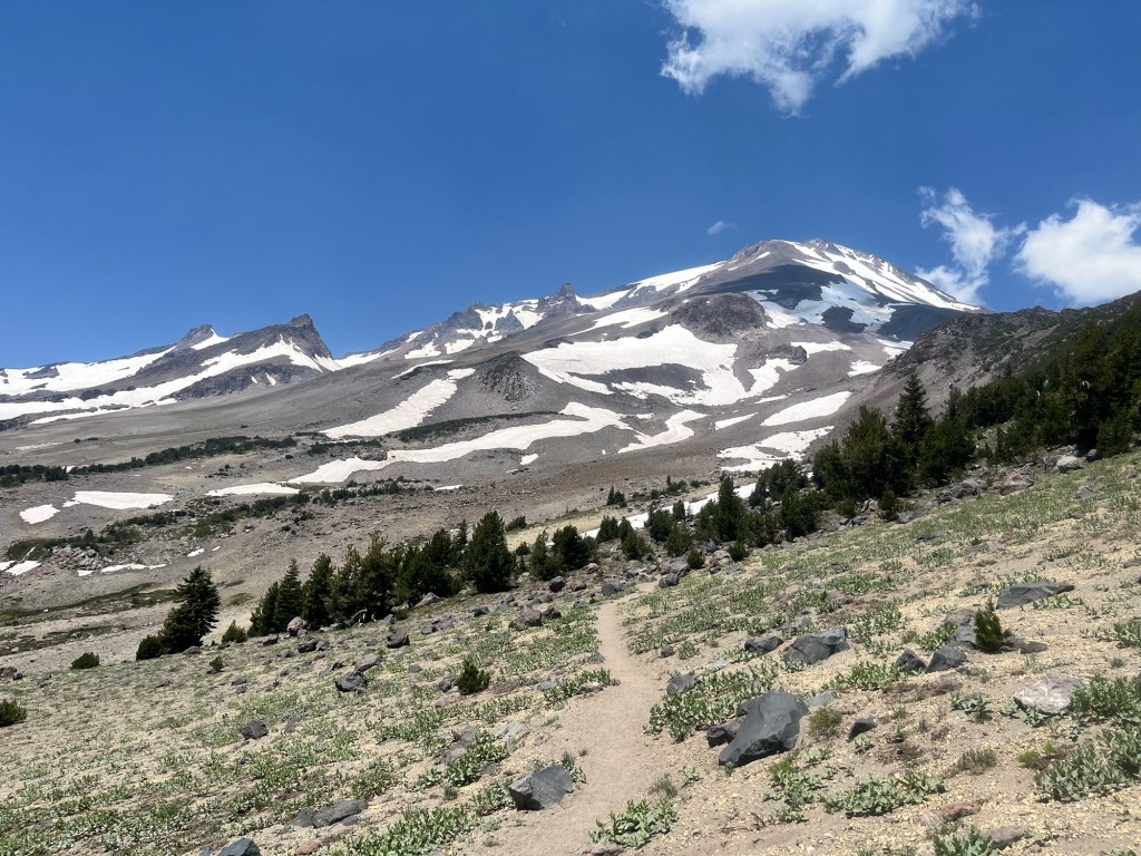
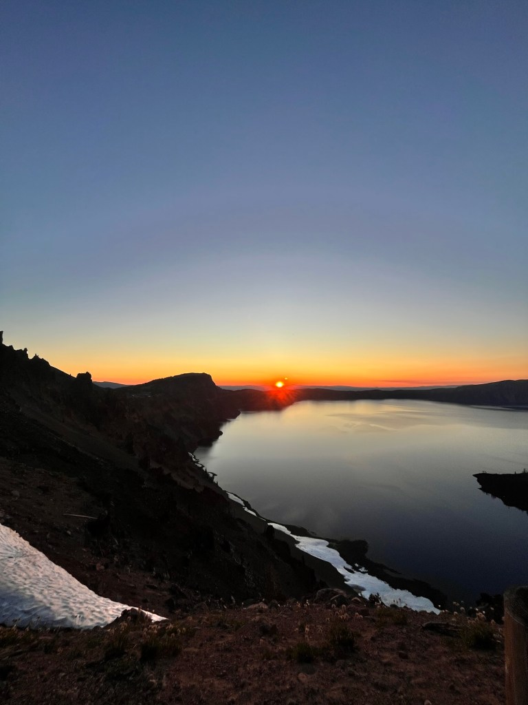
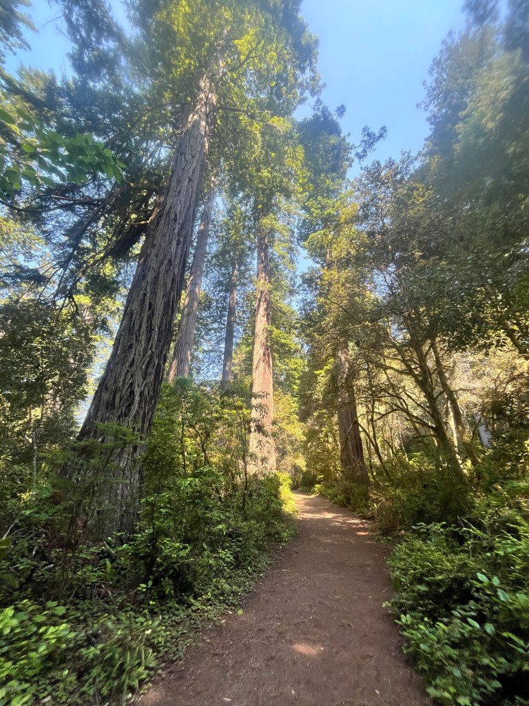
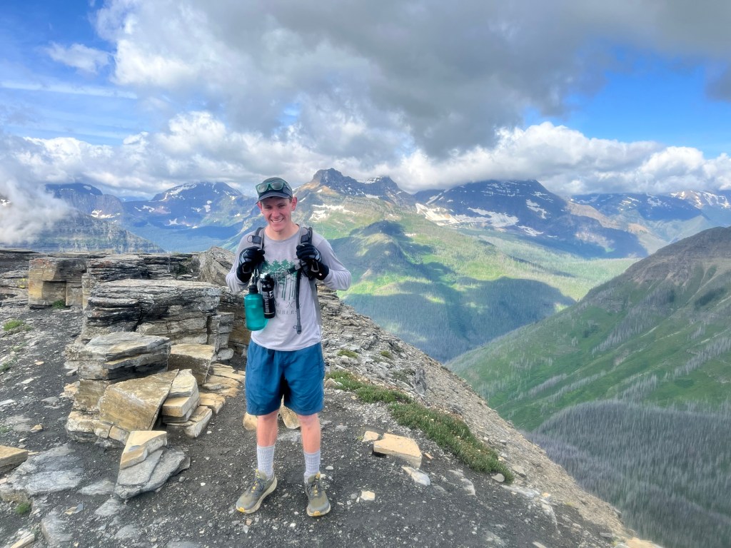
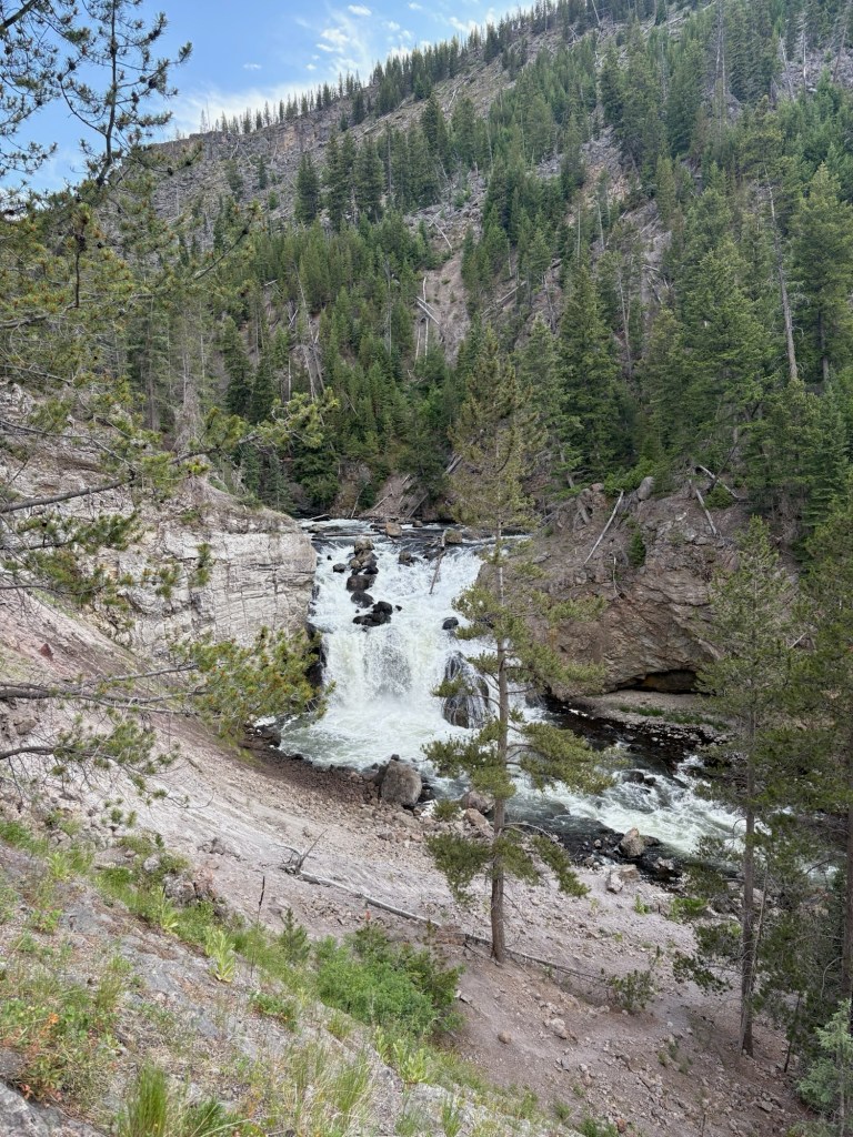
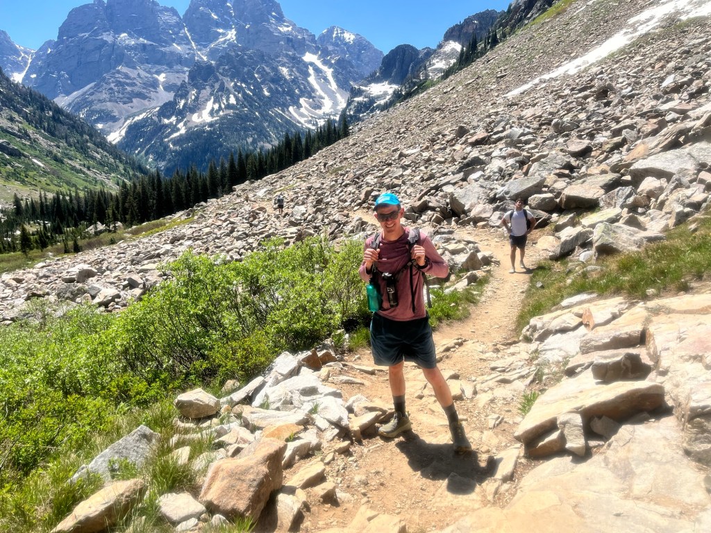
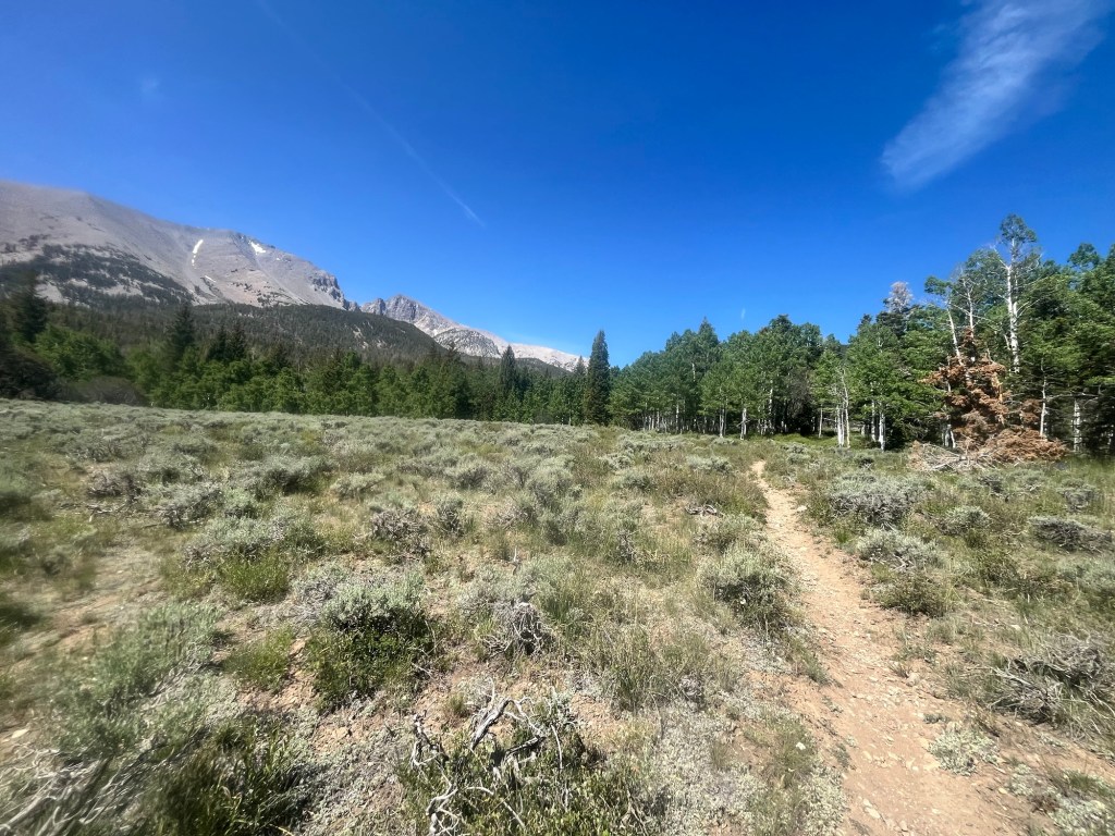
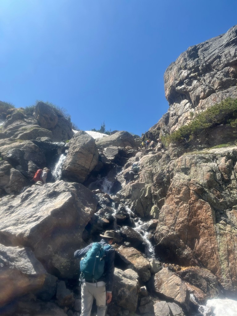
Today’s hike is a loop that includes an out and back to Emory Peak. It should be a little over 17 miles with a few shorter options should I need them. It’s the last hike of the trip and will be a good way to go out.
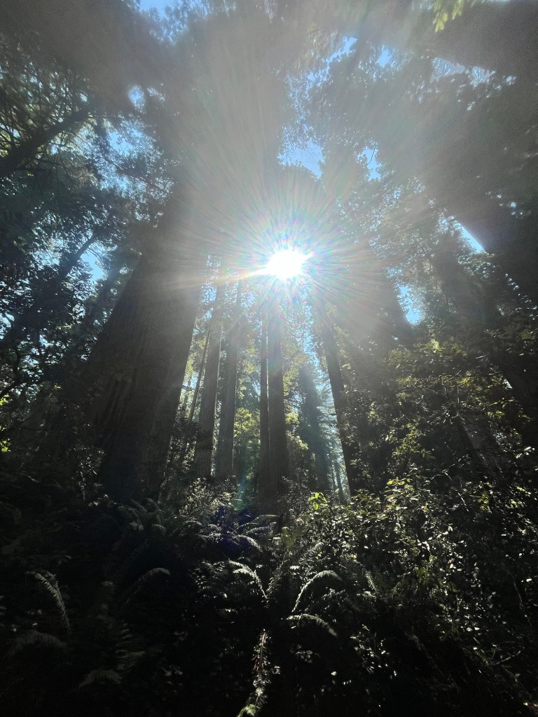
Sunrise is golden hour with birds chirping and the first rays of sunshine lighting up the sky. It’s also relatively cool out with temps in the mid-70’s.
The majority of the elevation gain is in the first few miles and I’m happy to get it out of the way early. Taking advantage of the weather I push the pace on the switchbacks. As I’m adjusting my water hose I hear a a hiss in front of me that after yesterday is unmistakable. It’s a rattlesnake a couple feet ahead of me. I back up in a hurry before it rattles its tail. The snake spends a few minutes staring me down before slowly slithering off the trail.
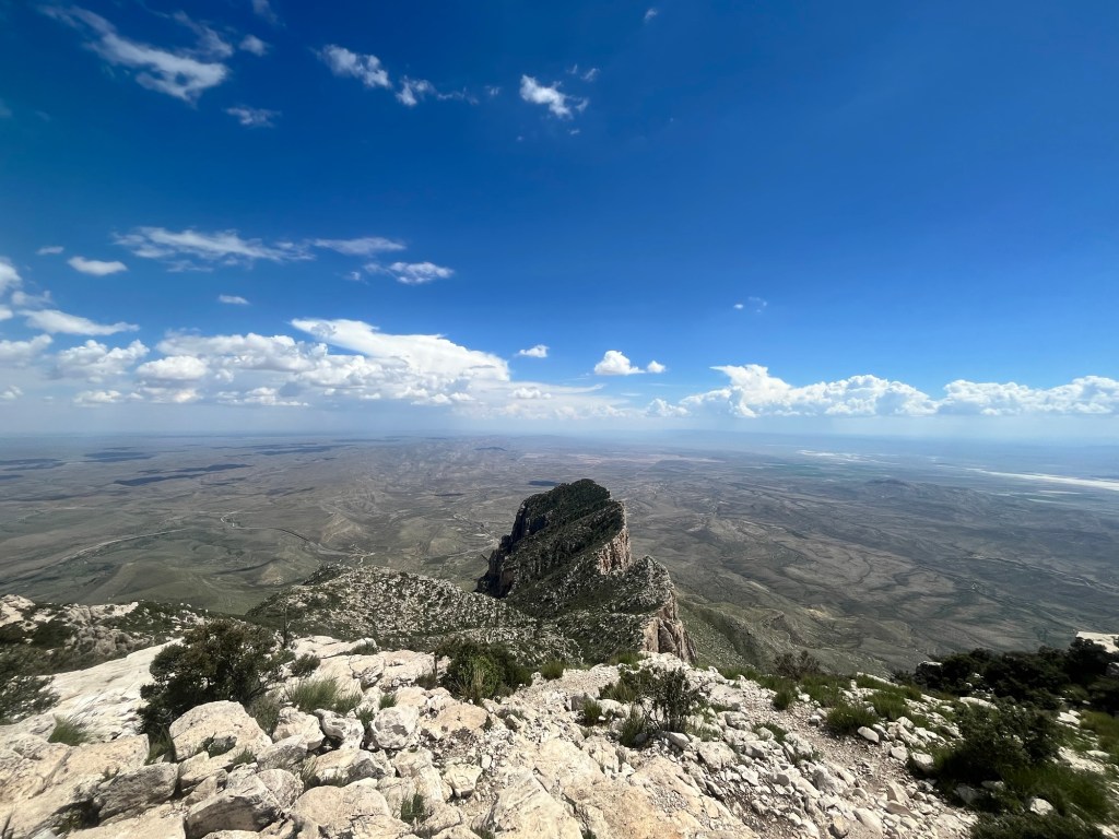
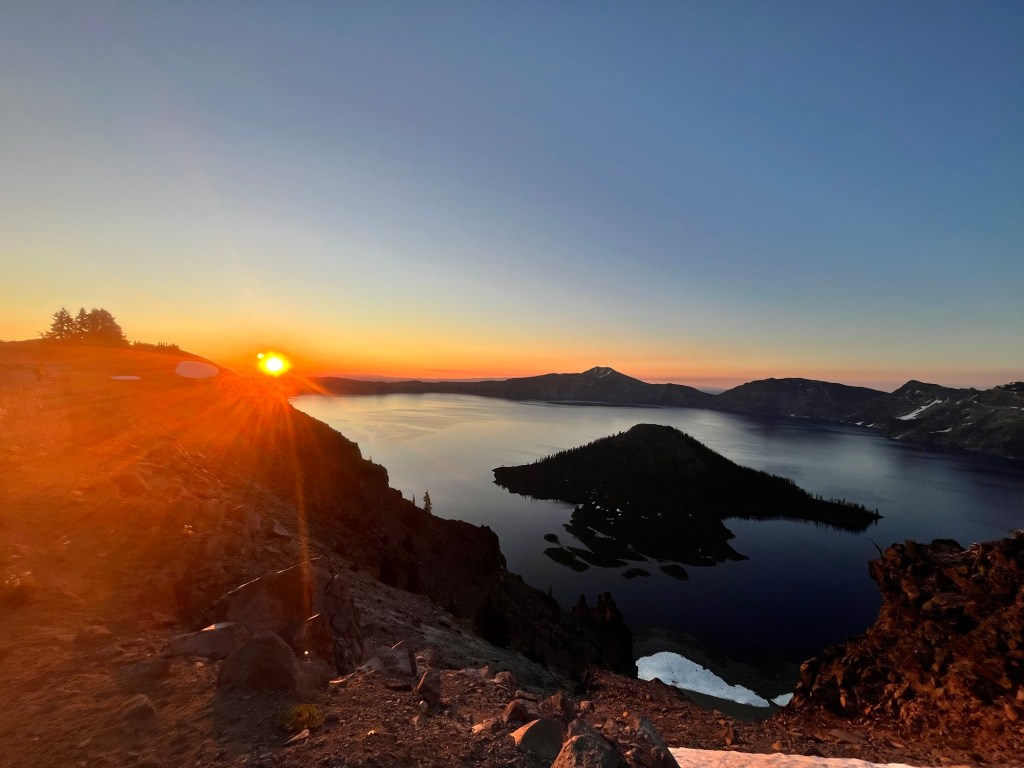
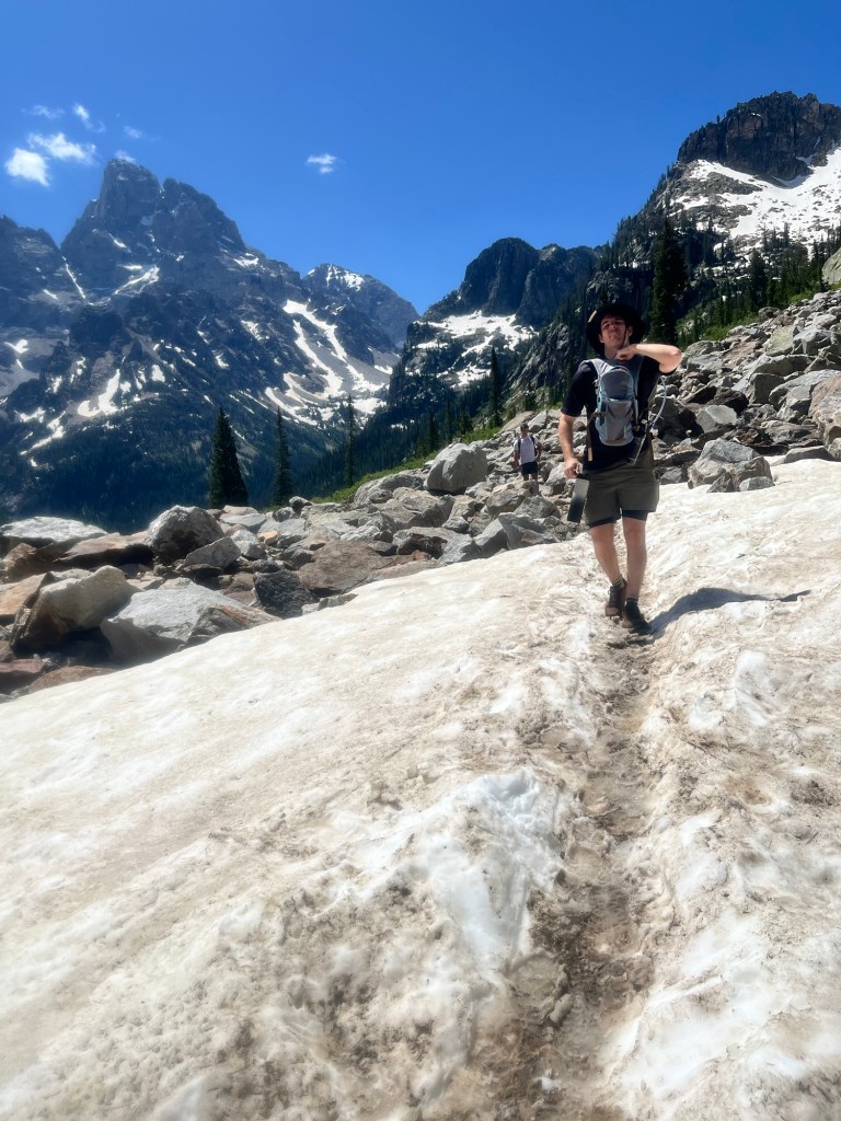
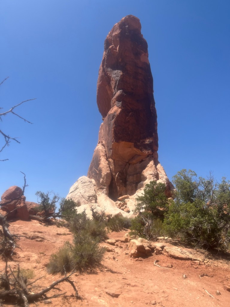
Following the snake break I continue the hike. I reach the trail for Emory Peak a few minutes later and am make my turn to head for the highest peak in the park. Around the 4.5 mile mark the top comes into view.
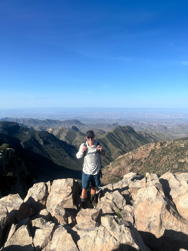
The trail description warned of a section of scrambling at the very top and even from far away the rock column is a little intimidating.
I follow the trail up to the rock and am met by two vertical columns. It’s tough to tell which is Emory Peak, and more difficult to determine which is the easier climb, until I hear voices at the top of one. It’s incredible how much easier it is to find a route up the rock when you know that someone has done it before you.
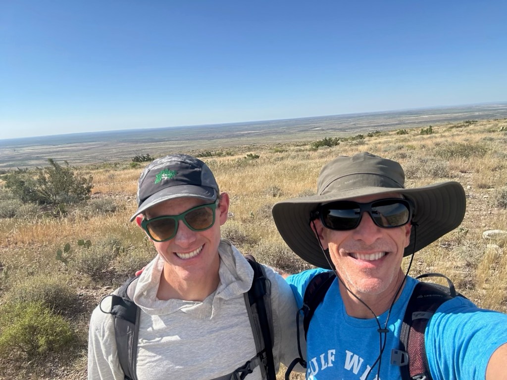
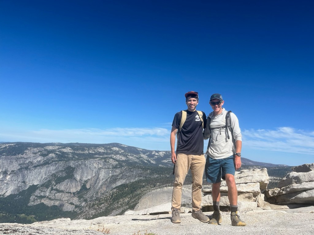
Finally, I made it to the top and am greeted by two groups of 2. The first are a couple of friends from the Austin area, the second is a young couple from rural East Texas, Travis and Ellie.
There is not a ton of room at the top, but we take turns eating pictures and munching on various snacks.
The guys from Austin headed down first then Travis, Ellie, and I began the descent. The Austin duo is headed straight back, but Travis and Ellie decided to join me for the longer hike. I’m pretty excited to have found a group for the last hike.
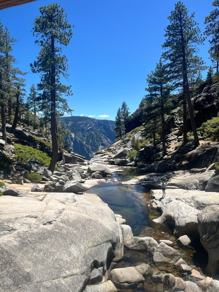
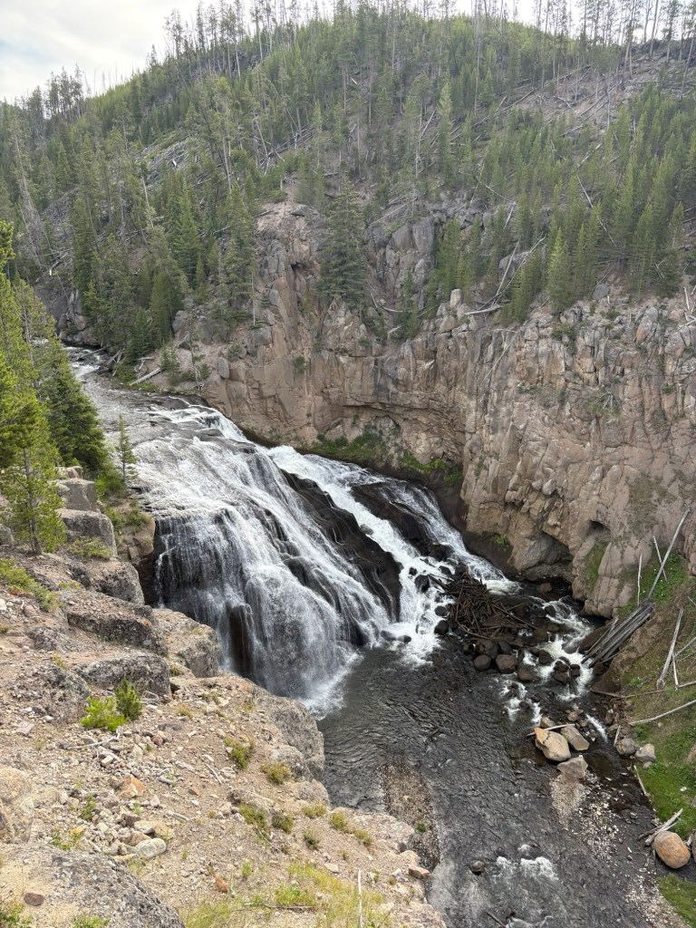
It doesn’t take long to reach to get back to the Northeast Rim Trail and we take a right to continue south and continue the long version of the hike. Shortly after that we see a sign for the South Rim Trail, which we know we are supposed to connect to. The trail is pretty moderate especially compared to the hike up to Emory Peak. There are additional signs for South Rim Trail making me comfortable enough to not double check the AllTrails map at every trail crossing. However, when I finally take out my phone to check it vibrates letting me know we have gone off course. I take a closer look and realize we went down Boot Canyon instead of East Rim Trail. It will still take us to South Rim Trail, but cuts off over a mile of the trek, which works well because it is getting warmer.
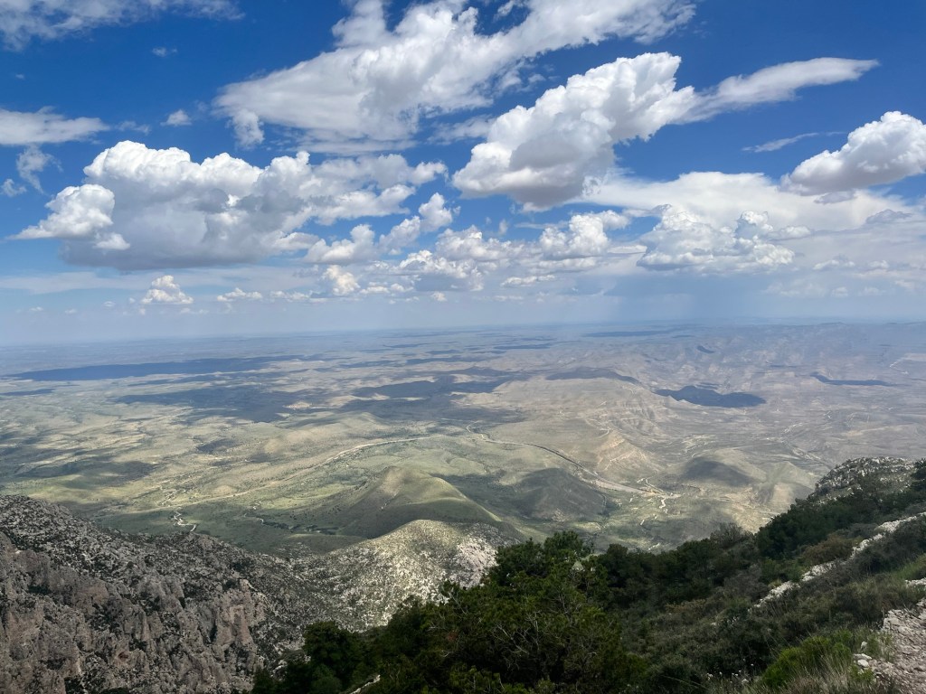
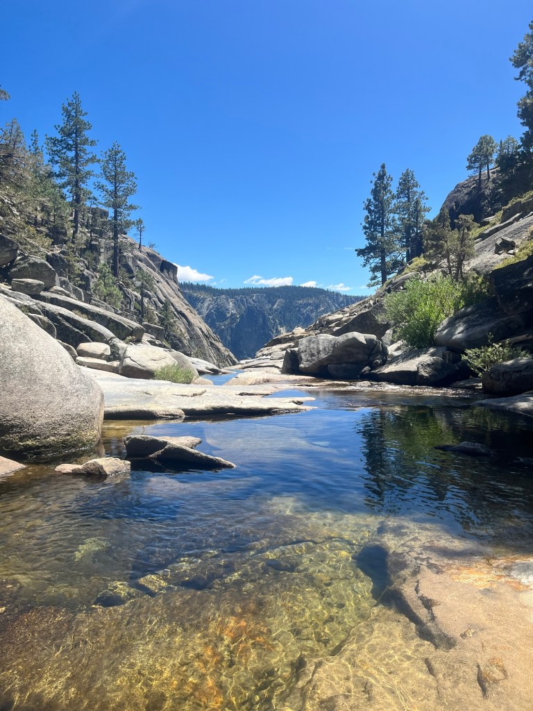
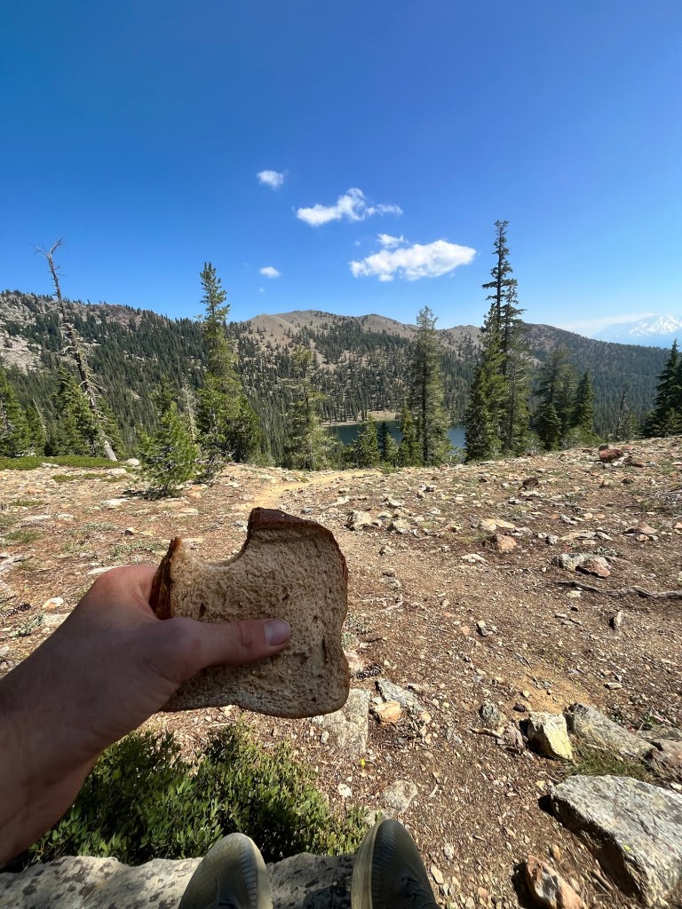
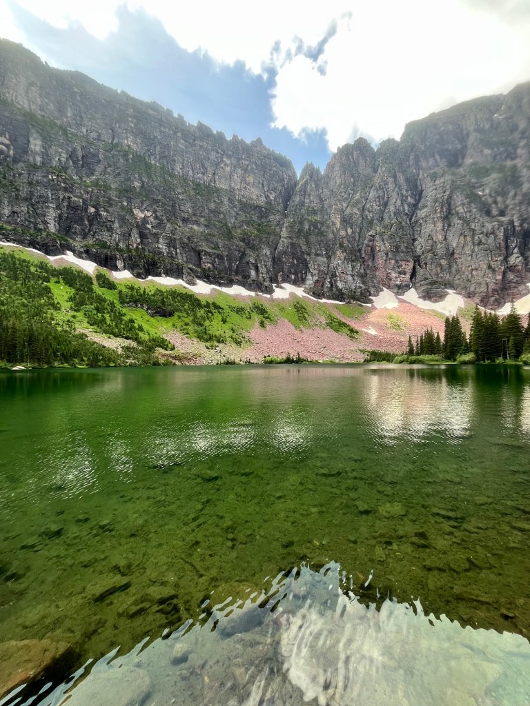
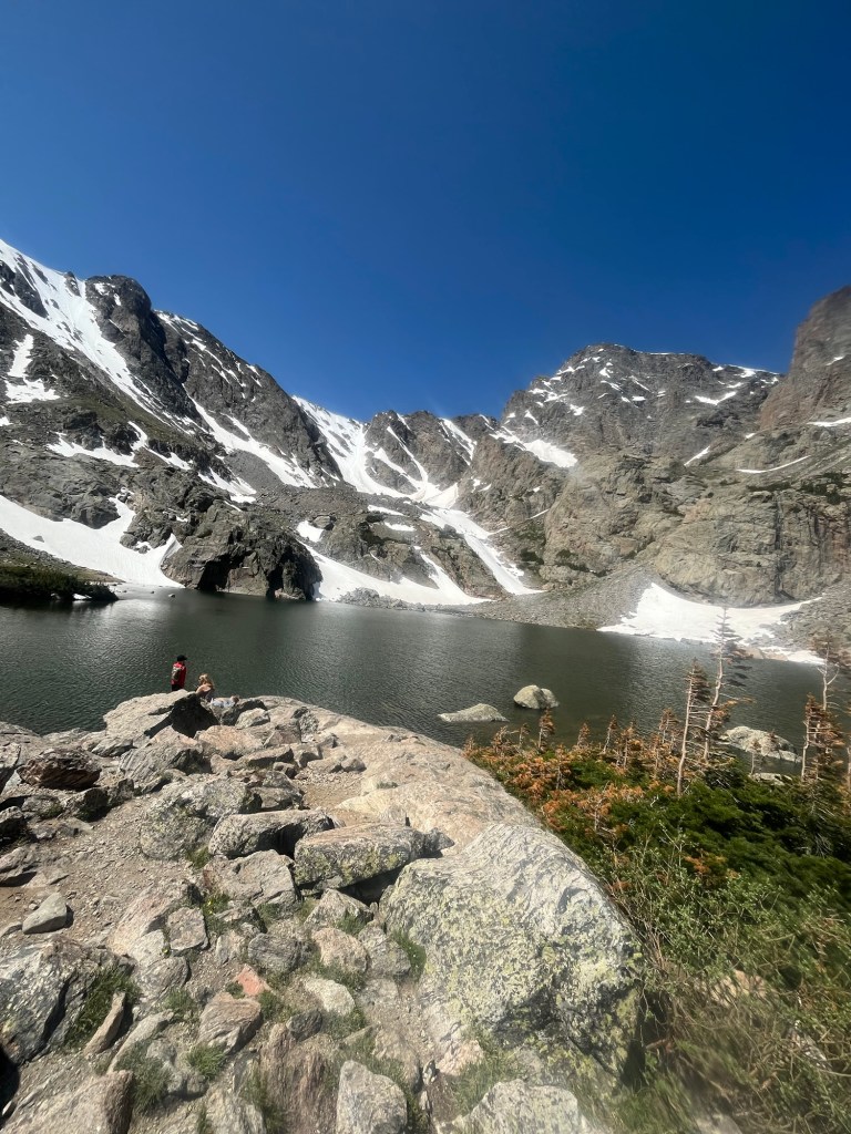
We follow Boot Canyon Trail through a canyon with a dried river bed. Occasionally there are pools of water with small water snakes that are a fraction of the size of the rattlesnake I saw earlier. We are nearly 10 miles in and decide to stop for lunch once we reach the South Rim Trail. Fortunately, it comes into view quickly and there is even a small tree for us to sit under.
The view is spectacular. Not wanting another smushed sandwich for lunch, I enjoy a meal of cliff bars and an apple, while the others enjoyed some deer jerky.
After lunch we continued along the rim for a little less than a mile soaking in the view as much as we could.
Soon after our descent into the canyon began it began to sink in for me that the last hike of the trip was almost over.
Big Bend had definitely exceeded my expectations and I was so grateful to finish off the trip in such a beautiful place.
We had parked in different spots, so with about a half mile left to my parking lot Travis and Ellie took a side trail to get to their car and we agreed to get together for s’mores after dinner.
Completing the hike is surreal. I’ve been so lucky to hike all over the American West and it’s hard to believe I won’t get to again for a while.
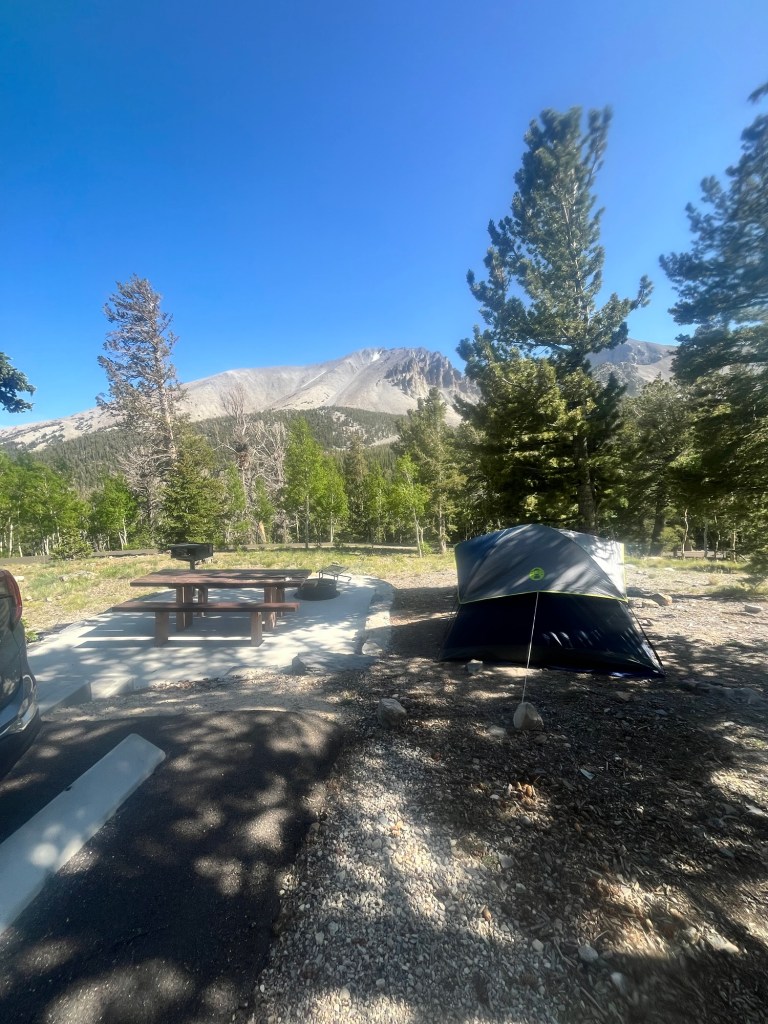
I spend a few moments in the car reminiscing before driving to my campsite in Chino Basin Campground, which is adjacent to the trailhead.
I take my time setting up camp, and am greeted by the campground hosts as I’m getting ready for dinner. They apologize that I stayed in the Rio Grande Campground, remind me that there is a dishwashing station at the restroom, and confirm that the hike we did today is the best one in the park.
I went down to the dishwashing station to clean my bowl from breakfast before making dinner. As I opened the door I looked down and saw a massive scorpion. I quickly shut the door and backed away. Texas is trying to kill me.
With no intention of trying to remove it I returned to my campsite and cleaned my bowl as best I could there before preparing supper.
After eating I head down to Travis and Ellie’s campsite. They already ate at a food truck by the campground store, and are taking it easy following the long day. We chat for a while, then make some s’mores. It’s the first s’more of the trip, which means I’m officially a camper now. The sun has already set behind the rock formation surrounding the campsite, but it is still light out and we hike up a nearby trail for about 10 minutes to the last remaining hues of light.
After the hike we say our goodbyes and return to our respective campsites. I take my time getting ready for bed soaking up as much as much of the last night in a National Park as I can before going to bed.
Day 56: Woke up around 1:30 to the wind whipping the tent. The tent is staked down well, but it is still pretty loud.
I’m able to fall back asleep until 6:30, which is incredibly late for me. I feel a little like a teenager who over slept, but I did need the sleep and tell myself that my body has not adjusted to Central Time.
I hustle to get packed up and am out of camp at 7, taking one last look to admire the canyon at daybreak.
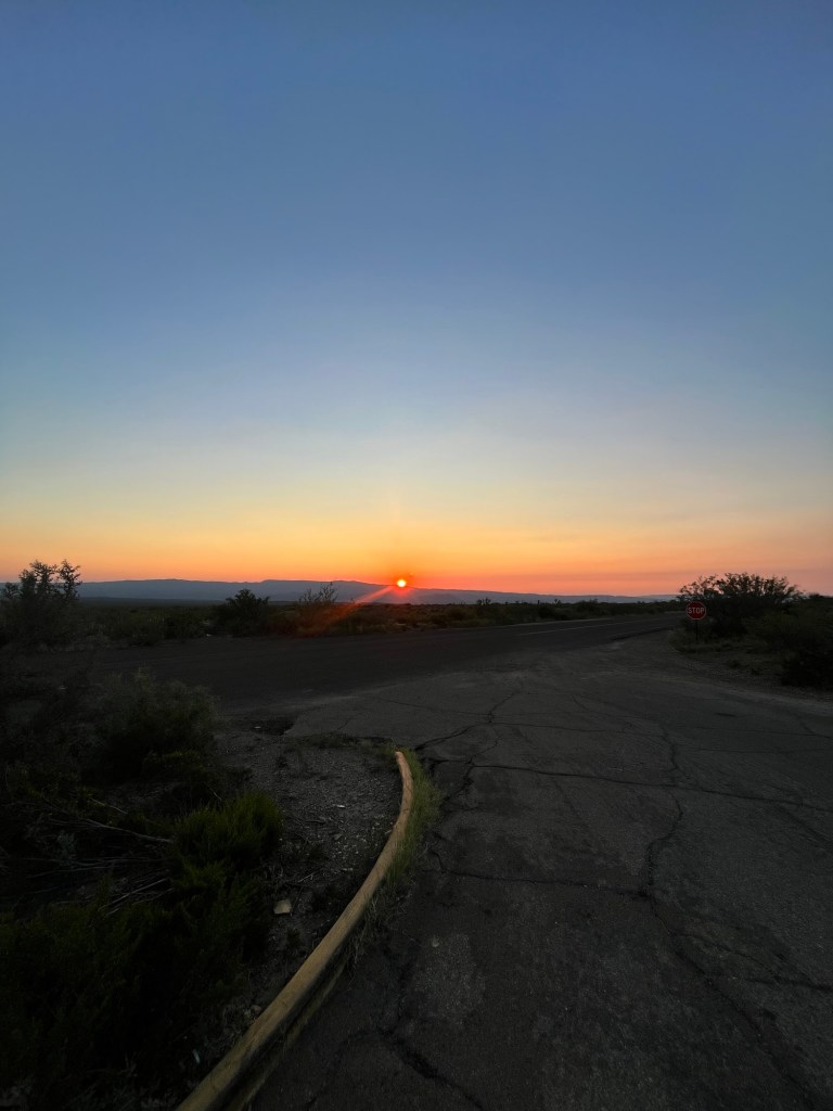
On the way out of the park I stop for gas and the tank fills very slowly. The camp host told me the station ran out last week, and it must be nearly out again. I feel lucky to get any and take just enough to get to the interstate. I’m doubly lucky because I get to see sunrise from the gas station.
The drive through West Texas went pretty smooth, and I move from the desert to the Texas hill country around lunch time. I’m reading through a biography on LBJ, so it’s cool to see some of the cities he grew up in.
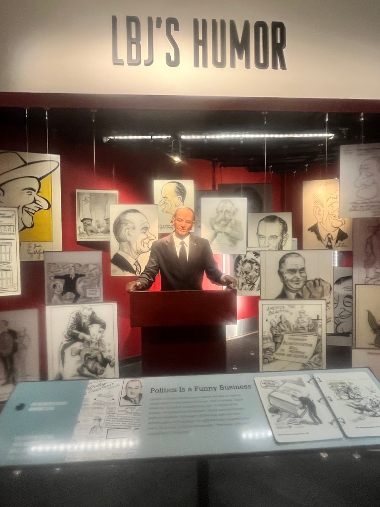
I get to Austin a little after 2 and head for the LBJ Presidential Library and Museum. The library is only open to historians, but I got to see the museum (and use a student discount to get in!) and really enjoyed it.
One of the highlights was getting to listen to some of the recordings of LBJ from his conversations in the Oval Office. There was also an animatronic LBJ that had clips of jokes he told.
There was even a replica Oval Office with the furniture he used while President.
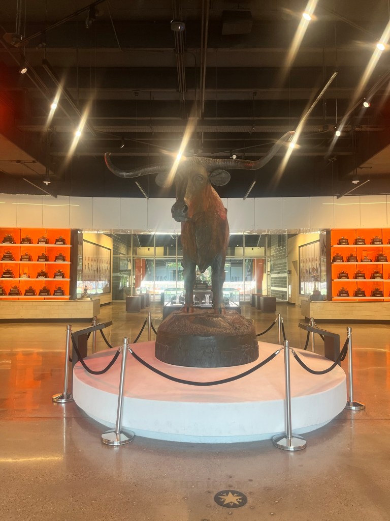
The Museum is on the campus of the University of Texas, so I was able to walk around campus for about an hour including the UT Athletics Hall of Fame.
I tried to make it out to the field, but was unsuccessful.
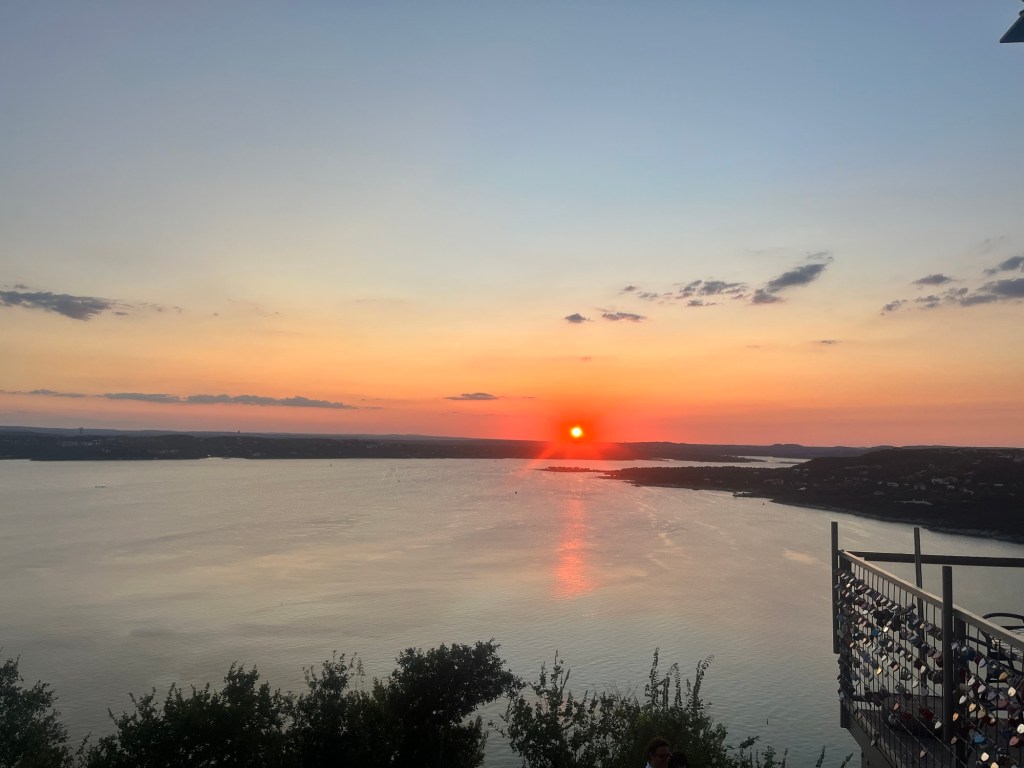
Following the visit to UT I met my friend and former coworker Josh, and his girlfriend for dinner at the Oasis, which is a Mexican restaurant on Lake Travis.
After dinner we headed back to their house in Round Rock and stayed up talking a little past my bedtime.
From 53: Up around 5 to make it to the dunes before the sun. Out of the house before 5:30. It’s really convenient to not have to pack up a tent.
I’m at the entrance by 5:45, but the gate is shut and a sign informs me that the park does not open until 7am. I debate waiting, but sunrise is at 6:20, so I’d miss it anyway.
Instead, I begin the drive down to El Paso. Carter is flying in at 9am, so I’ll have a few hours to kill, but I’d rather wait there than in the car.
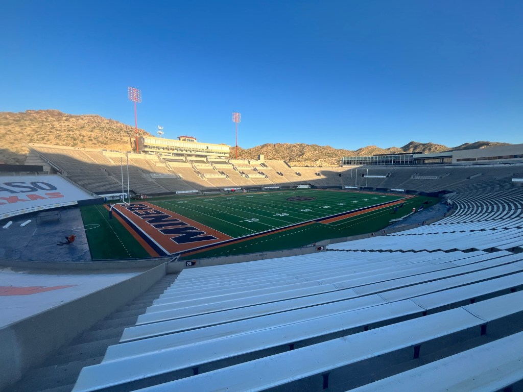
It’s only 1.5 hours to El Paso and my first stop is the Sun Bowl. The gates are open so I start walking down the tunnel and the field quickly comes into view. At first I think I have the place to myself, but soon hear people talking and a golf cart with some athletic trainers comes into view. They had just set up some coolers of sport drink for practice. Although, I wanted to go out on the field I decided not to push my luck and looked at it from the stands.
After seeing the stadium I drove around the rest of UTEP’s campus before heading for the Fort Bliss Museum. Unfortunately, as I got to within a mile of the museum I encountered a Department of Defense checkpoint that restricted access to military personnel. While nothing was going terribly wrong, it certainly wasn’t going according to plan.
With about an hour until Carter’s flight arriving, I decided to just wait in a hotel parking lot near the airport.
Once he arrived we set out for Guadalupe Mountains National Park about 1.5 hours away.
We make it to the campground around 11:15 and because the previous guest has already left and our check-in time is noon we are comfortable claiming the spot a little early.
Our hike for the day is Guadalupe Peak, one Carter did with some college buddies back in the 90’s. The start is within walking distance of the campsite, so we pack some sandwiches and hit the trail a little after 11:30.
The hike begins with some exposed switchbacks going up the side of the mountain. About a mile in we stop in one of the few shady spots to eat our lunch. It’s already in the mid-80’s and getting warmer.
We get a brief reprieve after a couple miles with a stretch of tree cover as we round the mountain pass. There is a wooden bridge Carter remembers as a marker for being near the summit. The GPS has us at 3 miles, so it seems a little early, but we’re both excited to be close to the top.
There is a brief downhill that takes us off the first mountain and onto Guadalupe Peak. We are welcomed with another set of exposed switchbacks. The views from the top of this section of switchbacks provide a great view of the valley below. It stretches for miles and we can clearly see the shade of each individual cloud covering portions of the valley.
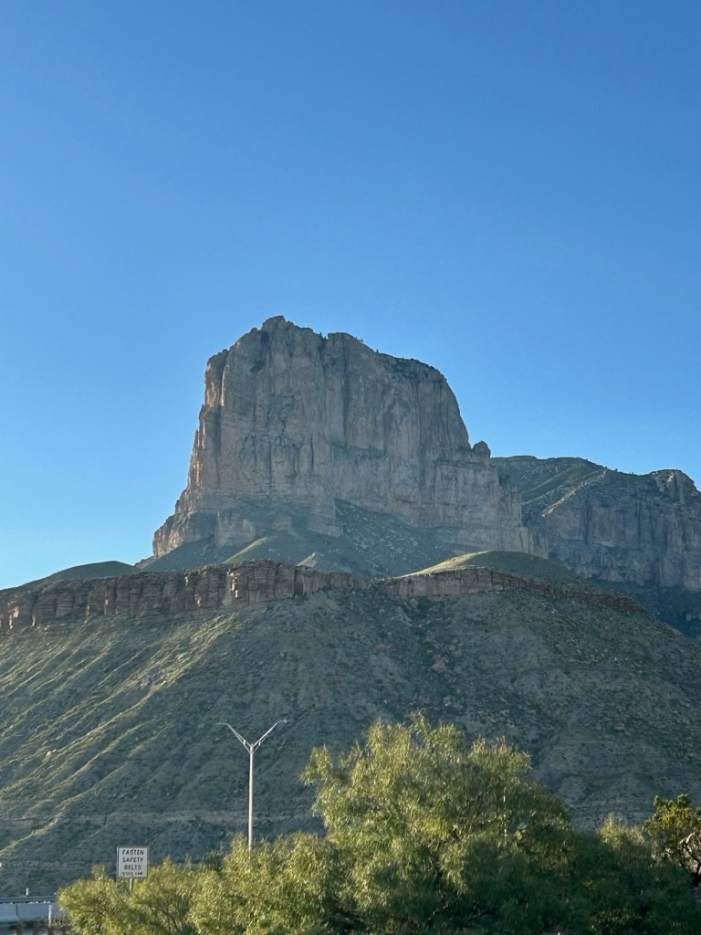
Following the switchbacks we round to the far side of Guadalupe peak and can see the El Capitan formation. In appearance it could never be confused with the granite wall in Yosemite that shares the same name, but is impressive nonetheless.
We are now nearing four miles, almost a mile past the bridge, and the peak must certainly come soon. Following some sections of bouldering and relying heavily on AllTrails to stay on the correct path we spot a partially turn down wooden structure just off the trail. It must be the bridge Carter remembers. Even though it is no longer part of the designated trail it is still an encouraging sight.
A few minutes later Carter asks for a quick break. He doesn’t have a water bladder like I do and can only drink when we stop. If I weren’t able to sip water with ease throughout the hike I would’ve needed many more breaks.
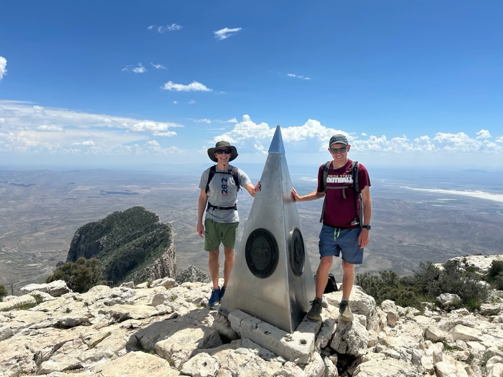
As he drinks some water I can hear some voices above us. I walk down the trail about 15 yards and realize the voices are at the top and it is just around the corner. Carter is right behind me and after a few more steps we congratulate each other for summiting.
Last time Carter was up here, he and his friends buried a bottle of Tequila with the expectation that they would all hike to the top again and enjoy a celebratory shot from their past selves. The planned reunion never took place and the memory of where exactly the bottle is buried has since faded. With zero expectation of actually finding it we spent about five minute looking around the rock covered mountain top and decided that it could have a bush on top of it at this point.
Despite the unsuccessful search our spirits were still lifted and we began the hike back down.
As with most hikes the descent may be easier on the heart and lungs, but with the steep descent we have to watch our footing and do not move any quicker on the way down.
With the later start, we do not finish until after 4:30 and immediately get to work setting up camp. I could nearly set up the tent and my sleeping pad blindfolded, but Carter has a new sleeping pad and takes a little longer.
Following dinner and clean up we start get to bed fairly quickly.
Day 54: Up around 5:15. Carter is about 30 minutes behind me. He must be tired after a long day of travel and hiking yesterday, but doesn’t show it.
The plan for today is hike McKittrick Canyon in the morning then drive over to Carlsbad Caverns in the afternoon.
After finishing breakfast and the 15 minute drive we reach the road to the canyon at 7:20, however there is a locked gate across the road and a sign informing us that the road opens at 8am.
Unwilling to wait we decide to switch the order and drive over to Carlsbad Caverns. The place is all but deserted. The main attraction are the ranger led, and self-guided tours into the caverns. However, they do not open until 9am and we are not terribly interested in venturing into the caves. Instead we decide on hiking part of Old Guano Trail. It is a seven mile out and back, but we decide to only spend an hour on this trail as our big hike for the day is the canyon.
After about 30 minutes we turn around and begin the walk back to the parking lot. On the way out we see the bat amphitheater which is by the natural entrance to the cave. The bats are already inside for the day but dozens of cave sparrow are flying around at the mouth of the cave.
We stop by the now open visitor center and it’s teeming with park guests who are anxious to see the caves. Having had our fill we enjoy a few moments of a/c then drive back to Guadalupe. Although, they are a n different states (Guadalupe in Texas, and Carlsbad in New Mexico) they are only 30 minutes from each other, so the drive back is brief.
There are not many people at the trailhead when we get there around 11. The hike into McKittrick Canyon can be about as long as we could want it to be, but our chosen destination is the Grotto, which is a 7.5 mile out and back hike that follows a mostly dried river bed.
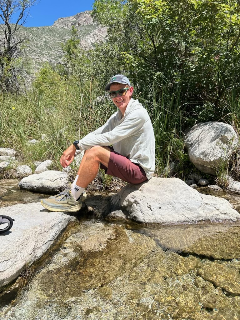
It is a fairly easy hike with minimal elevation gain and about two miles in we encounter some running water in a small creek. It’s a great spot for a break and Carter even soaks his feet for a few minutes.
Less than a mile after the creek we reach the side trail for Pratt Cabin. It’s the site of an almost 100 year old homestead of a geologist who was enamored with the canyon, and subsequently donated large tracts of land for the formation of the National Park. Much of the original structures still stand, but are closed off. There is shade and picnic tables making it a great spot for lunch.
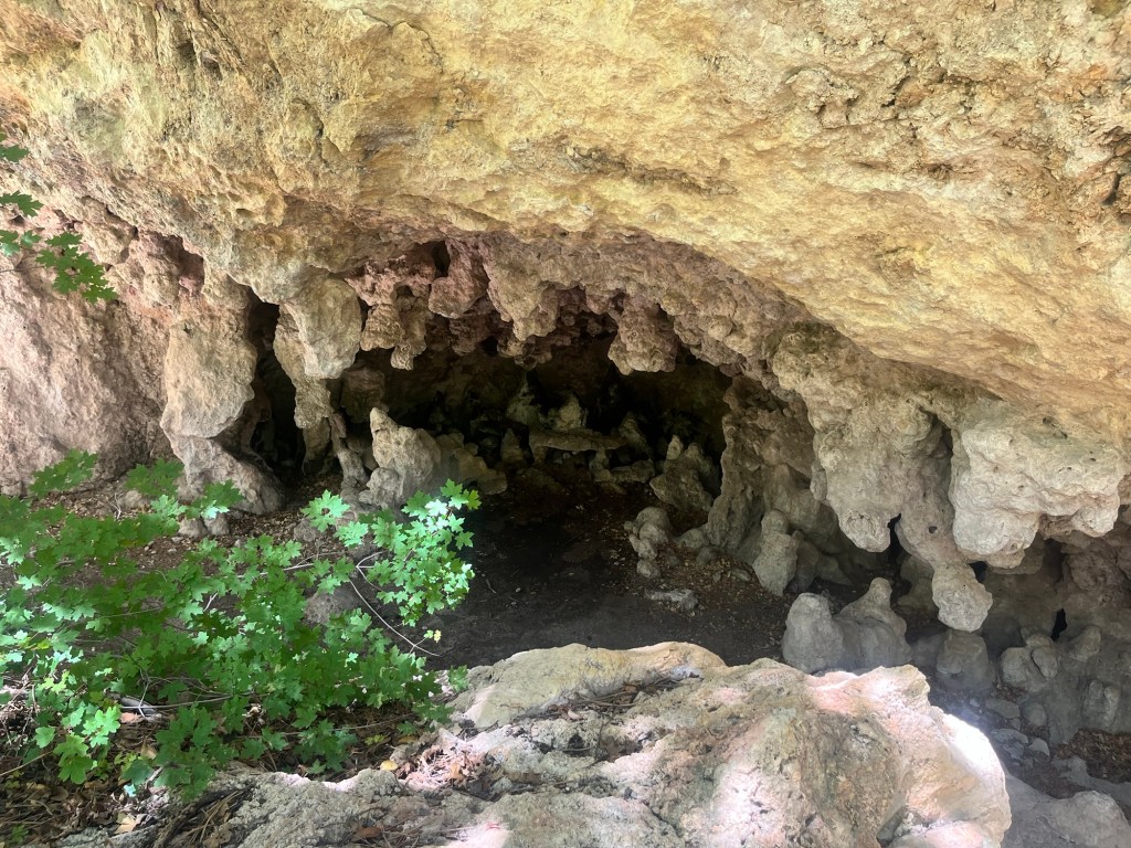
Following lunch we continue hiking out to the grotto and reach it in less than a mile. It’s a cool semi-cave like rock formation with dripping water and stalactites hanging from the roof and dripping water on the stalagmites beneath them.
With the end goal reached, and an earlier hike already under our belts we begin the return trip.
It goes fairly smooth including another break at the creek. This time I run my hat under the cool water and Carter soaks his shirt. It provides some relief from the 90 degree heat, but can not last the rest of the hike.
After the stop we finish out the rest of the trail admiring the West Texas flora along the way. Carter is particularly impressed with the Sotol Cactus which grows a large stem up to 10 feet in the air to capture pollen.
We wrap up the hike around 3 then head to the Visitor Center to get some advice on tomorrow’s hike, but mostly to enjoy some air conditioning before it closes at 4.
After the visitor center closed we hung out around camp for a while before eating dinner. Following dinner we went on a short drive to see El Capitan from a different vantage point. It is even more impressive when looking up at it from the valley than looking down from Guadalupe Peak.
Once we returned to camp we started getting ready for bed and were asleep shortly after the sunset.
Day 55: Woke up a few times in the night, but up for good shortly after 5:30. Carter wasn’t far behind and after breaking down camp and eating breakfast we are able to hit the trail by 7:30.
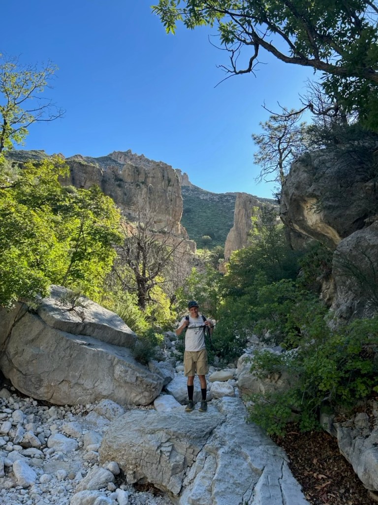
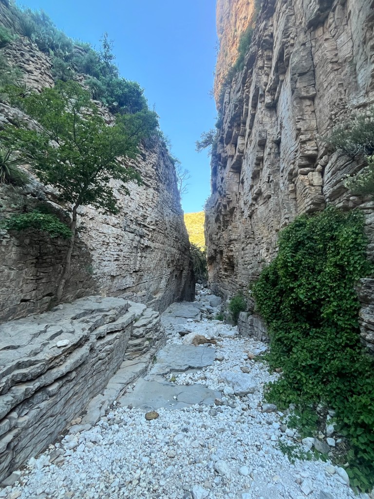
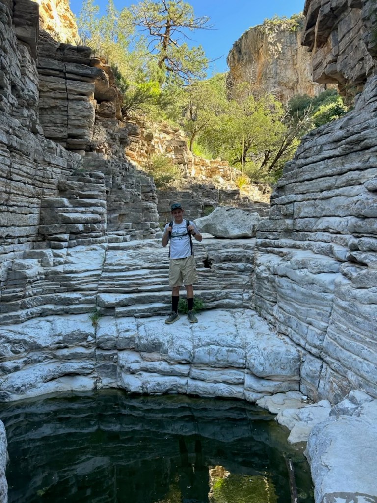
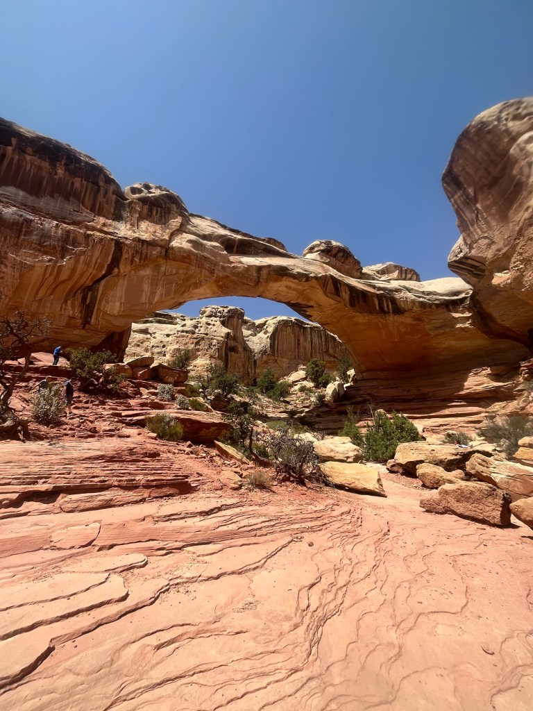
We are hiking Devil’s Hall Trail which starts not too far from the campsite and we opt to hike from there instead of driving 100 yards to the trailhead parking lot.
The hike is about 4.5 miles round trip and is an out and back hike with miles 1.5-3.5 in the “wash” (bottom point in between two ridges that becomes a river during heavy rains but is normally dry).
With the early start we are the first people in the trail and are also ahead of the heat for now.
I’m walking in front and a little over a mile in I hear a shrill hiss, and a rattle to my left. As I’m turning to see where the sound is coming from it registers just what I’ve heard. It’s a rattle snake. I begin to run before I even see it, catching only a glimpse underneath a prickly desert plant. Carter also takes a quick look as he runs out of striking distance.
We briefly stop to confirm that the other heard and saw the same thing and conclude that it was definitely a rattlesnake coiled and potentially ready to strike. I throw a rock in its general direction to see if it’s still there but hear no response. It was likely just as scared as us and slithered away. Hopefully far away.
We continued the hike and soon reached the wash. As advertised the bouldering began. It was challenging, but not too challenging and was a fun change of pace.
There was one section where the canyon narrowed to about 15 feet across reminding me of the Narrow hike I did in Zion back in June.
About a mile into the wash we reached the end of the trail and turned around.
For much of the hike back Carter, who is a professor in the Criminology department at FSU, gave me advice for my PhD program. I was very appreciative, but it also served as a reminder that I would soon return to the real world.
We finished out the hike before 10, and with camp already broken down prepared to go our separate ways. Carter was returning to El Paso for a flight home tomorrow, while I was driving down to Big Bend National Park.
Before leaving I refilled on water and made a sandwich to eat on the drive down. It’s about a five hour drive, plus a switch into Central Time and I was underway around 10:30.
The trip down is all highways and I’m able to continue catching up on FSU football podcasts as well as respond to some texts from friends that I hadn’t gotten to over the weekend.
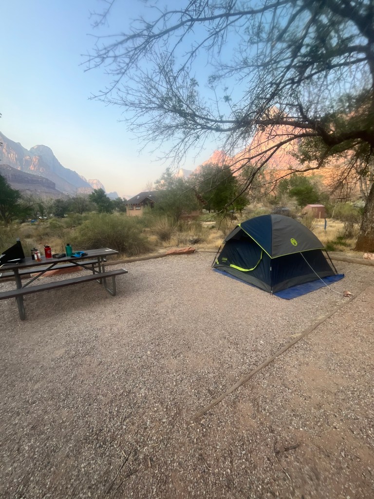
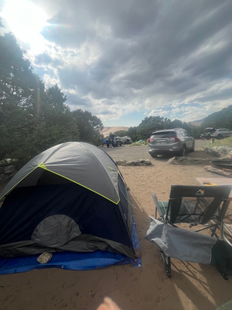
By the time I get to my campsite it’s 4:30 central time. I’m situated a stone’s throw from the Rio Grande River, but can’t see it from the campsite due to heavy vegetation around it.
After setting up camp I spend some additional time in the car to take advantage of the air conditioning. My car thermostat reads close to 110, but I think it’s likely closer to 95.
I get out to make and eat some dinner, but continue to take advantage at least once ab hour before heading to bed.
It thundered earlier but the storm never came and likely never made it past the mountains, so I feel comfortable enough to sleep with the rain fly off. Hopefully it’ll continue to get cooler throughout the night and stay cool tomorrow morning for my hike.
Day 50: Is that right? Wow, 50 days. How lucky am I to get to do this.
Petrified Forest doesn’t open until 8am so there is no need to get up early, but I wake up at 5am nonetheless. I try to sleep for another hour before getting up.
I break down the tent before eating breakfast and driving the 30 minutes to the park. I get there about 5 till 8 and the gate is still shut. I wait in the turnout with a few other cars for the gate to open and am one of the first few cars in the park.
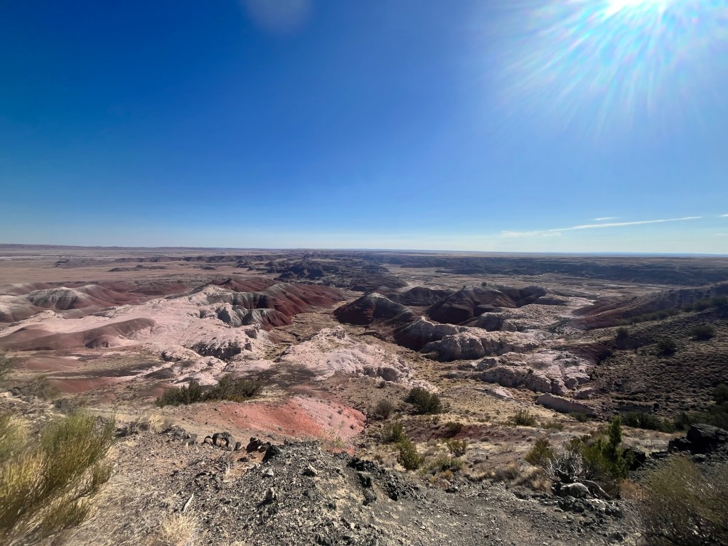
My first stop is Rim Trail which is a little less than a mile and overlooks badlands below.
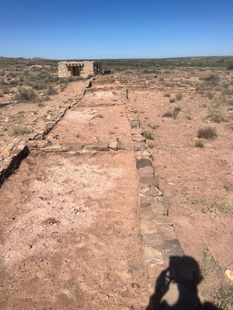
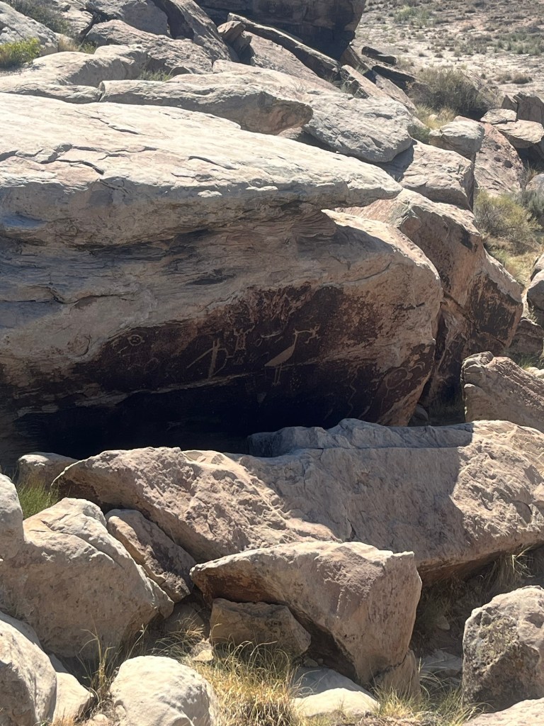
Next is a former Pueblo structure now referred to as the Agate House, as well as some petroglyphs.
Following that is the Blue Mesa Loop which is about a mile through a series of badlands.
It’s starting to push towards 90, and the water I filled my bottles with earlier is lukewarm and not at all refreshing.
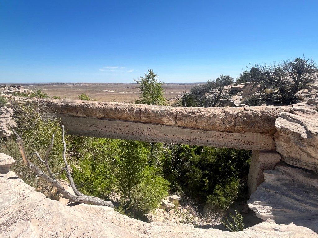
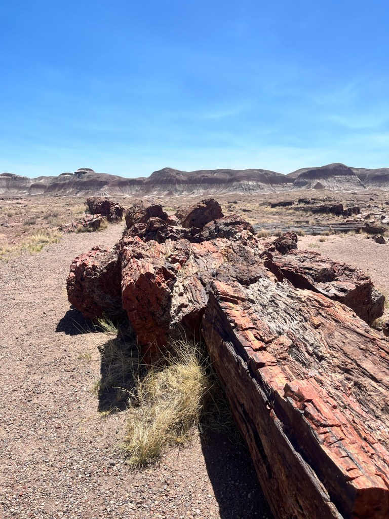
This park doesn’t have many of the longer trails I’m used to hiking, instead most of the attractions are just off the road, including this natural bridge of petrified wood that was reinforced in the early days of the National Park Service.
I’m now getting into a section of the park with more of the petrified wood. It’s pretty mind boggling to think it is millions of years old, yet still here. It’s a good perspective to have on just how short our time on earth is.
My final stop is the southern terminus of the park where I do a couple loop trails totaling 3 miles.
Before leaving the park I make a sandwich for the road. It’s a five hour drive down to Tucson and I’m on my way a little after noon.
On the way down I’m able to catch up with my nephew as well as a few other friends who made the drive fly by and I make it to my AirBnb just after 5:30. The entrance hall is lined with books and I spend a few minutes admiring the host’s collection.
The tv can’t connect to the internet, so that’s a bummer, but I’ve spent most of the past 7 weeks without it and don’t feel like I’m missing much.
Still trying to plan out tomorrow. One of my former coworkers used to live in Tucson and sent me a handful of recommendations for the city. Should be a fun day no matter what I do.
Day 51: I could get used to waking up in a bed. I even have my own bathroom that I don’t have to put shoes on to get to. Fancy.
Even with blackout curtains my body knows when the sun comes up, so I’m out of bed by 5.
First on the agenda is an approximately 8 mile hike in Saguaro National Park to Wasson Peak. After a 45 minute drive I get to the parking lot just after 6 and eat some breakfast in time to start at 6:30. There are a couple other guys in the parking lot, but one is planning to run the trail, the other is doing a different route.
The trail is surrounded by large cacti for whom the park is named. There are also some smaller prickly plants that are closer to the ground and immediately adjacent to the trail.
I have to watch my footing more than most hikes, so I don’t get a massive splinter.
While I’m partial to hiking in the mountains there is a beauty to the desert, especially one like this that boasts so much life.
Less than 3 miles in the trail runner is coming back down the trail complaining about the heat. It’s not yet 8, and far from the warmest part of the day. He must not be used to heat.
Undeterred I continue up the trail knowing I’m on my own out here. It’s cool feeling to have such a large place all to yourself. I do my best to soak it in.
Some friends mentioned in a group chat in the way up that it was Harry Potter Day (his birthday is July 31 in the book/movie), so I celebrate in the log book at the peak.
Although, it’s smaller than some of the others I’ve been on it provides a 360 view of the surrounding area.
On the way down I brush one of the small cactus with my shoe and stop to take the thorn out. It didn’t get me bad through the shoe, but is a good reminder to stay alert the rest of the way.
There is only one other hiker on the way down, which goes relatively quickly. I’m back in the car before 9:30 and head to the visitor center. I catch the last couple minutes of a ranger program and fill up on some warm water before driving a loop trail in the park that wasn’t much different than where I hiked.
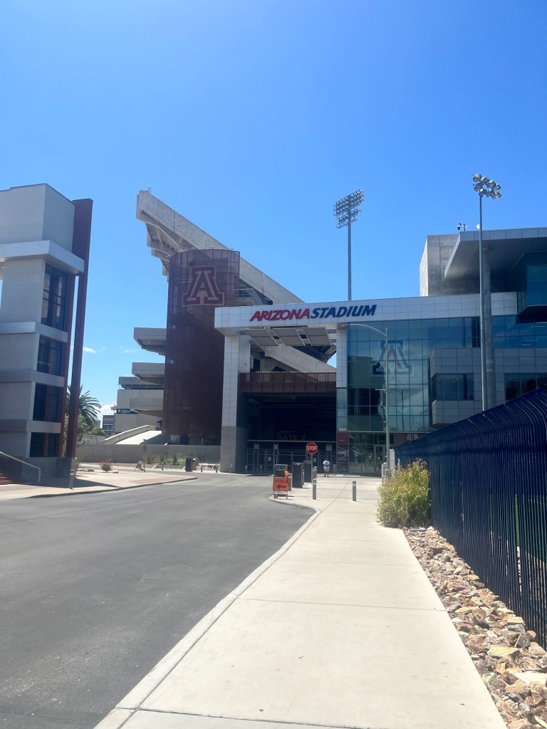
Feeling like I saw most of what I could see I decided to check out the University of Arizona. I love visiting college campuses, especially stadiums.
One downside to visiting in the summer is there are so few students that it feels like a ghost town. Nevertheless, it’s still a nice campus.
After completing a loop through campus, I pack a sandwich for the drive over to Mount Lemmon on the other side of town. A former coworker, Ben, who went to school at U of A and used to live in Tuscon recommended visiting.
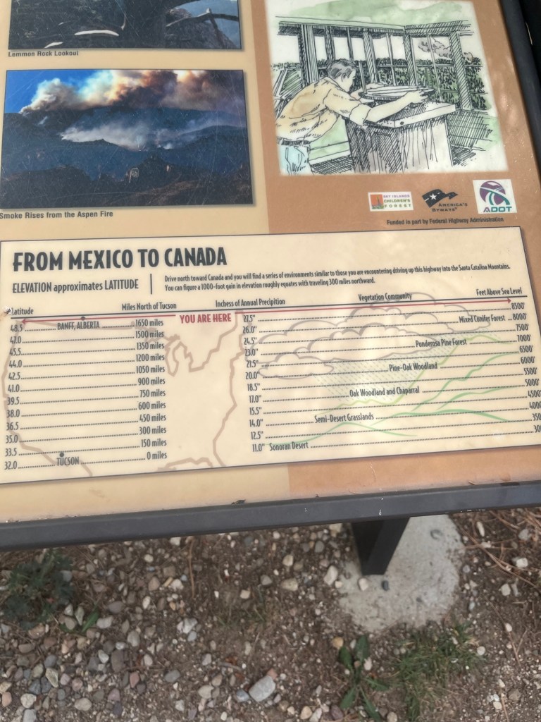
The drive to the top takes about 1.5 hours, but is pretty cool. The top is at 8,500 feet and the mountain has several different climate zones you drive through from the Sonoran Desert at the base to the conifer forest at top. It’s also 30 degrees cooler at the top, which is a welcome relief from the 100+ degree heat.
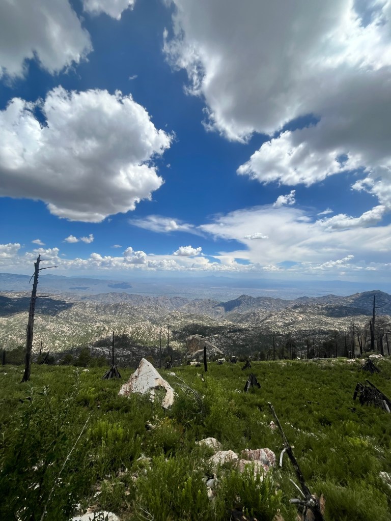
After walking for much of the morning I decide on a shorter 2 mile loop hike.
It has a great view of the other mountains as well as the city.
After the hike I spend a while at the top catching up on some correspondence and enjoying the cool mountain air before heading back to the desert below.
For dinner, Ben recommended El Carro which was established in 1922 and is one of the oldest family owned Mexican Restaurants in the country.
Fajitas are one of my favorite foods and these may have been the best I’ve ever had. These are especially good as I have not had many opportunities to eat fresh veggies on this trip.
Following dinner I head back to the AirBnB to get ready for bed.
Day 52: Even with blackout curtains my body is in rhythm with the sun and I’m up around 5, which is good because I have a five hour drive and a time change to contend with before getting to White Sands National Park.
It’s crazy how a five hour drive now feels routine. All it takes is a few FSU football podcast episodes and a call with my mother to get me to the park. Still, even with departing Tucson before 5:30, it is almost 12 by the time I get there and the temps are rising.
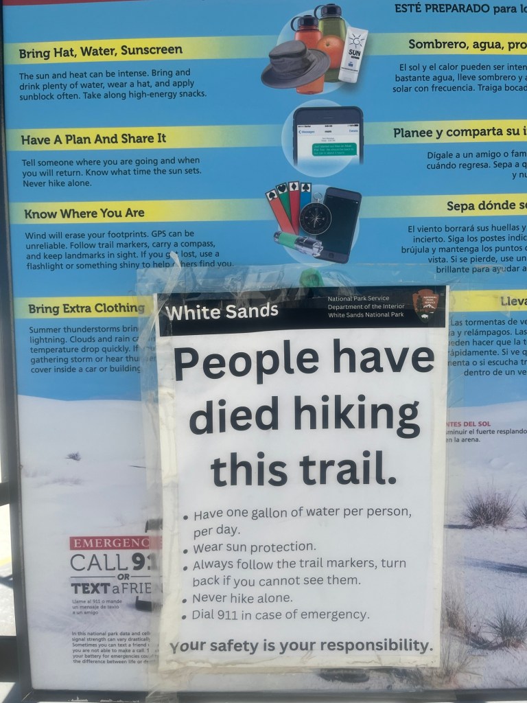
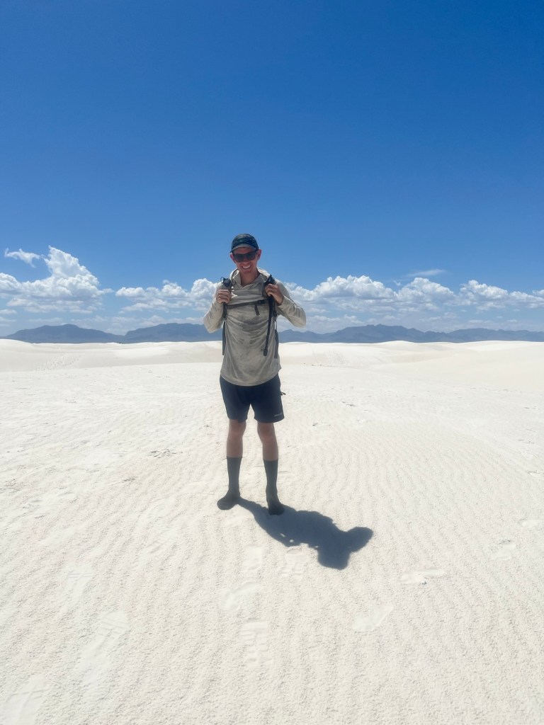
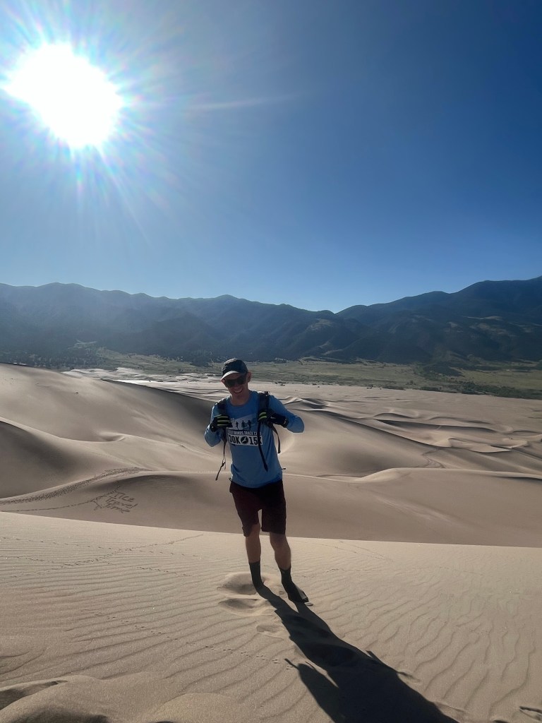
I stop by the visitor center long enough to confirm that there is sand here, and science can explain it if you’re interested in that type of thing. I’m more eager to get out and hike and start driving to my trailhead. The park is not large and my trailhead is at the back, so I get to complete the entire drive passing several smaller trails and picnic areas along the way. There are also sledders out, similar to Great Sand Dunes National Park which I visited back in June (seriously, was that the same trip?). However, I’m more determined to hike through the dunes this time, and after making and eating a sandwich I am on my way. I’m doing the Alkali Flats Trail, which is a 4.5 mile loop through the dunes. It’s rated as only moderately challenging, but with temps now pushing 90, it will be a fun challenge for the day.
The sign at the trailhead offers some tips as well as encouragement and I greatly appreciated the support.
The beginning was a little foreboding as there are no trail markers in sight, but there are footprints and another hiker in front of me so I’m not too worried (also, the parking lot is still in sight behind me).
About 10 minutes in the first trail marker appears and the next couple are also in sight. I have much greater faith in these and any concern about getting lost faded away.
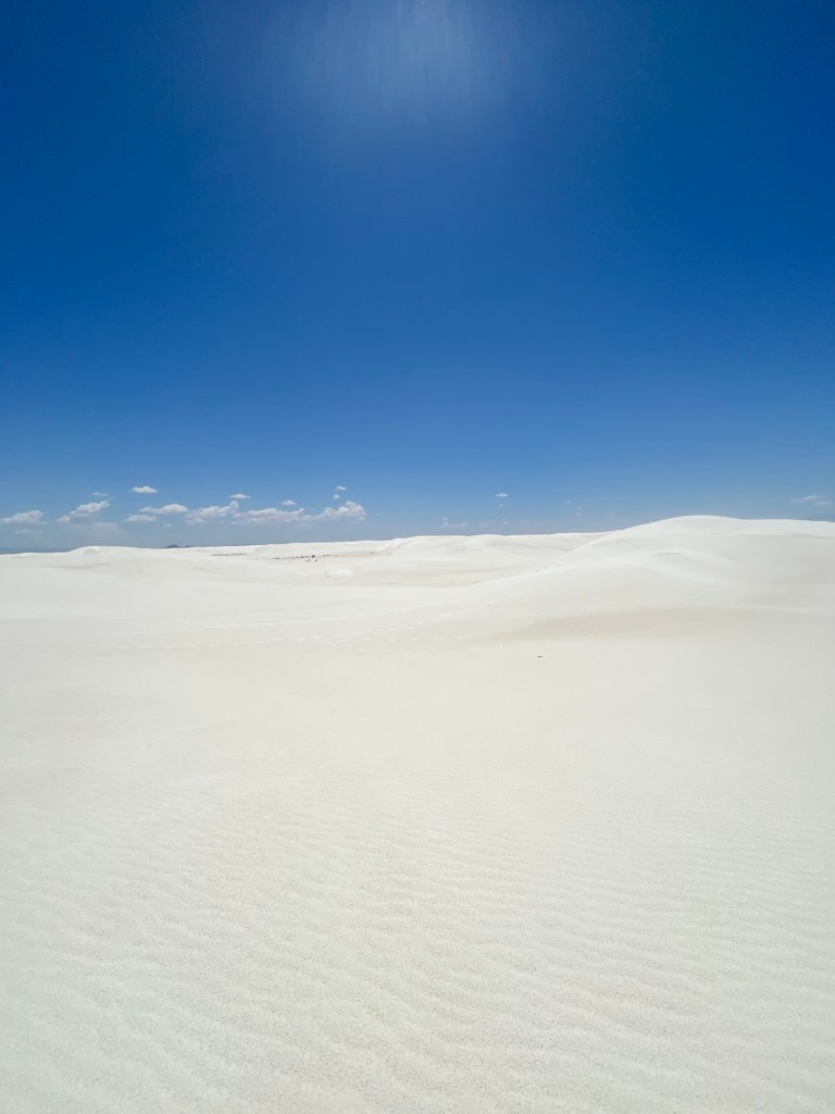
With that concern behind me I’m free to enjoy the beauty of the white sands. This week is the first I’ve really missed home and even though Tallahassee isn’t on the beach it feels closer to Florida than I’ve been in almost two months.
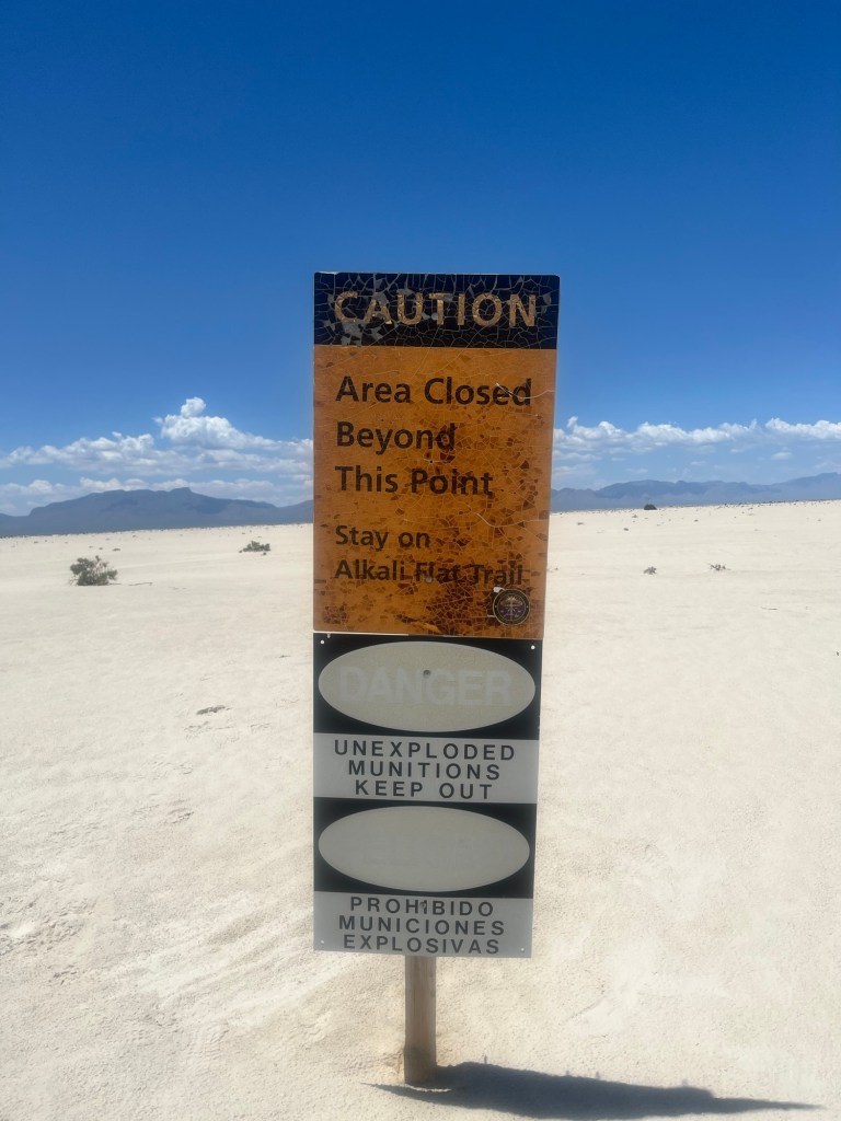
The halfway point is the edge of the park that is adjacent to the White Sands Missile Testing Site. It’s still an active military facility, but is most well known as the home of the Trinity test site.
The rest of the hike goes fairly smooth. The scenery doesn’t change much on the dunes.
I could see one hiker in front of me for most of the hike, but I can tell I’m getting close to the end when a few others appear.
Then I cross over the last dune and the parking lot is in site. The sand boarders who were there earlier are now gone, likely somewhere inside. I’d like to spend longer in the park, but there isn’t much shade to be had and what little there is does not provide much relief. Instead of hanging around longer I head to my Airbnb in Alamogordo about 20 minutes away.
It’s just before 3 when I arrive a little sandy, and very sweaty. I forget Rule #1 and leave my shoes on as I enter the house. The host walked me in and quickly reminded me. Not a great start, but she warmed up to me and even let me borrow some Tide Pods to wash my clothes.
After laundry my host asked if I had any dinner plans and offered to cook me dinner. We had some great tacos (really just decent, but I didn’t have to cook, so we’ll say they’re great).
After hearing many stories about bad guests, I headed to bed with plans to catch sunrise at White Sands.
Day 48: Surprisingly I only wake up a few times during the night and each time I can feel a great accumulation of sweat. However, the last time it is relatively cool, and I pull a blanket over my torso.
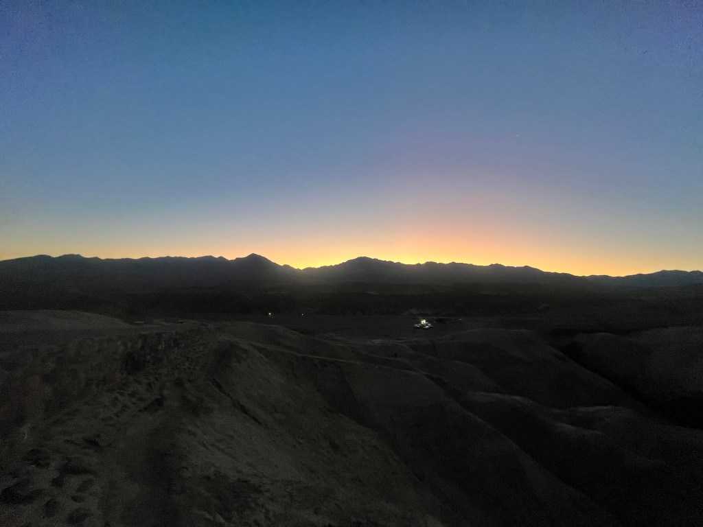
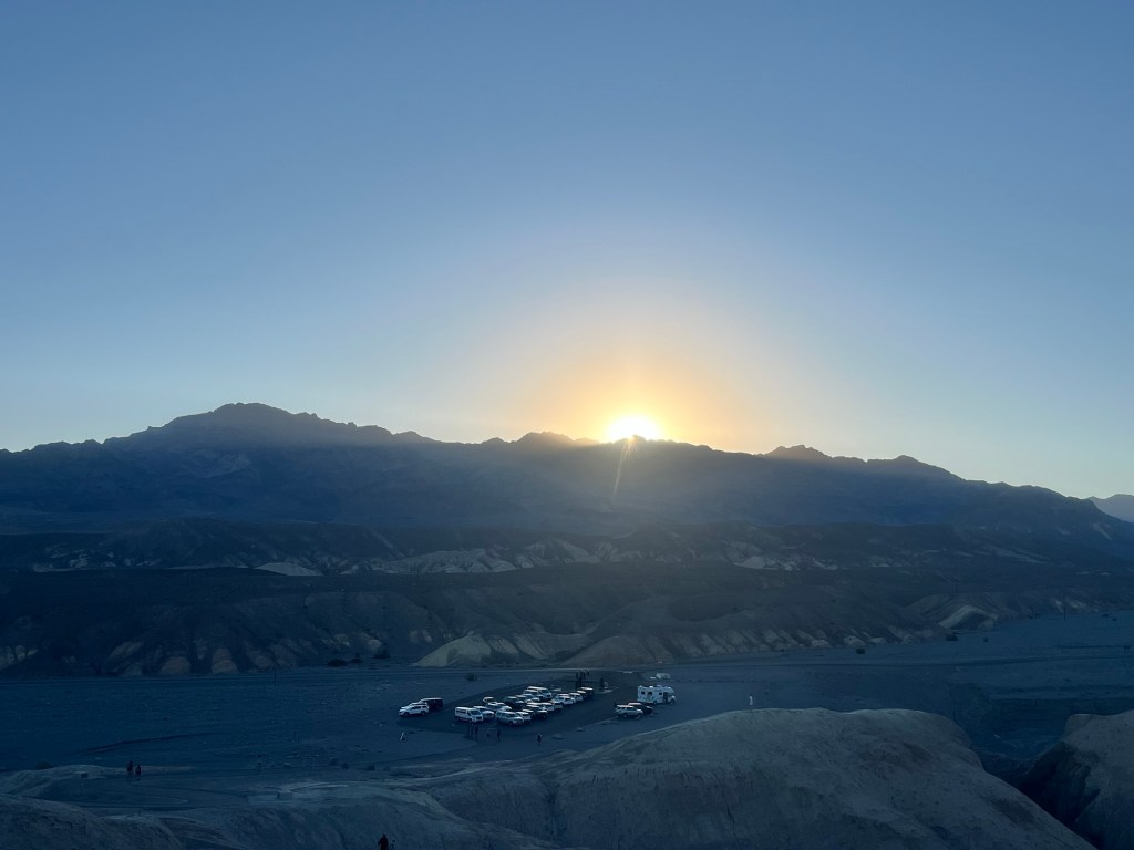
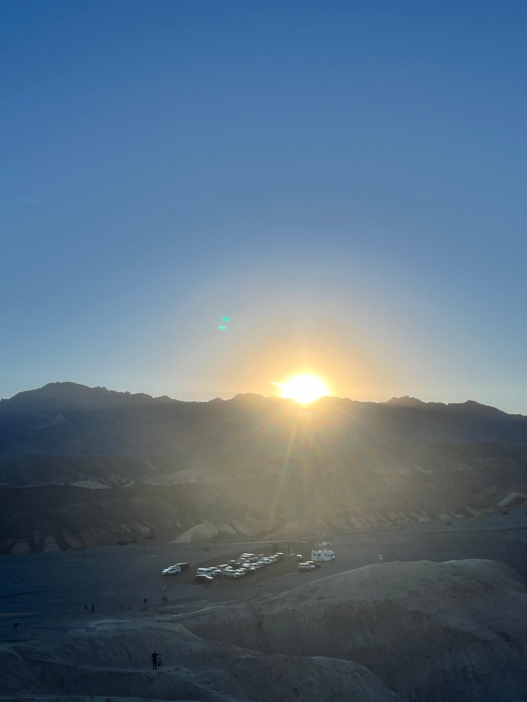
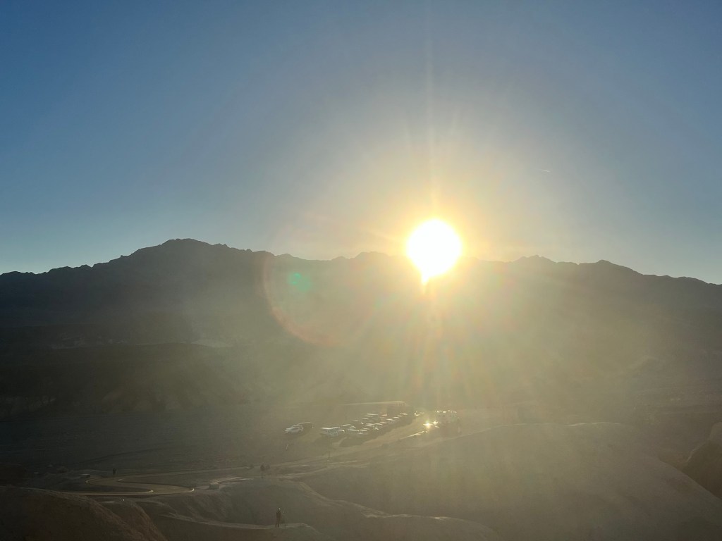
When I wake up for the final time the stars are still out, but I have a little over an hour till sunrise giving me plenty of time to break down camp and find a place to watch.
I opt for Zabriskie Point about a 10 minute drive plus a short hike. It’s starting to get light when I arrive and there are only a couple other people there. Perfect. But, as sunrise gets closer more and more people start showing up and the serenity is ruined by the dull roar of conversation that includes at least four languages as well as several screaming children.
However, must of the crowd looked west instead of east. I’m not sure if their goal was to watch light hit the mountains to the west or if they’re just confused, but even when the sun crests they do not pay much attention. Some people had even left before even seeing the sun.
Despite their impatience, it’s a beautiful sunrise.
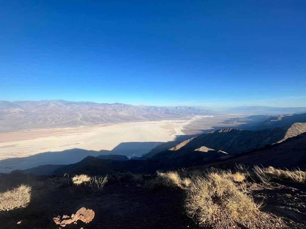
After sunrise I make my final stop in Death Valley at Dante’s Peak.
It overlooks Badwater Basin and it’s pretty neat to get a perspective from much over 5,000 feet.
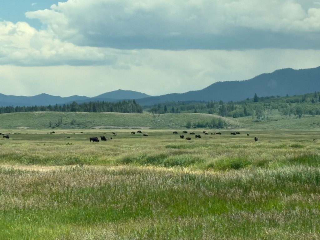
I decided yesterday to skip a full day in Death Valley to go to the Grand Canyon. It wasn’t in the initial itinerary, but I’m happy to work it in.
It’s nearly a seven hour drive, so I leave straight from the peak to make my way over. The path skirts me just south of Las Vegas, but close enough to see the strip. It feels like I was there much longer ago than just last month.
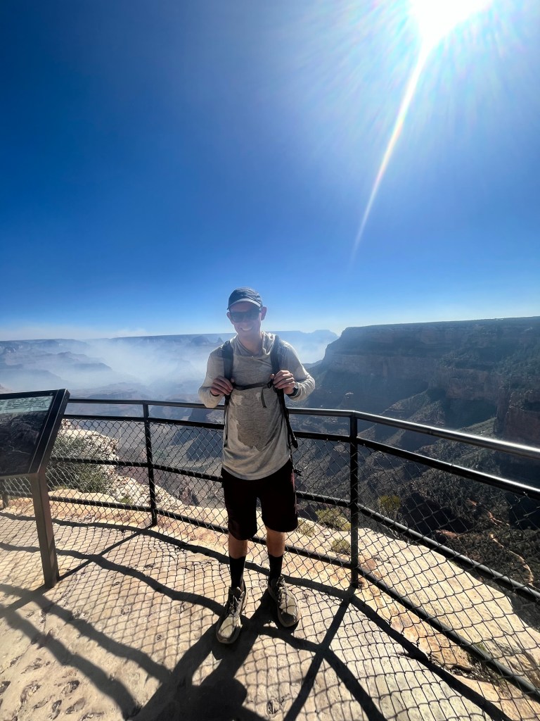
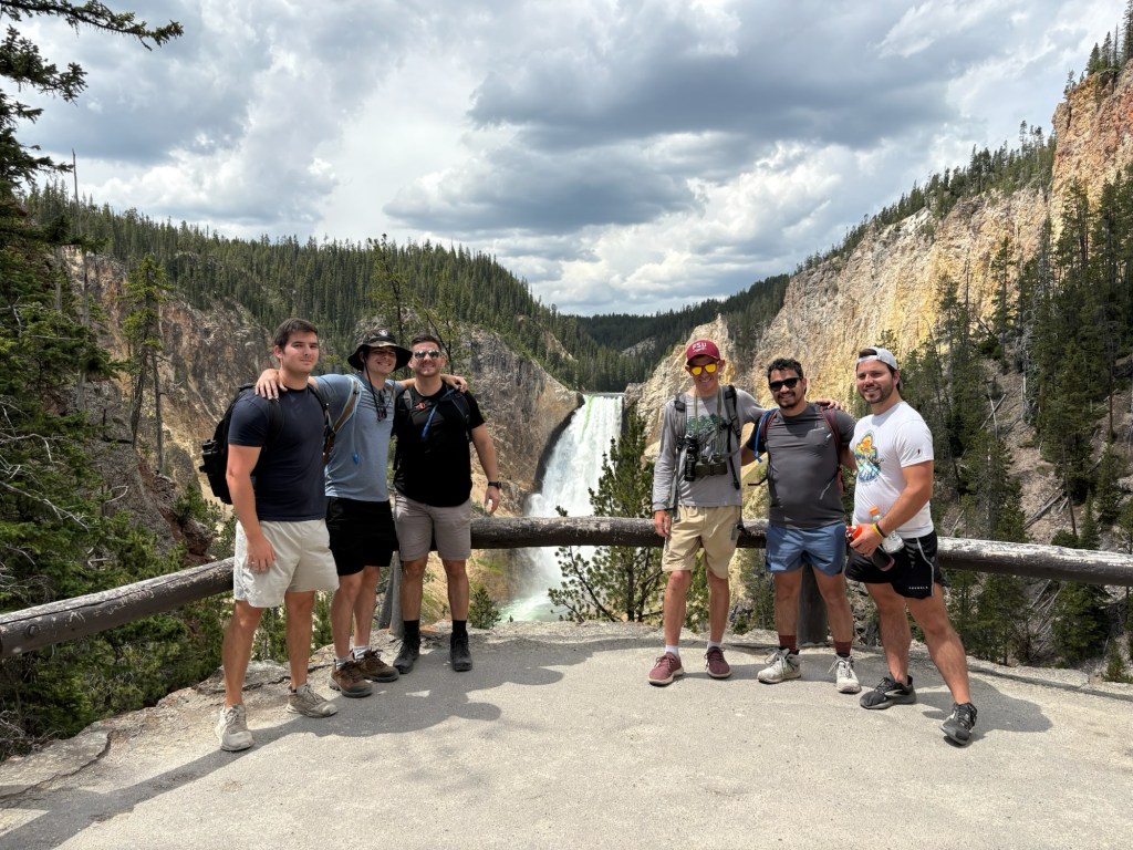
I made it to my campsite just before 3 and after setting up walk over to Rim Trail and follow that along the rim to Grand Canyon Village.
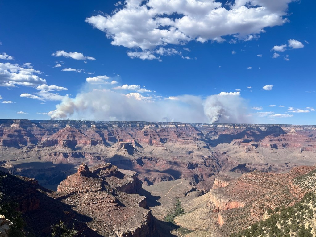
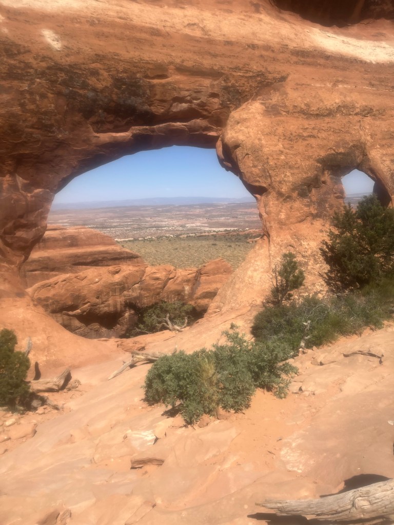
I stop briefly to talk to a ranger about conditions for tomorrow’s hike. A fire destroyed much of the North Rim and there is still smoke in the distance. He told me to expect to take 2 hours to get to Havasupai Gardens and longer to get back.
After that I walked back to my campsite to make some dinner. Arizona is on mountain time, so I spent much of the afternoon thinking I lost an hour today, but as I was eating I realized that Arizona doesn’t recognize day light savings time and my 6pm dinner was actually 5pm. Oh well, planning for an early start tomorrow, so an early dinner will help with that.
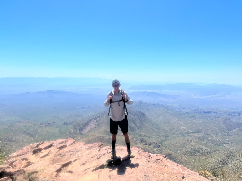
Day 49: I wake up just before my 4:45 alarm and turn it off, so I don’t have to hear it. Planning to hike into the canyon today and want an early start.
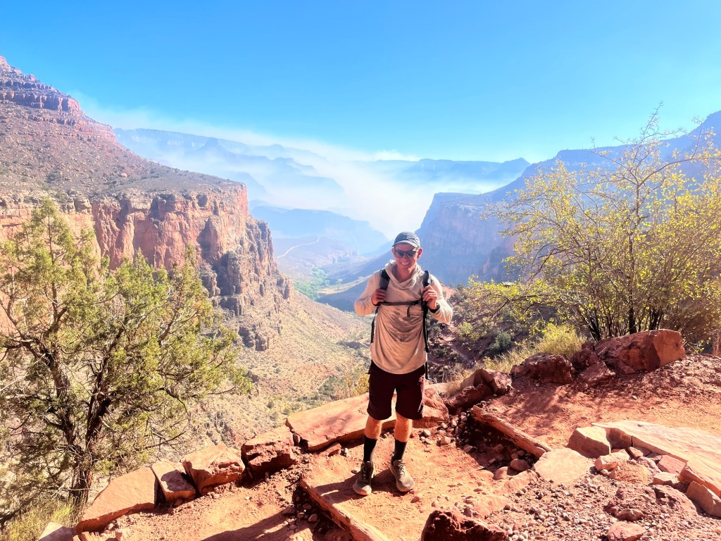
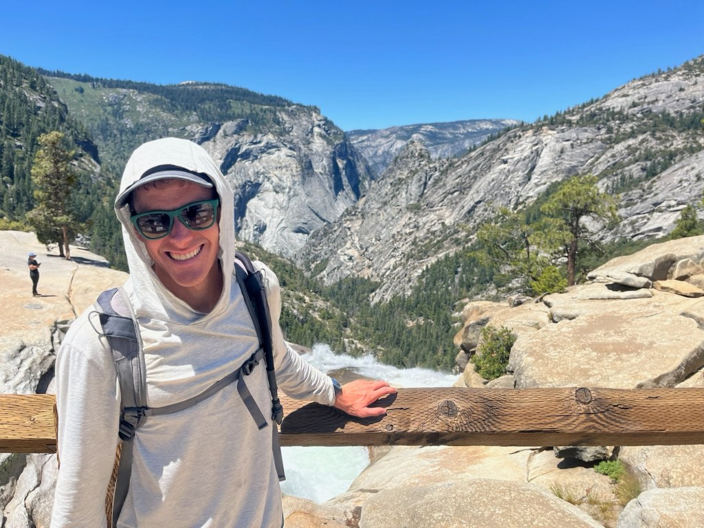
After packing up I drive over to a nearby parking lot, eat breakfast and get my day pack ready. Instead of starting at the Bright Angel Trailhead I park about 1.5 miles away, so I can walk along part of the rim trail. The hike into the canyon is about 9 miles round trip with a 3,000 foot elevation drop on the 4.5 miles down into the canyon and the same 3,000 feet up on the way out. The ranger yesterday expressed how tough it would be, but I haven’t done a big hike in a few days and am excited for a new challenge.
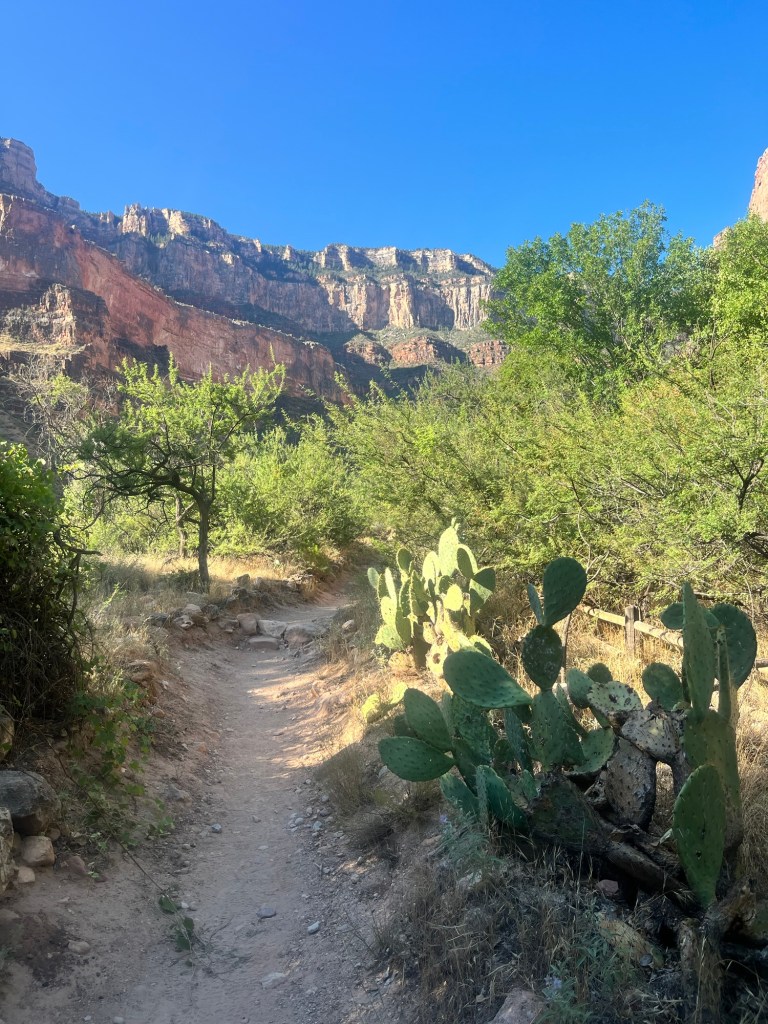
After starting a little after 6:00, I reach the Bright Angel Trailhead at 6:30 and begin the main part of today’s hike.
The trail isn’t to steep compared to some of the others I’ve been on and I can comfortably stride out without any discomfort. Most of my hikes have started with the elevation gain at the beginning, so it is different to have the easier miles at the beginning, but I take advantage and push the pace a little on the way down. I’m interrupted less than 10 minutes in by a group of mountain goats. I yield the trail to them and they walk past.
It’s relatively cool out still, likely in the low 70’s, and there are quite a few people on the trail. I breeze through the 1.5 mile rest area and keep pushing down. It’s not long into the hike, but I’m starting to calculate how fast I can do it if I keep the sub-20 minute mile pace.
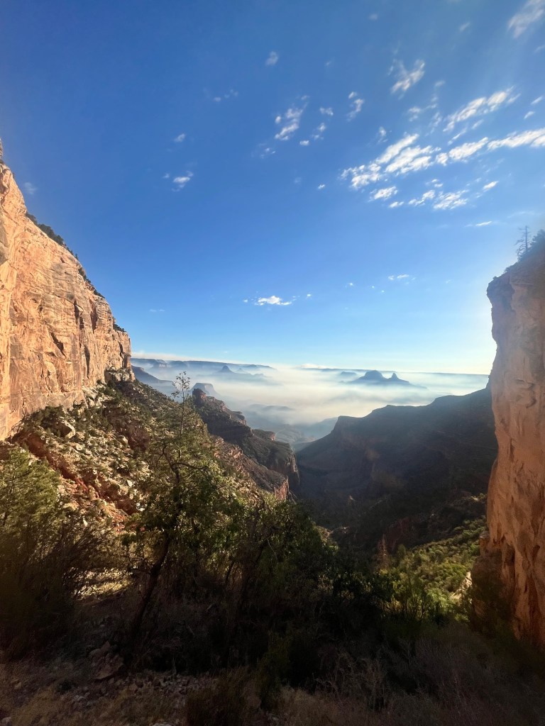
The smoke from the fires on the other side of the canyon is getting thicker as I descend, but it doesn’t impact my breathing much and I continue down passing the 3 mile rest area in just under an hour.
There are fewer and fewer people this far down, but some backpackers who camped at Havasupai Gardens are on their way up.
I reach Havasupai before 8, around 1:25 from when I started Bright Angel, and the thought of a sub-3 hour round trip starts to creep into my mind. The trail is closed past this point because of the fires, but if it weren’t I’d be tempted to go farther.
I feel pretty strong as I start the hike back up. A thermometer at the bottom told me it was already 80 degrees, all the more motivation to get out of the canyon quickly.
I’m holding the same pace I did on the way down, although my breathing is certainly heavier and sweat starts to trickle down my face.
I’m back at the 3 mile rest area still ahead of pace and say hello to those taking a break as I trudge past.
There are a lot of switchbacks now and they would be much more monotonous if not for the view.
I make it past the 1.5 mile rest area and quickly run my hat under the spigot. It has the desired cooling effect and I march on determined to finish this part of the hike. It’s got to be in the mid-80’s at this point and sweat is pouring out of me. I know I’ll cool off more at the top than in the hot canyon and keep pushing to the top. The last section drags on, but I’m able to finish out in about 2 hours and 50 minutes, much quicker than the ranger told me.
After taking a few minutes to look at the Rim Trail map I decided to take the Rim Trail west for a 30 minutes instead of returning straight to the car.
There are a few observation points that I stop at before turning around. I want to hike some of the trail east of where I’ve already been and I’m already near 13 miles.
The Rim Trail is flat and paved and the miles tick off much easier. As I near my eastern turnaround point I stop at an overlook with an expansive view of the canyon.
While there I talk to a young park ranger. He has a view finder set up on the fire and explains that low humidity and high winds are continuing to strengthen the fire, which has grown rapidly in recent days.
After talking to the ranger for a few more minutes about the various parks he has worked at I finish out my hike getting in 18 miles in under 6 hours, and am pretty happy with the days effort.
I pack a lunch before heading out. The plan for tomorrow is to see Petrified Forest National Park, but it is only open limited hours and has no camping option, so I have a site booked at a KOA.
I get there around 3:30 and set up my tent, before getting in a wonderful shower, and lounging by the pool for an hour before dinner.
I must have been in a good mood when I booked this site because it is one of the premium sites with a sink, and fenced off from my neighbors. Life is good.
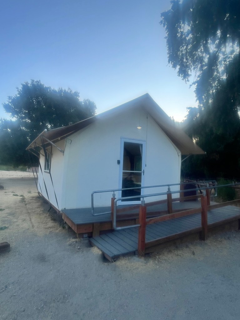
Day 45: I sleep fairly well in the tent cabin, but wake up a little after 5 as it starts to get light outside. I spend most of the next hour trying and failing to get some more rest after the long day yesterday.
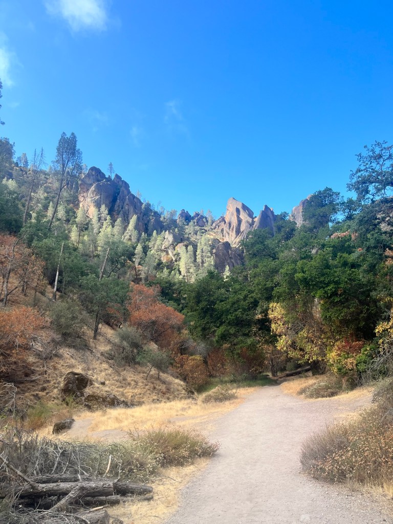
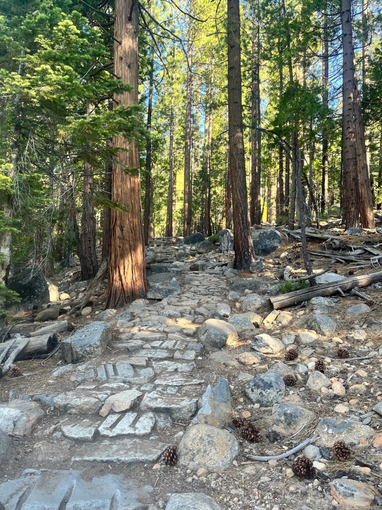
I give up a little before 6 and shave, eat some breakfast, etc. until Sam wakes up. He doesn’t take long to get ready and we are able to drive over to the trailhead and start our hike around 8:15.
We are doing a variation of the Old Pinnacles Loop, which takes us through most of the highlights in the park over 11 miles. The first is the Balconies which is a set of rock formations shooting up into the sky.
From there we did an out and back into the Balconies Caves, which were pretty short.
By the time we left the caves and hiked up to the High Peaks section of the trail I was starting to feel pretty sleepy after not getting enough sleep the past couple days. We stopped for a few minutes so I could close my eyes, but realistically I wasn’t going to get any sleep sitting on the side of the trail and we continued on.
I never fully woke up the rest of the hike and the rest went by in a bit of a blur.
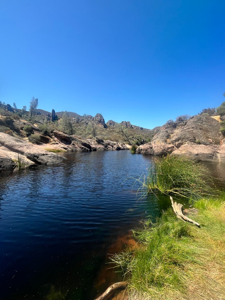
We stopped briefly at Bear Gulch Reservoir and Sam, ever the amphibian enthusiast, looked for a frog that was local to the area while I did my best job of sleeping standing up.
At this point we were on the last quadrant of the loop which was a pretty flat section allowing me to sleepwalk through it on the way back to the car, which we reached around 12:30 about four hours after we started.
Our drive today was down to Ojai, CA which is about 5.5 hours from Pinnacles. We got started around 1 following a quick dip in the campground pool and making some sandwiches.
I tried to nap the first couple hours with limited success, but some rest is better than none and I’m happy to have gotten at least a few minutes.
We are staying with Sam’s friends from residency – Lindsey and Margaret – and get to their house just before 7.
For dinner we picked up some pizza from a local shop and ate on the front porch. I was particularly fond of the goat cheese.
With a boat trip to Channel Islands National Park planned for the next day we got to bed pretty soon after eating.
Day 46: Despite the comfortable bed I fail to catch up on sleep and am up before 5:30.
Sam moved to the couch at some point in the night, apparently my leg was shaking while I was sleeping.
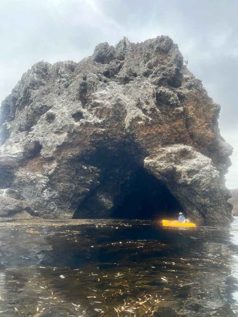
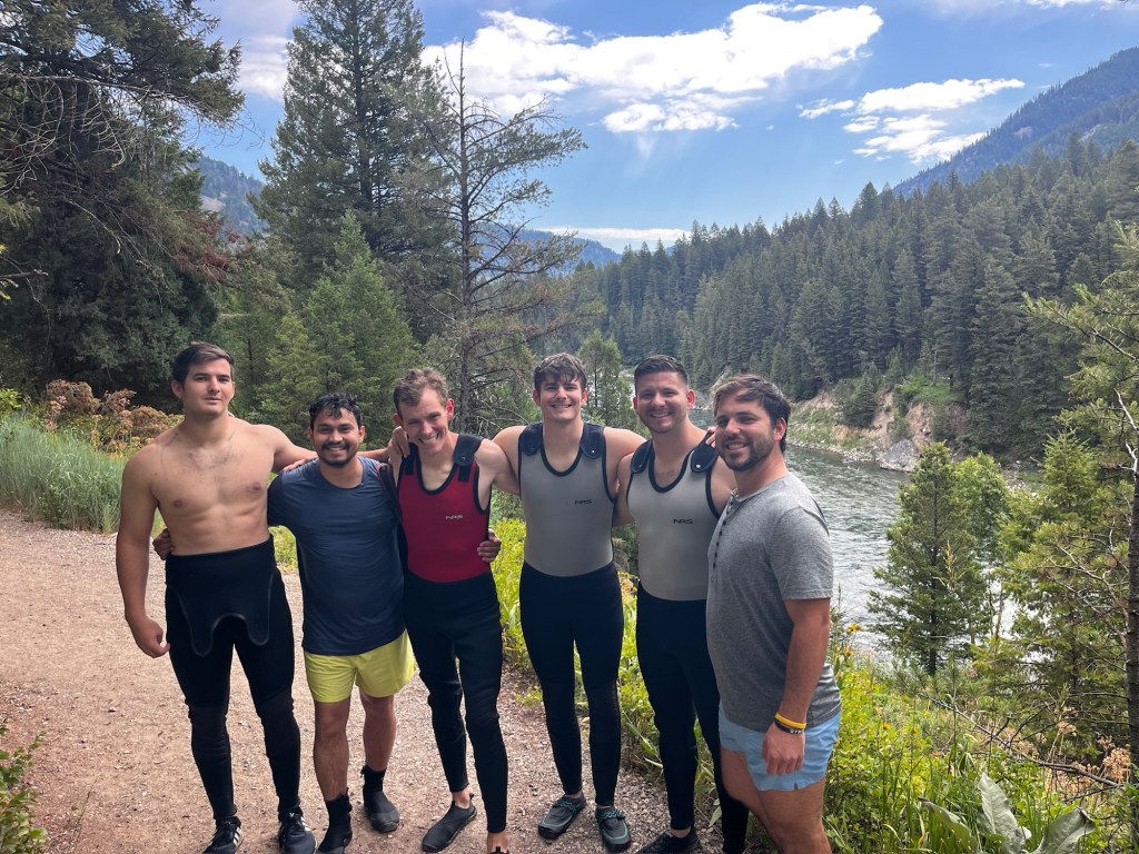
After eating some oatmeal and drinking a smoothie Sam and I headed out for the drive down to the marina in Ventura. Channel Islands National Park is a group of islands off the coast and the only way to get there is by boat. Today we are specifically headed for Santa Cruz Island which is the largest and one of the closest to the mainland.
We spent the ride out at the front of the boat enjoying the cool sea air and looking for wildlife. We lucked out and got to see a pod of dolphins who followed the boat for several minutes playing in the wake.
The boat is fighting the wind and current on the way out and the trip takes about 1.5 hours to get to the island.
In addition to the ferry passage we also rented kayaks and the crew brought them to the beach for us.
Once we were on the beach we hopped in the yaks and started paddling to the south. The winds typically pick up around late morning to midday and blow north to south, so we wanted to get this portion of the way first.
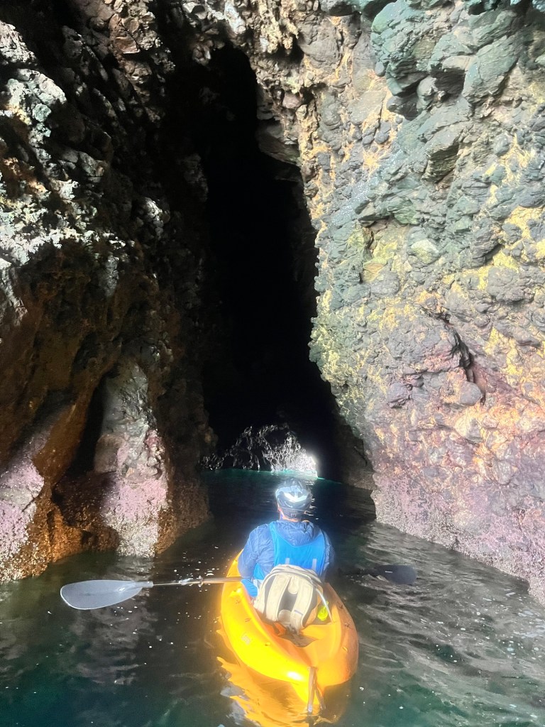
It takes an hour to paddle through this section before we start heading north to check out other caves.
Each one is unique and we decided to eat lunch in one of the larger caves that had less chop, and plenty of light to see.
From there we continue north and are encouraged to keep going out by a group of Purdue students we met on the ferry.
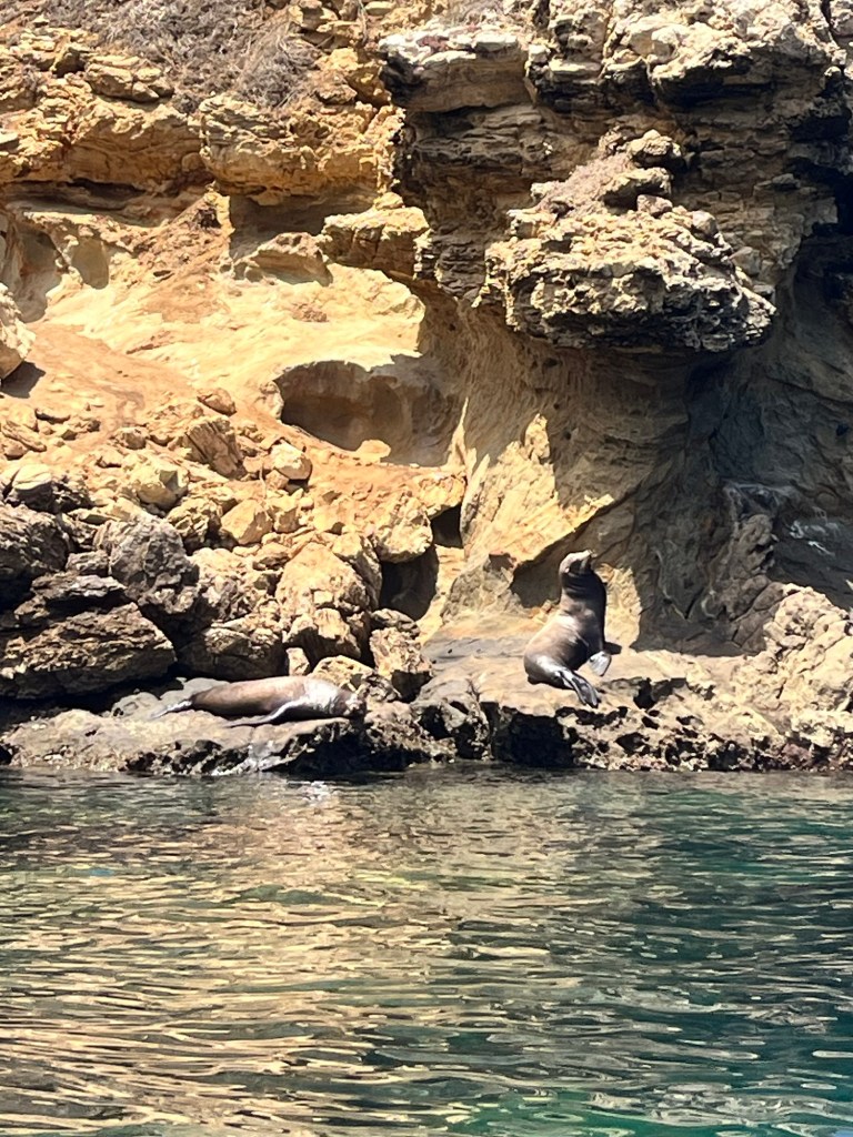
It’s close to 1:30 when we reach our designated turn around point and we stop so I can eat some snacks. While I was eating we hear the bark of either a seal or sea lion behind us and paddle over to investigate. There are a couple sea lions sun bathing on a group of rocks. I’ve seen them from shore before but this is the first time from the water and it is undoubtedly a cooler experience.
I’m pretty tired on the way back and mostly take the tangent while Sam hugs the coast looking for any wildlife. He’s pretty successful finding a sea star at the bottom of the water.
When we were about 20 minutes from returning to the pier we passed a tour group and the guide told to look out for a sea lion up ahead. With eyes fixed on the rocks I am completely surprised when the sea lion pops out of the water about 5 yards from me. Fortunately he was more concerned with finding a meal and let us pass without issue.
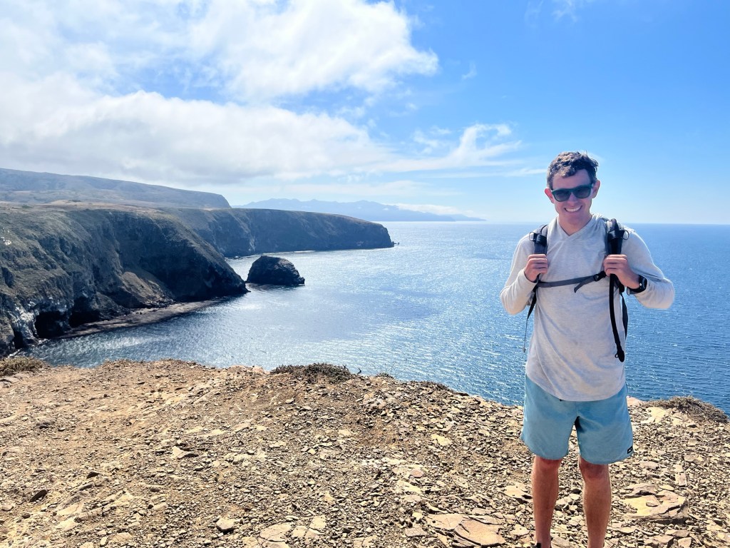
After finishing with the kayak trip around 3 we stop by the visitor center then go for a short hike to Cavern Point.
When the time comes to get back on the ferry Sam and I grab a spot at the front of the top deck for the ride back. It’s a great view of the water and potentially any wildlife.
On the way back to Ventura the ferry takes a sudden turn to the south where there is a large pod that of dolphin. We saw some on the way out, so I’m surprised that we diverted to see them again. However, as we approached the pod one of the deck hands gets on the PA system to inform us that large cetaceans had been sighted ahead. As he finishes the statement water spouts into the air and then again. We were not headed for dolphin, but for a couple humpback whales.
Sam and I have a great view, but not the best cameras, so after attempting to take videos we put the phones in our respective pockets, and take in the majestic creatures with our own eyes instead of staring at them through a screen.
The boat follows the whales for about 30 minutes and we get to see their tails exit then renter the water numerous times as they dove deeper into the water. The tail is unique to each whale similar to fingerprints for humans, so it’s cool that we got to see the identifying characteristic of each.
After returning to the marina Sam and I head over to the Ventura Pier to meet Lindsey and, Margaret, as well as Noah and Andrew for dinner. Andrew is from Tallahassee and it’s the first time I’ve seen him in six years. It was really good to catch up. Sam is close with the entire group and they try to persuade him to move to Southern California, while I lobby for the east coast. Through all the conversation we close the restaurant down before heading back to the house and getting to bed.
Day 47: Sam and I’s last day together. I wish he could come on the rest of the trip, but he has to go back to work and my journey now turns east.
Relative to the last couple weeks I’m able to sleep in and wake up around 5:45. After a quick shower I head out to the living room and everyone else is already up and drinking coffee.
Sam and I make it out of the house around 7 and drive up to Bakersfield for me to pick up my rental car. It’s about 2 hours and we reminisce on how special the last two weeks were and start brainstorming the next trip.
After getting the car and transferring all my stuff we say our goodbyes and head our separate ways.
The turn eastward to Death Valley feels like I’ve now entered the homestretch, and it’s starting to sink in that the trip can’t last forever.
After a few hours of driving I’ve definitely entered the desert and reach Death Valley National Park. The car thermometer is over 100 in the early part of the afternoon. I will have to settle for seeing the park from the car along with some short hikes.
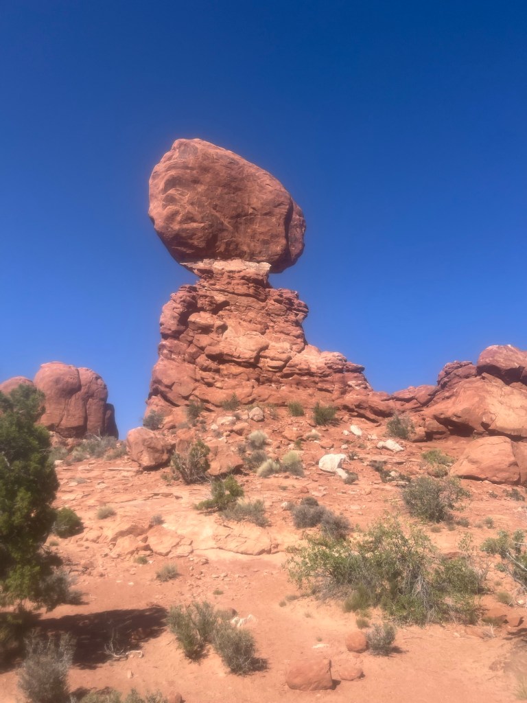
My first stop is the Mesquite Sand Dunes. There is no clear trail and wanting to avoid hot sand in my shoes I settle for the seeing them from just off the parking lot.
After that I stop by the Furnace Creek campground to scope out a spot. It’s first come first serve in the summer and I’m nervous driving in whether any good spots will be available. I feel both foolish and worried when there is not only no ranger at the entrance, but no other campers. Maybe camping below sea level is not the best call. I decide to wait on grabbing a spot and head out to see other parts of the park.
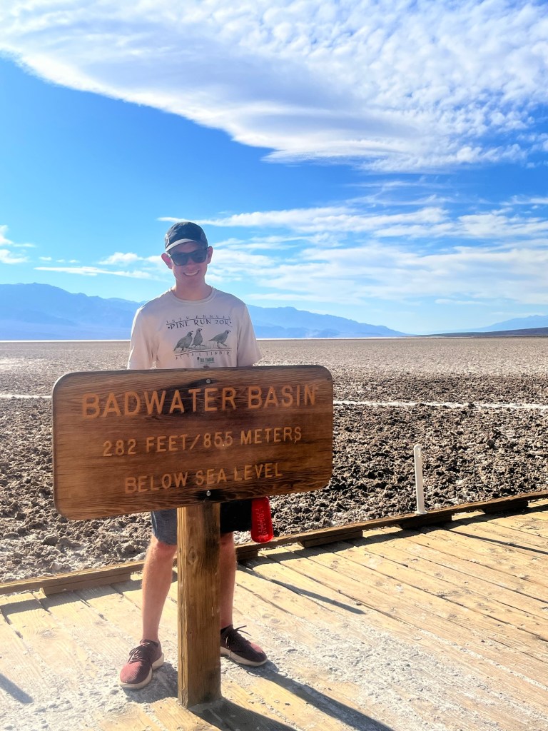
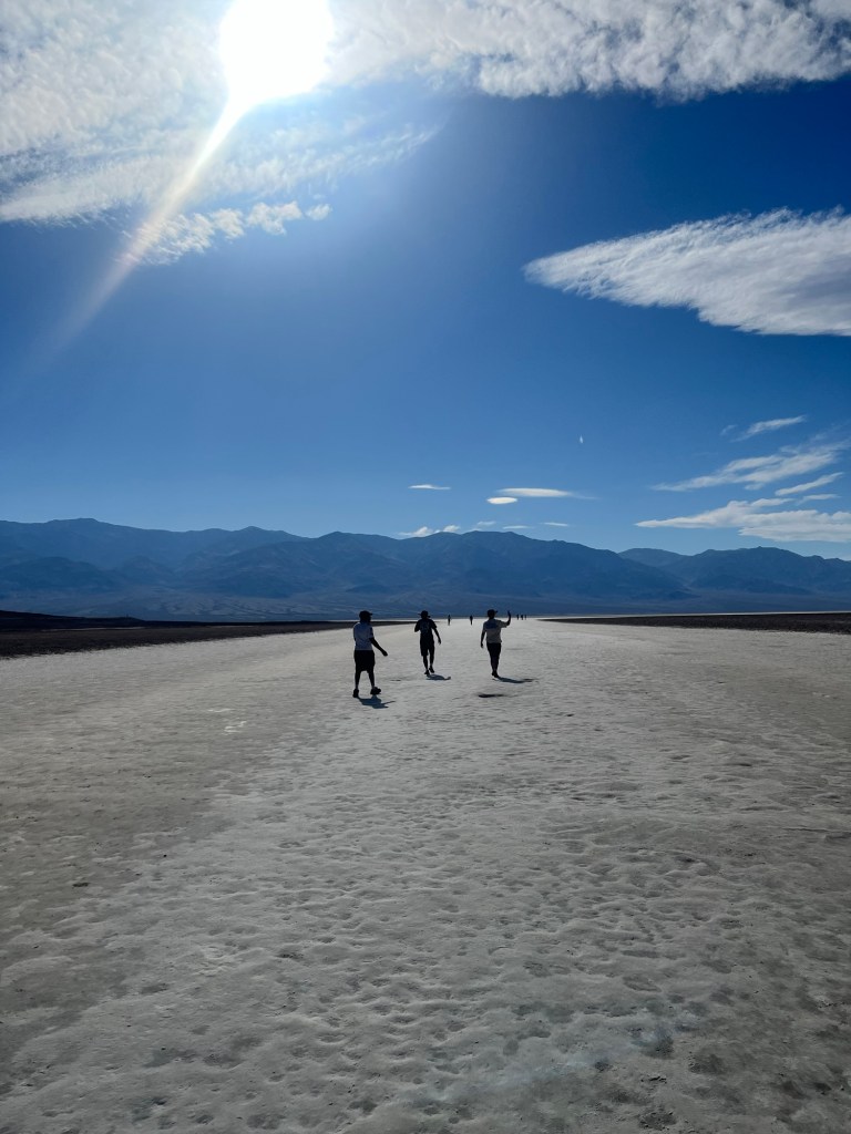
First is Badwater Basin. It’s a salt flat that sits at 282 feet below sea level. It is the lowest point in the western hemisphere. There is a sign high in the mountains above that is barely discernible: “Sea Level”. A stark reminder of how much 282 feet is.
Despite the now 110+ temps I can’t resist walking out for a little over a 1/2 mile then back. It was farther than anyone else, but still felt relatively safe.
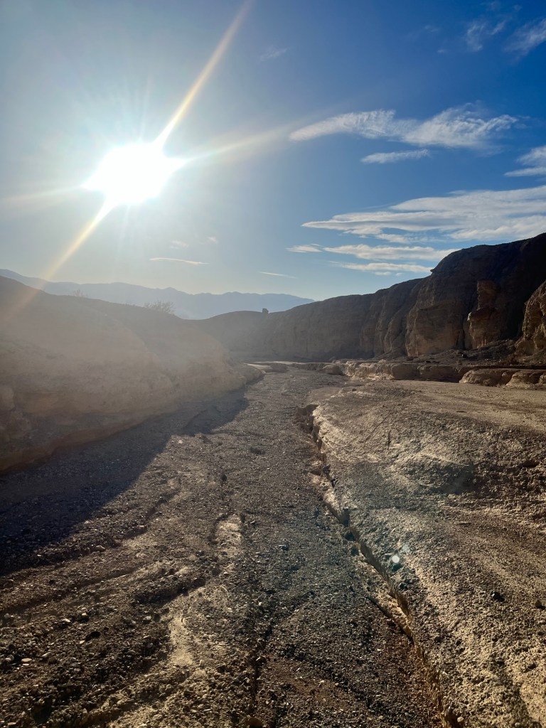
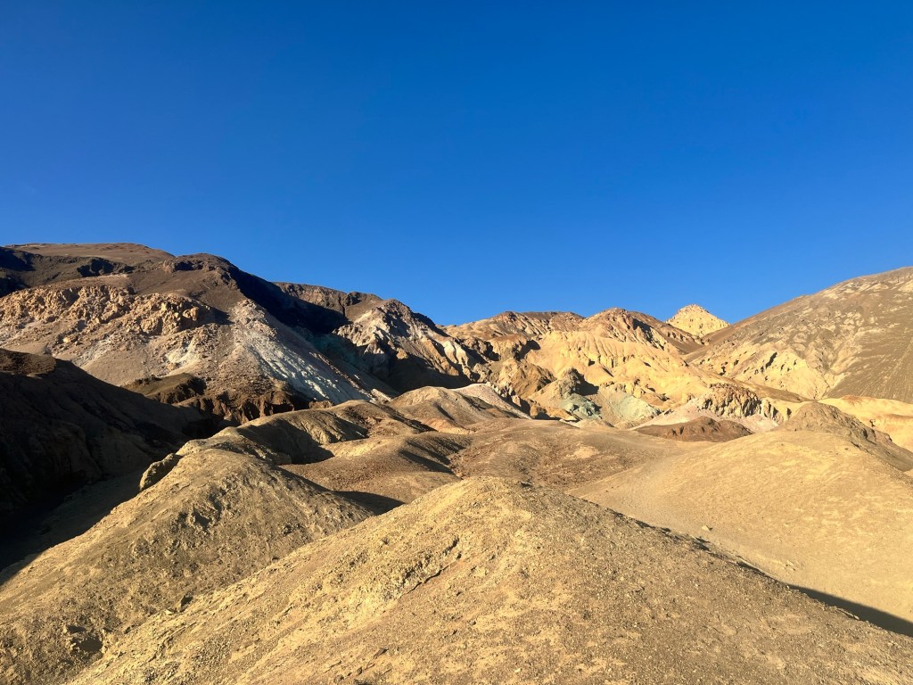
Following Badwater, I take the loop to Artists Palette. It’s a windy one way road to parking lot and once there I head for a trail before stopping to take a picture.
It takes me to the backside of the palette, but I’m wearing regular tennis shoes, as opposed to hiking sneakers, and don’t have the grip to continue in the steeper sections of the trail and decide to take the dried river bed back.
It’s a little over a mile round trip and still over 100 even though the sun is getting lower. I finally take in the view of the palette before getting back in the car to head back to Furnace Creek.
It’s after 7 at this point and I’m ready to set up camp, eat dinner, and go to bed. When I get back to the campground there is still no one there. I expected to at least see a RV, and one oven does a loop as I’m setting up my tent, but continues on presumably to a cooler spot.
After setting up the tent I eat my dinner in the car and enjoy the air conditioning until the sun sets behind me.
The stars come out quickly and there are a lot of them in this area with so little light pollution.
I get in my tent a little after 9. I left the rain fly off to allow for greater circulation and can see the Milky Way galaxy as I gaze up from my sleeping pad. No sleeping bag or even a blanket tonight as it is still a little over 90. I think as many cool thoughts as I can and am able to drift to sleep relatively quickly, if not comfortably.
Day 41: The sun is coming up, so I’m up a little after 5. Almost 4 hours of sleep. Not ideal.
Sam is getting up at 7, so I hang in the tent for a while before getting up breaking down, paying for our campsite, and eating breakfast in time to help him break down his tent when he gets up.
We head out a little before 7:30 and get to the trailhead about 45 minutes later and are on the trail just after 8:30.
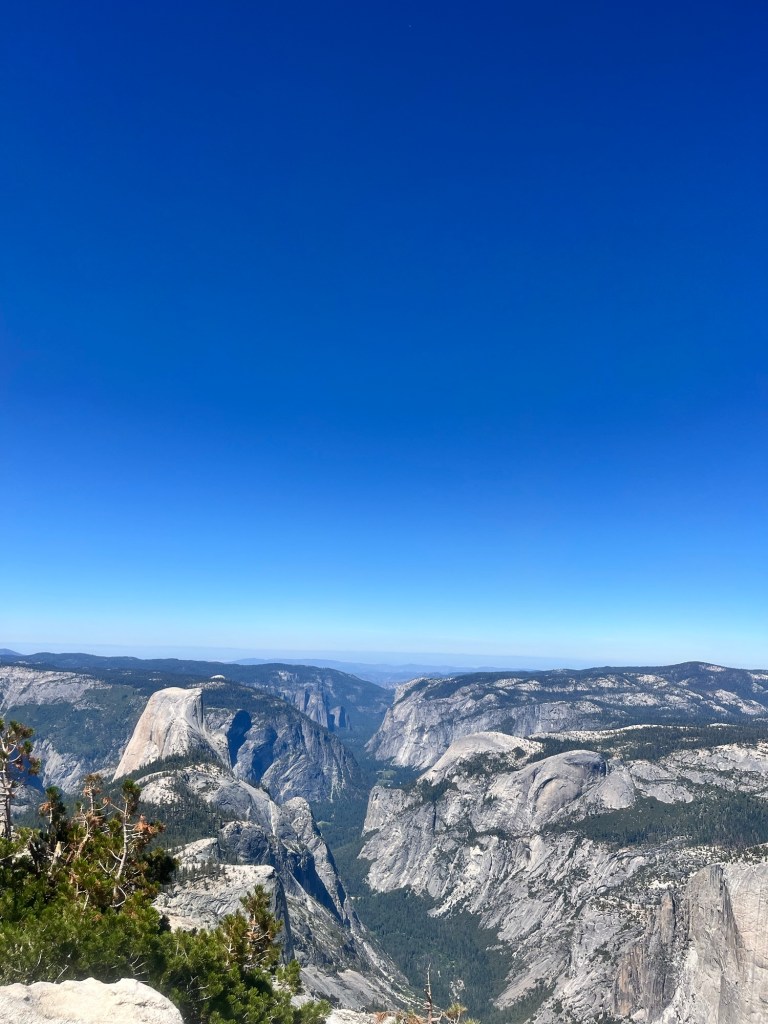
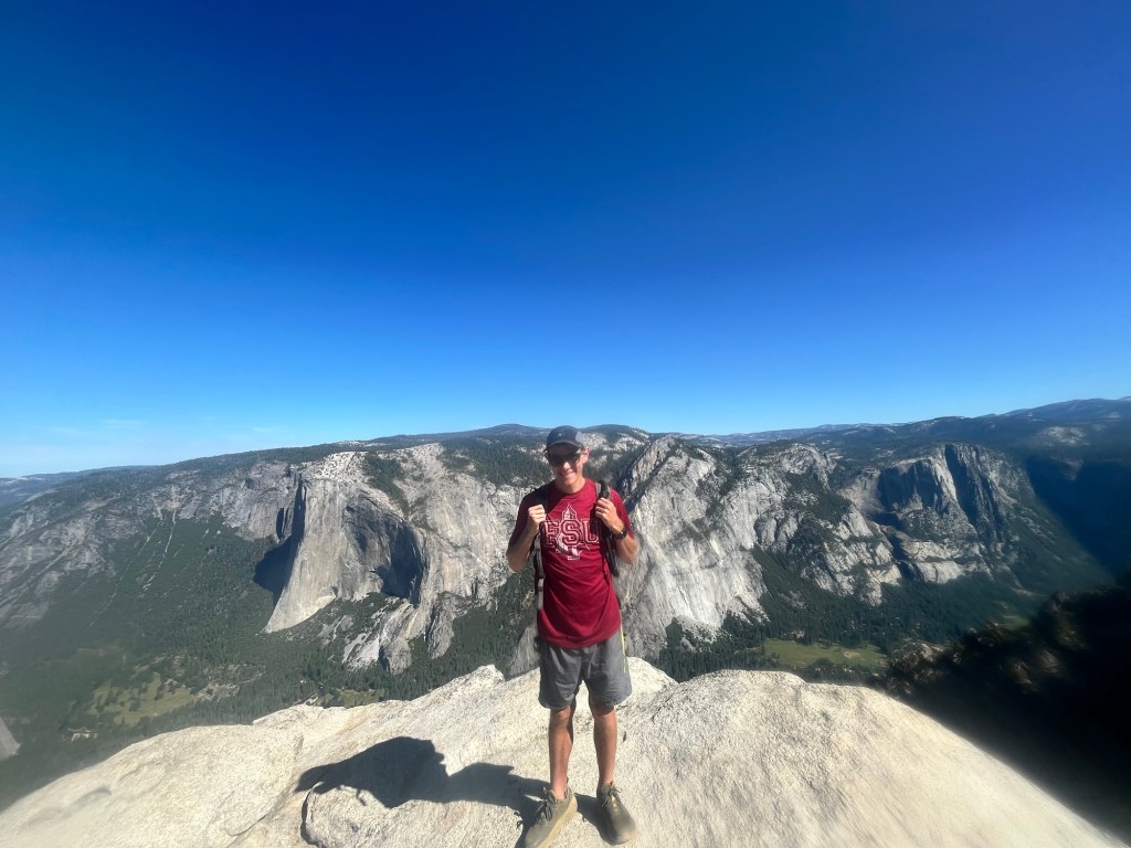
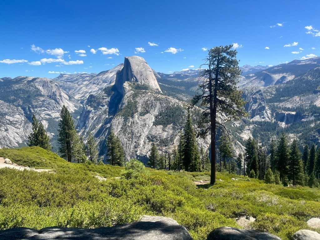
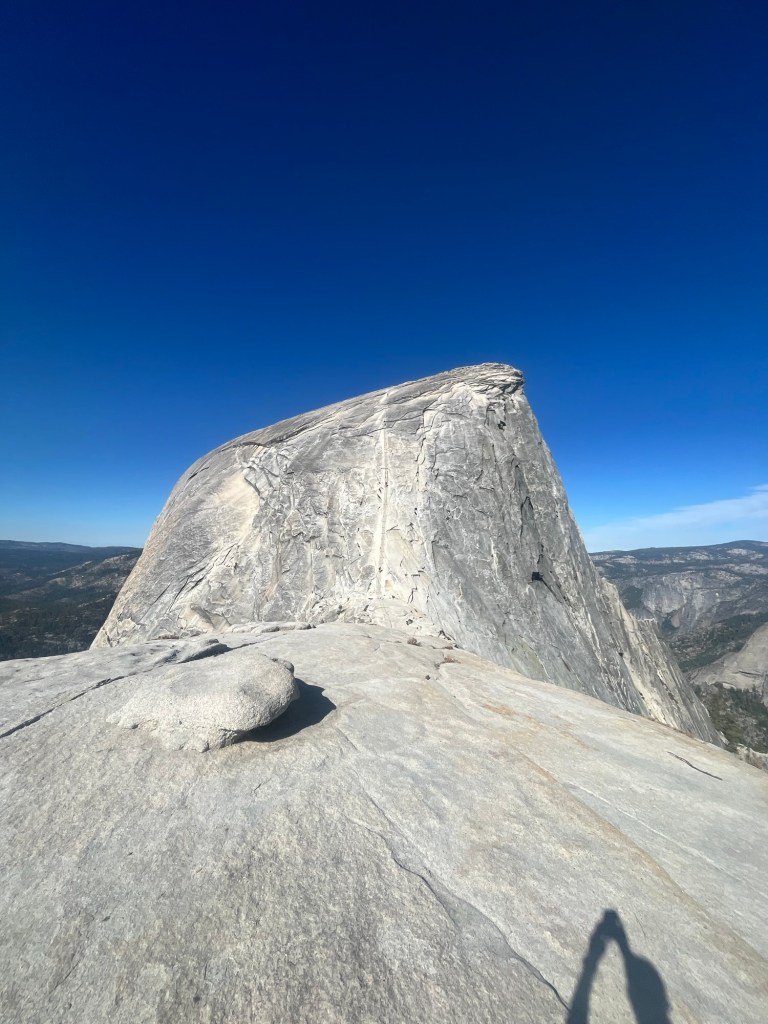
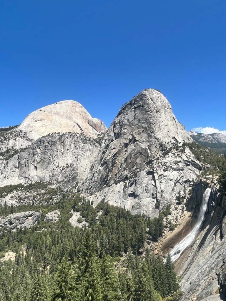
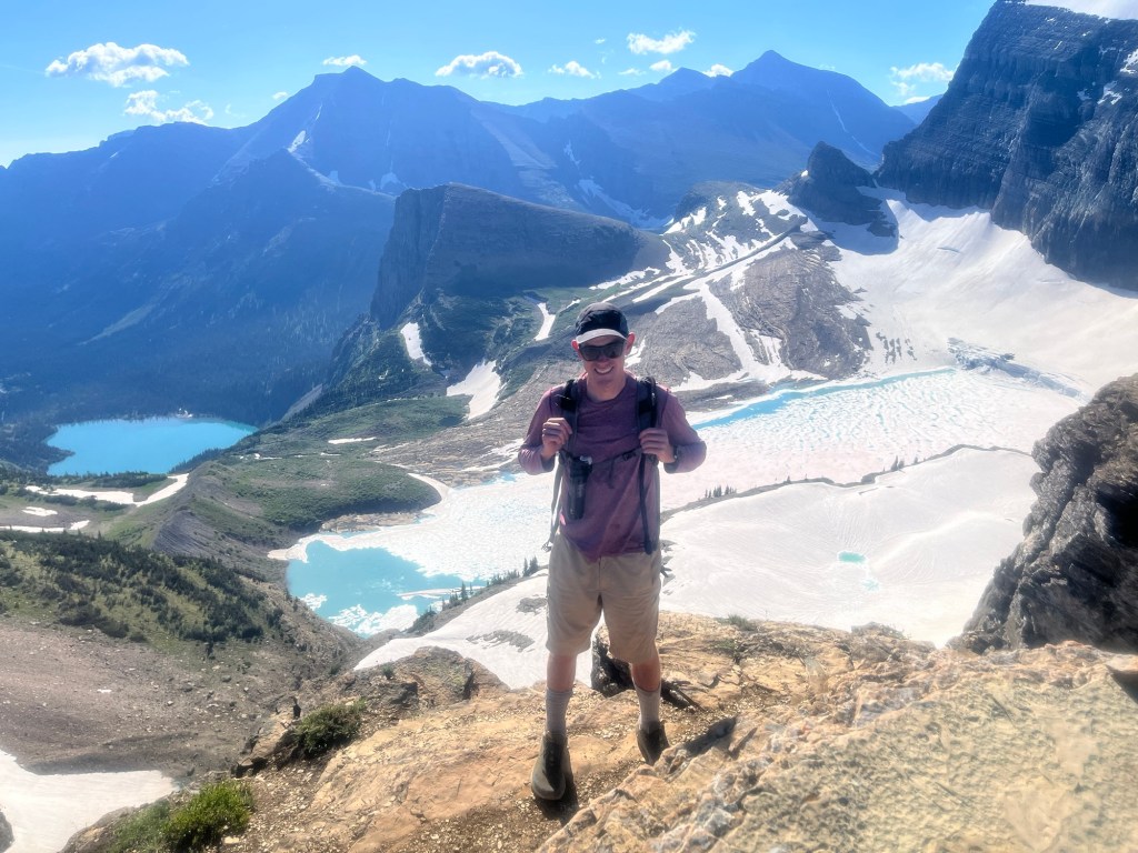
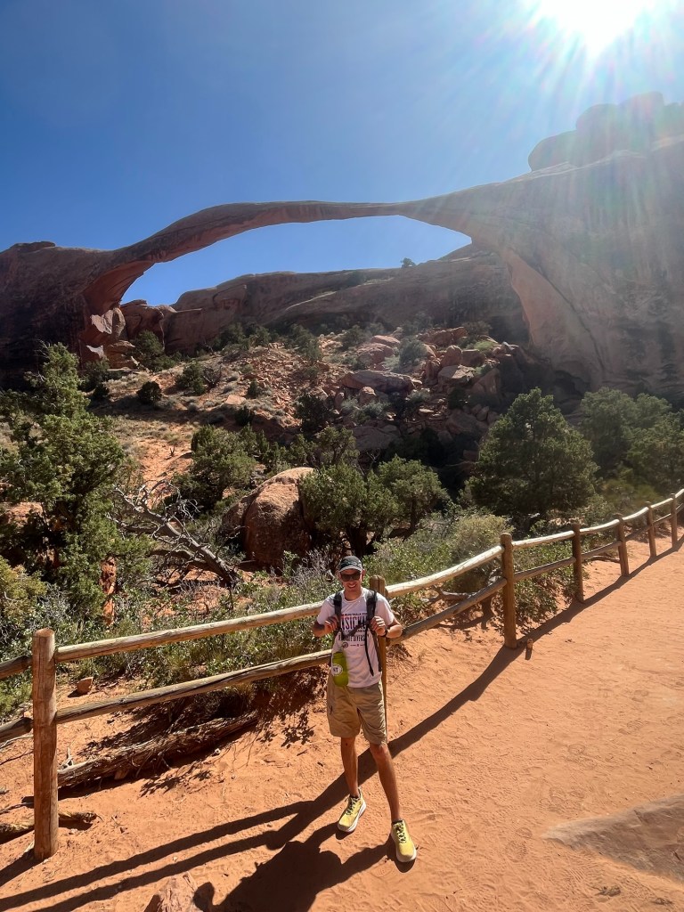
We are hiking Cloud’s Rest which is a hike I tried to do six years ago, but the road was closed, and I could not do it. The hike is about 12 miles with 3,000 feet of elevation and is popular because it finishes by walking out to the edge of a ridge that has a 360 degree view of the surrounding area including the side of Half Dome.
Although we are both tired, we are excited for the hike and in good spirits. The hike begins in the tree line and has a lot of switchbacks on the way up. There are plenty of other hikers many of which are backpacking down after spending the night in the backcountry.
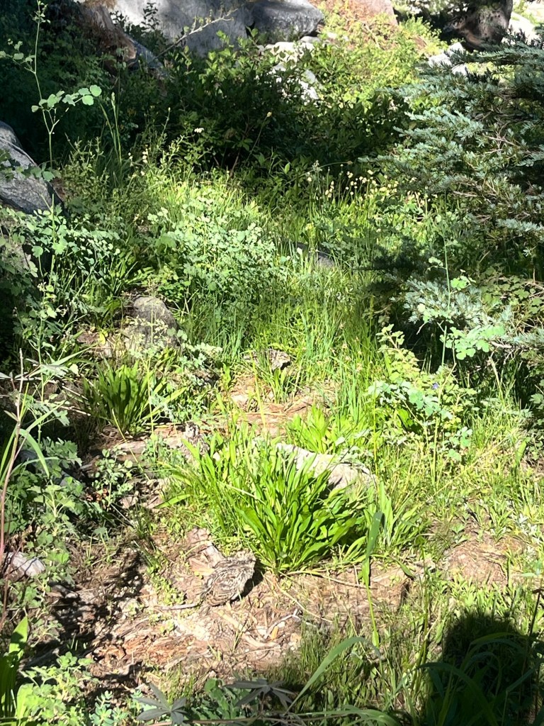
A little over an hour in we passed a pretty mountain lake as well as a Partridge and her young chicks.
Not long after that we caught up to a hiker who we met in the parking lot. Her name was “Lauren” and she was from Modesto a couple hours to the west. Although her family comes to Yosemite frequently it is her first time on this trail. We also found out that she opened up a coffee shop (Penny University) about a year ago. As we neared the top she wanted to take a break and told us that she’d catch up at the top.
The topdid not come much later and it was everything I dreamed of.
The hike up the final ridge line was about five minutes along a rocky path. Although it looked intimidating, the footing was good and the drop off was not that steep, so there was nothing to worry about.
The final view at the top was a spectacular. Yosemite Valley was beneath us and it we spent about 30 minutes admiring it.
Lauren made it up shortly thereafter and gave us some additional recommendations on hikes. She even took a picture of a half scone with Half Dome in the background. Very cool.
After taking the obligatory pictures Sam and I headed back down. The trip down was certainly easier, but took the same amount of time as the way up as we had to watch our footing.
We make it back to the car just before 2 and take off as soon as we get to the car because we are trying to apply for the 48 hour Half Dome lottery by 4pm and need service. We know there is a lodge in the Valley and head that way as our campsite is in the valley.
On the way down a coupe texts come through letting us know there is service, so we pull over to apply. Fingers crossed.
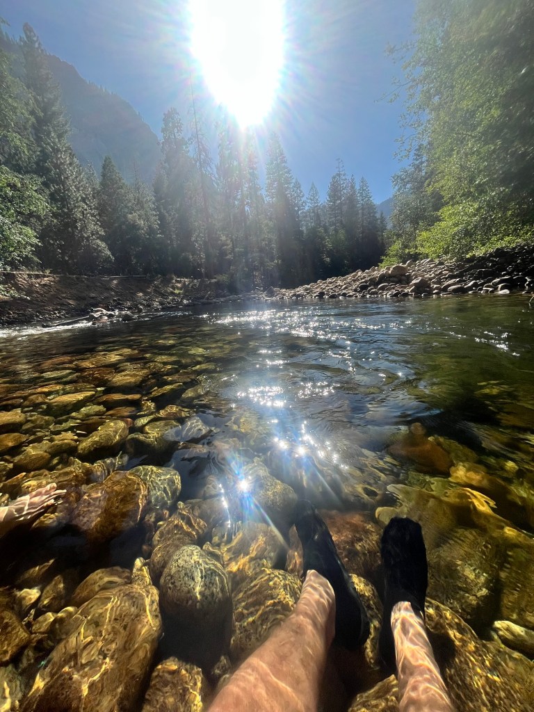
We continued the drive down to the valley and get to our campsite a little after 4. After setting up our respective tents we headed for a dip in the Merced River. As a true Floridian I despise the cold and only intend to soak my legs. Sam is far more adventurous and swims around in a calm section for a few minutes.
A little before 6 we headed back to the campsite to cook dinner, but our propane was out, so we walked over to the general store to buy a new bottle. It was well above market rate.
Gas acquired we prepared and ate some dinner and planned out the hike for tomorrow.
We both tried to get to bed early to catch up on sleep. The campsites were pretty close together, and the campers next to us (three elderly gentlemen and their respective teenage grandchildren) were having a conversation about electrical engineering while listening to classic rock about 10 feet from where I lay. I appreciated the music more than the loud conversation.
Day 42: Slept in until 5:20, then get up to start getting ready. Sam isn’t far behind and we’re pulling away from the campsite shortly after 6.
It’s not a long drive to the trailhead and I eat my breakfast in the way. Once there we make some sandwiches, pack up our bags and hit the trail at 7:20.
We are only 1/4 mile in when we realize we forgot sunscreen and have to turn around.
Sunscreen applied we are back on the trail that is mostly switchbacks on the way up with views of Half Dome and Yosemite Falls.
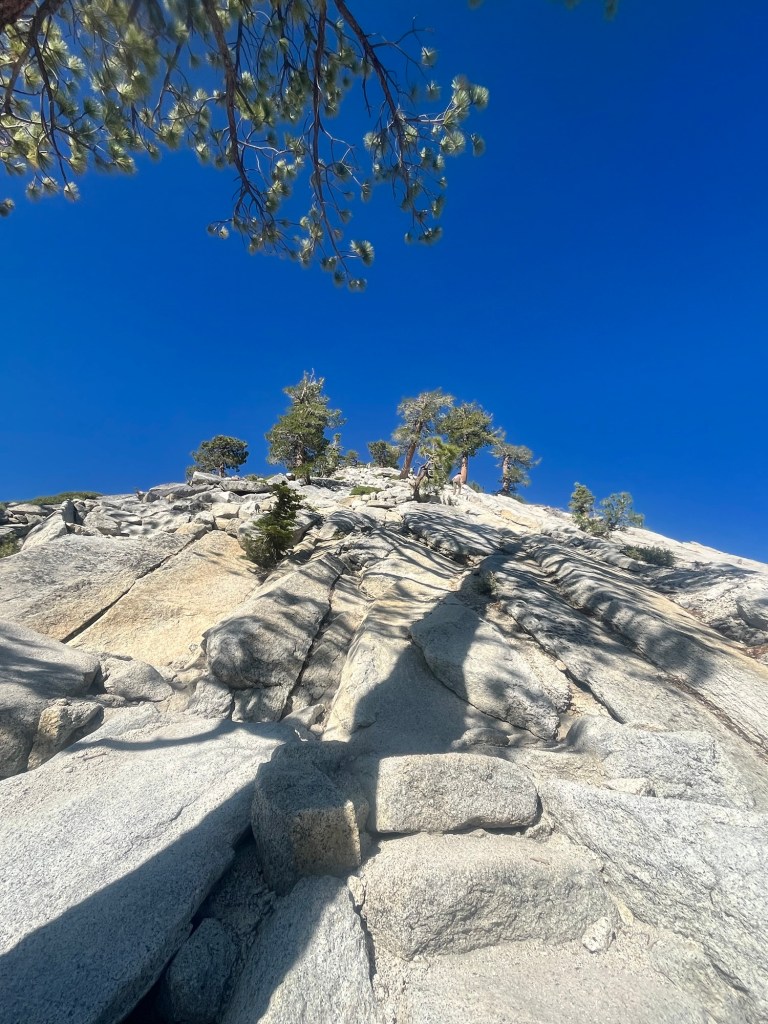
It about 3.5 miles to the top and the trail levels out after that, and stays within the tree line for a few miles keeping us cool after hiking up about 2,000 feet.
The trail wraps through the trees for a few miles and we are able to pick up the pace. We only encounter one group of backpackers in this section as most of the day hikers on the way up only go another mile in the other direction to Yosemite point. Our trail is about 5 miles to the top of El Cap.
After a few miles we enter a more exposed section on the rock. We are getting close. About a mile later the route on AllTrails ends. There is still a section of rock sloping toward the valley. It’s not too steep to walk down and we carefully walk down until we get to the edge. There are some rocks that are about waist high near the edge creating a natural safety barrier between us and the edge.
It’s a phenomenal view of the valley and we were the only ones there at that moment.
We savored the moment and stayed comfortably away from the edge. After spending some time enjoying the view we headed back up the slope and to the trail.
On the way back we stopped at Eagle’s Point which arguably has an even better view of the valley.
From there we continued the walk back, and made some time to stop by Yosemite Falls. The flow was not as strong as last time I was here, but it was still beautiful. The slower current allowed hikers to take a dip in the water without fear of being swept away.
Neither of us was keen to get in before hiking down, but we went close enough to put our hands in and wash our faces with the cool water.
Going down switchbacks is certainly easier than going up, but you can only go so fast down the steep, rocky sections. Fortunately, the crowds were pretty thin and we made it down a little before 4 to complete our 18 mile hike.
We began the drive to our next campsite, Wawona, in the southern part of the park (we tried to get all three nights in the valley, but they sold out in about 30 seconds).
On the way we stopped to look up at El Cap and it was a sight to behold. 3,000 feet of sheer granite. We used some binoculars to look for climbers but were unsuccessful.
After that, we completed the drive to Wawona and set up camp, and eat some dinner.
Taking advantage of camping by another river we headed down to to chill for 30 minutes before bed. I checked my phone as we were headed back and found out that we (finally) won the Half Dome Permit Lottery! After trying in the initial lottery a few months ago and the 48 hour lottery four times we got the permit for our last day in the park on Thursday.
We adjusted our plans to make tomorrow’s hike a little less strenuous and headed to bed.
Day 43: Woke up around 5:20, but with a shorter hike I laid in my sleeping bag for over an hour enjoying my warm cacoon before heading out into the cooler weather.
Sam is up shortly after me and we enjoy a breakfast in camp before heading to the trailhead.
Our hike for today is a loop trail with a couple out and backs totaling 7.5 miles. We don’t get started until a little after 9. As we started near the top of the south side of the valley there is very little elevation gain and we mostly take it easy.
It’s a hike I did six years ago but in the opposite direction, and given the company I enjoyed it even more the second time.
Our first lookout is Taft Point that is across from El Capitan giving us the opportunity to reflect on yesterday’s hike. Following Taft on the trail, if not ascension to the presidency, is Roosevelt point. The trail followed the rim giving us a great view of the valley.
After Roosevelt, we took an out and back to Glacier Point, which gives a great side view of Half Dome. Glacier Point is drivable and overrun with people, but we found a spot off to the side to eat a snack and admire the rock we wanted to stand on top of.
From there we hiked back to our loop and continued to Sentinel Dome, which felt like a good warm up for tomorrow as it is a domed rock with a semi-steep surface on the way up. We ate our lunch on top of the dome before heading down and competing the trail back to our car. Although it wasn’t as fun a challenge as the previous two days it was still great to see the valley, El Cap, and Half Dome from a different perspective.
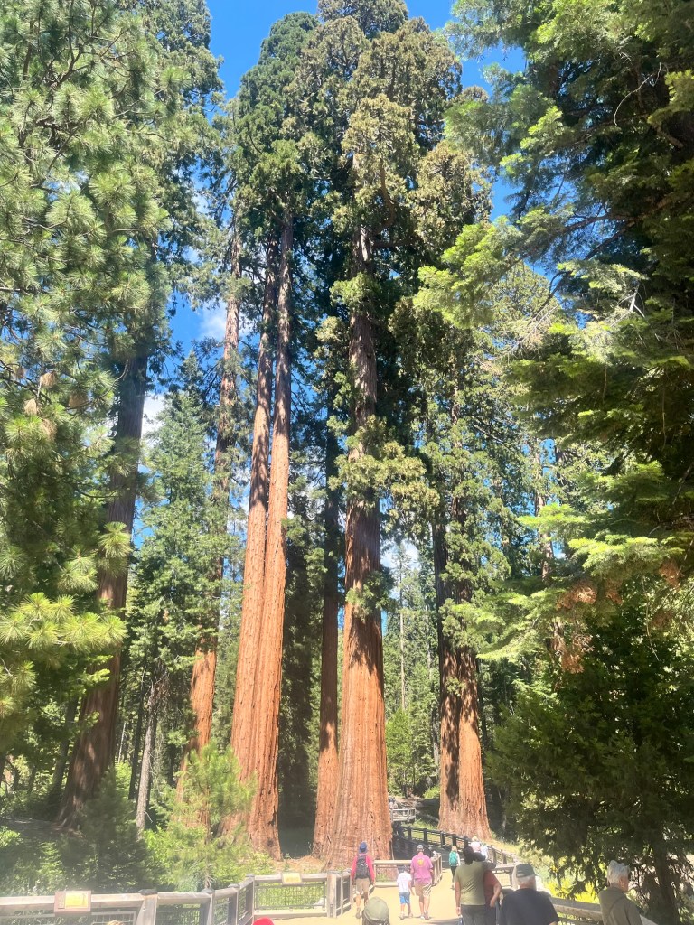
Finishing the hike a little after 1 we still had plenty of afternoon left and drive to the southern part of the park to the Mariposa Grove of Sequoias.
We skipped the two mile trail to the grove and took the shuttle that let us out right at the grove.
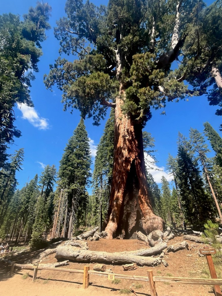
We opted to walk the two mile Grizzly Grove Loop, which included the Grizzly Giant Sequoia which John Muir and Teddy Roosevelt camped under. Story goes that John Muir convinced Teddy to make Yosemite a national park that night. For that I am thankful.
We made it back to our campsite around 4:30, and began prepping dinner and our day packs for tomorrow in order to get an early start in the morning. As we were about to eat a park ranger drove by and invited us to his campfire talk at 7 down the road from our campsite.
After finishing all our chores for the evening we walked over to campground amphitheater. Ranger Eric – late-20’s, slight build, sandy hair underneath his ranger hat – took us through a brief overview of the founding of Yosemite, then the impact hippies had on the park in the late 60’s and early 70’s. Ranger Eric was an excellent story teller and even played a few songs on the guitar. It was a really fun way to spend our last night here.
Day 44: Today is the day. It is the day. Half Dome. HALF. DOME. We are hiking Half Dome today!
After entering the lottery six years ago and failing to get a permit. After entering the permit lottery a few months ago for any date in a two week period and coming up empty. After entering the 48 hour lottery for our first three days in the park and almost giving up. After all that we got the permit to hike today on our last possible chance.
Yes, today is the day we are doing one of the most popular day hikes in the country.
It’s over 18 miles including the walk from the Curry Village parking lot in the valley and we have a four hour drive afterwards, so we’re up a little before 4:30 to break down camp and start the drive a little after 5.
We found a parking lot with an EV charging station and parked there even though it was a little farther from the trailhead than the main lot.
It doesn’t take long to get ready as we packed our lunch and snacks for the hike last night and we are able to start at 6:15.
The first mile is paved trail in the valley that goes by a Curry Village where there are multiple dining options and a general store, as well as several campgrounds including the one we stayed in a few nights ago. It doesn’t take too long and we are on the actual trail.
Sam recently took part in an ultra relay race where his team kept track of the number of people they passed throughout the race. With a long, popular hike in front of us it felt like a great time to count the “passes”, especially because there were a couple shorter out-and-back trails on our route.
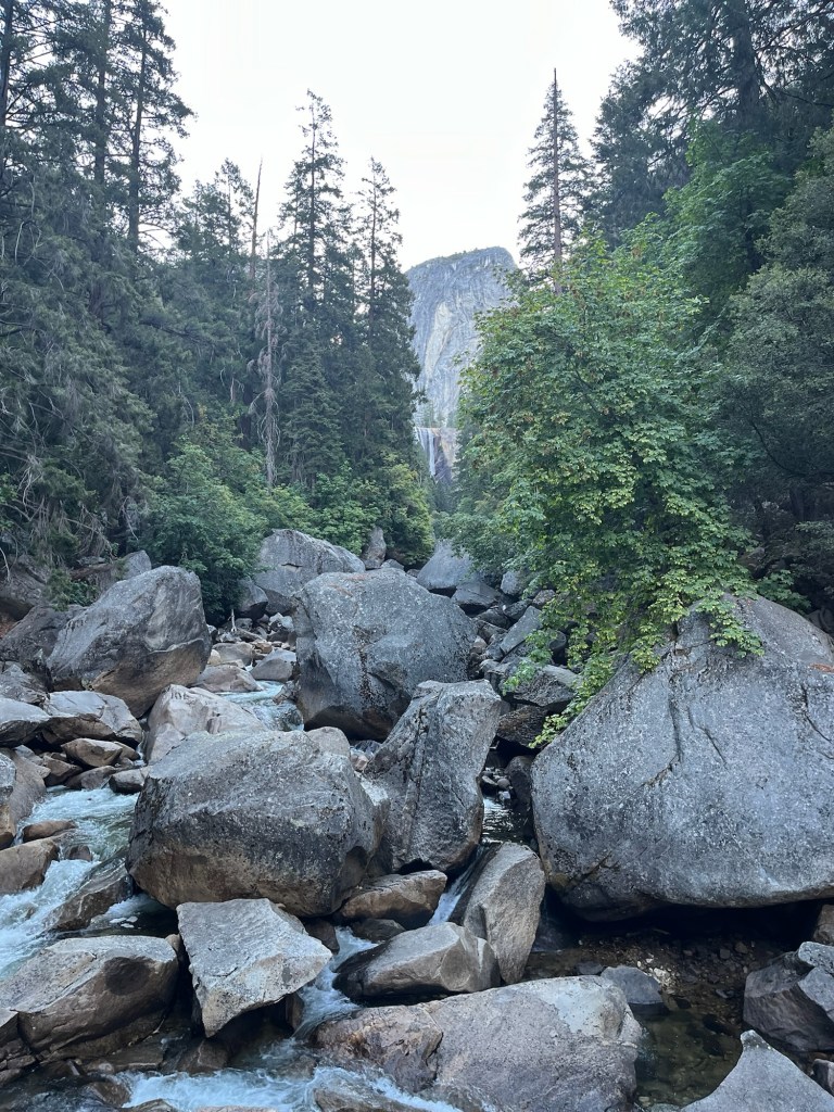
We are at 20 before the first mile, and the trail is starting to get steep as it climbed up to a couple waterfalls, the first being Vernal Falls.
The next section of our route is the Mist Trail which is under construction from 7-3:30, so we have to get there quickly to not take the longer detour. 34, 35, 36.
We make it with about 10 minutes to spare, passing the barricades on the side of the trail and are relieved to have made it. It’s still steep, more of a meandering staircase than a traditional trail. But, we have hiked many steep trails the past few weeks and continue to pass those in front of us. 43,44.
The Mist Trail culminates in Nevada Falls. There are a few larger groups taking a break at the top. There is a short conversation over whether they count as passes as they likely are not going any farther, but we’re walking past them so they count. 88, 89, 90.
We are now on the John Muir Trail which runs from Mt. Whitney by Death Valley National Park 220 miles to Yosemite Valley. The crowds have thinned after the falls. There are no other major destinations for day hikers on this route other than Half Dome and that is still 4.5 miles away. But the trail is now a trail again and almost all my competitive juices are flowing with Sam keeping pace behind me. 99, 100, 101.
We passed Lower Yosemite Falls campground which is a backpacking campground that you must have a permit for. By this time must of the backpackers have left and there are a few on the trail. 106, 107.
The trail turns upward again and we are now only a few miles away. A couple hikers are on their way down having already been to the top and back. I wonder how early they started, and they tell us that the experience of getting to the top was incredible. The switchbacks and hours already spent on the trail are slowing the other trailer goers down, but we’re still feeling good. Actually, I’m thriving. 126, 127, 128.
There are more hikers coming down the trail, but not down from the high they received at the top. Feeding off their energy we make it up the final push to Sub-Dome. 135, 136.
This is where we show a couple rangers our permit, receive some instructions that went in one ear and out the other and are allowed to continue. I let out a sigh of relief as if I expected the permit to not work. Such was the disbelief at how close we now were. 144, 145, 146.
Sub-Dome by itself was quite the challenge. Narrow steps were cut into the rock and sometimes we hiked up the sloped rock face. 157, 158, 159.
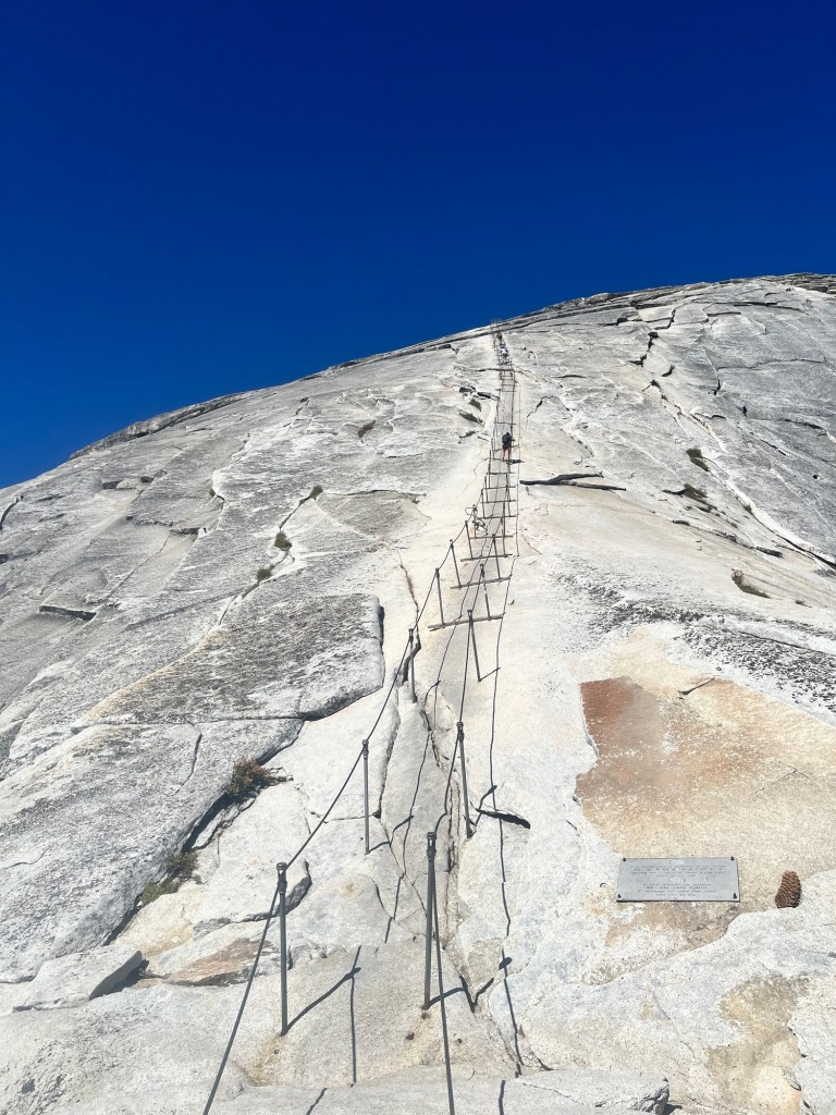
The top was now in sight, and so were the cables. The route to the top. This is the reason the park limits the number of hikers. The final couple hundred yards involved climbing up the rock face via a set of cables. They were as intimidating as the pictures. But, without them getting to the top would be impossible for a non-rock climber.
We took a few minutes to size up the challenge and give another hiker in front of us a head start.
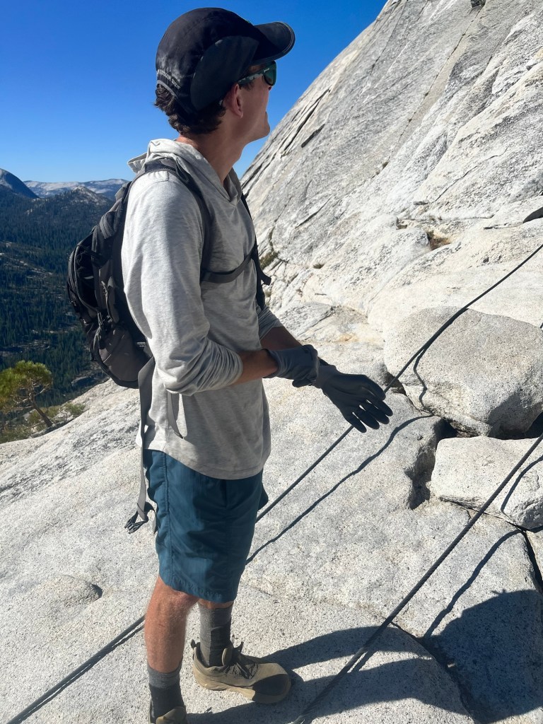
I was definitely nervous. A wrong move could result in disaster, and I slowed my breathing to try to stay calm. I had brought my own set of gloves, but there was a pile of gloves with more grip than mine, so I put mine back in the pack and got a better one from the pile.
Sam starts up and I give him a few minutes to before I follow. My strategy for dealing with nerves is to focus only on the next set of posts and a steady rhythm of one foot forward, opposite hand forward, and so on. Moving steadily and keeping my momentum in the forward direction gives a feel of equilibrium as gravity tugs down. It also keeps my mind clear of doubt.
However, there are slower climbers ahead of Sam and others on the way down. This is the toughest part for me. There are 2×4’s on each set of posts allowing a sturdy, firm place to stop and allow others to pass down or for us to go around others. We even pass a young lady who had a climbing harness and clips that she moved up the cables as a safety precaution. It slowed her significantly, but I was a little envious.
Finally, there was no longer anyone in front of us and we were able to finish out the climb, which got significantly easier (read safer) near the top.
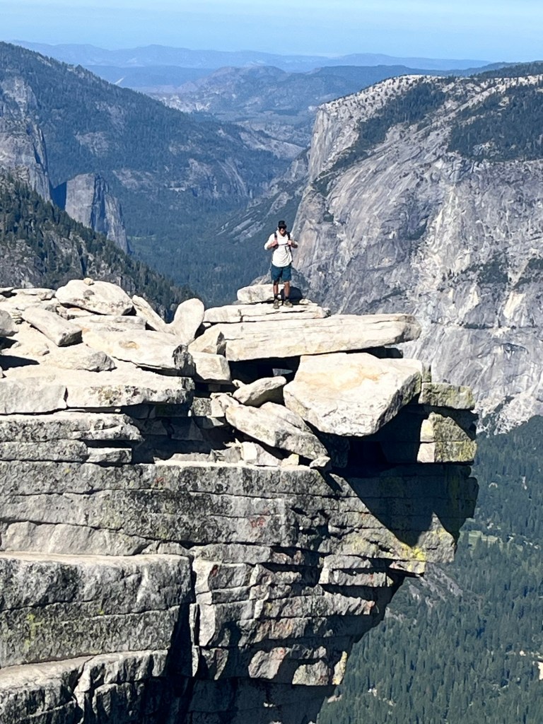
Relief. Elation. Disbelief. I was happy to be on more level ground, excited to be on top of this hallowed piece of rock, and couldn’t believe how lucky I was to be here.
The view from the top was breathtaking, but simply being on top was surreal. There was a group of hikers at the first overlook, and we stayed with them for a little before continuing to the other side, which provided an even better view of the valley.
This was my new favorite spot in Yosemite.
After admiring this piece of granite from other parts of the park we now imagined other people using binoculars to look at us on top, as if we were the stars of Yosemite and I sure felt like it.
Nothing was going to bring me down from this high, except that set of cables we were now headed back to. It was more crowded and we discussed with those around us which direction to walk on the way down. Some favored walking down backwards as it allowed for a better grip on the cables. Others favored looking forward to better watch each step.
I started backwards, but even on a more gradual slope I was uncomfortable and had to turn around. I leaned back to keep my weight over my feet and found a rhythm again. There were more people in front of us and we moved slowly. Sam loved the additional time on the cables, but I was ready to be off them. About halfway down there was one section where the cable had been repaired and I had to lower myself into a full squat in order to maintain my grip on the cables that were now knee instead of chest height. I was certainly afraid, but tried not to panic, as I navigated through this short section.
One of the guys in front of us, Michael, encouraged all those going up to take their time and generously allowed others to pass on their way up. He was doing the right thing, but I would have preferred if he kept moving forward.
Finally, we passed the last group and could go down at our own pace uninterrupted. I took the gloves off and returned them to their pile, grateful for whoever left them there.
On the walk down Sub-Dome I enjoyed the best apple of my life and we made a friends with a solo hiker, “Ryan”, who had come down the cables a little in front of us.
Now it was our turn to encourage others on the way up, and we all did so enthusiastically.
We walked down the entire way with Ryan, who is an engineer in Huntsville, and has completed a lot of hikes throughout many of the National Parks.
We have to take the detour instead of the Mist Trail on the way down and get a different perspective of Nevada Falls which we passed on the way up.
The rest of the trail down is clogged with other hikers on their way to or from the falls and being the biggest jerk in the group I took the lead to blaze and occasionally bully our way through.
We made it back to the car a little after 2 still buzzing from the trip to the top. We still had to drive to Pinnacles National Park about four hours to the southwest, so we got in the car and started our drive. I had saved a jar of peaches for several weeks to celebrate a successful summit of Half Dome and happily ate the entire 24oz jar on the way out of Yosemite.
The drive to Pinnacles took us through the Central Valley and some agricultural communities before we made it to the park.
Instead of a normal campsite we had reserved a tent cabin, which Sam had forgotten about and was very surprised to see when we pulled up. It even had cots for us to sleep on and was a nice change from setting up and breaking down our own tents.
Feeling like a king of Half Dome earlier in the day, such a setup for the night felt appropriate.
Day 39: Almost made it to 6. Up for food around 5:45.
Have to immediately start packing as we’re hitting the road today and I’m not coming back to Sam’s house.
It takes a few hours to get everything back in Sam’s car and reorganized to fit the stuff he needs for the next week.
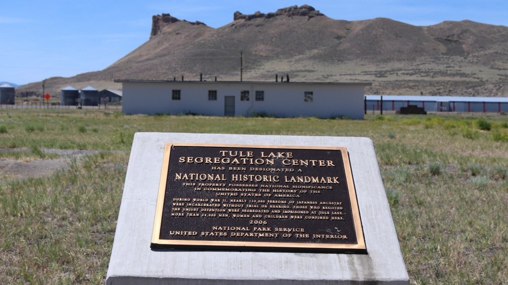
After eating some oatmeal we are on our way a little before 9. Our first stop is Tule Lake Relocation Camp where at one point 18,000 people of Japanese origin were detained during WWII. All of the barracks were repurposed to housing for local farmers and moved off site after the war, but one of the recreation rooms, the top of a guard tower, and the jail are still there.
It is a sobering piece of our history.
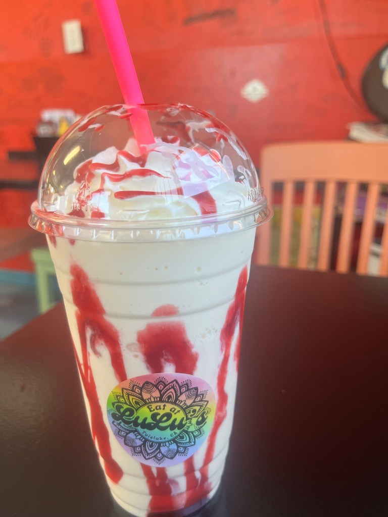
Following that visit we stopped at Lulu’s Diner for lunch. They are popular locally for their milkshakes and we got a Raspberry Lemonade that was delicious.
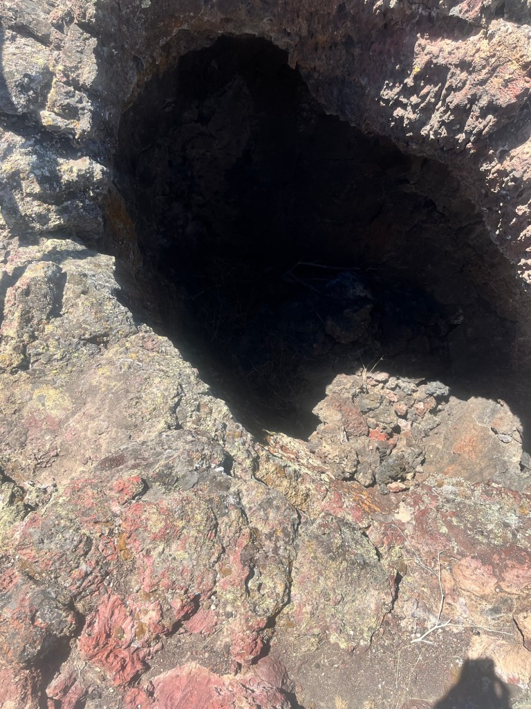
Following lunch we headed for Lava Caves National Monument. There were several lava flows still intact that we were able to walk on.
We even stopped “the Chimneys”, where the lava created vertical tunnels that you could look down.
However, the highlight of the National Monument are the lava tunnels you can walk through.
The first one we stopped at was the Balcony Tunnel, which involved some light crawling. Fortunately, we left our headlamps in the car and could only use one hand to crawl as the other held the phone.
After that we went to the Golden Dome tunnel named for the shimmering gold dust on the ceiling of the tunnel (ok, it wasn’t actual gold dust, and I’m sure I read a sign that explained the phenomenon, but I don’t remember the explanation and it’s more fun to pretend it was gold).
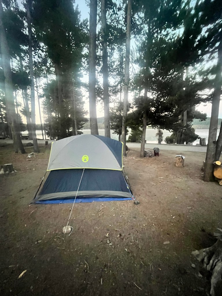
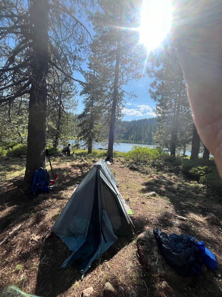
From there we headed to our final destination of the day: Medicine Lake. Campsites were first come, first serve and we were able to find one right by the lake.
After setting up we did a short hike to Glass Lava Flow and scrambled up to the top.
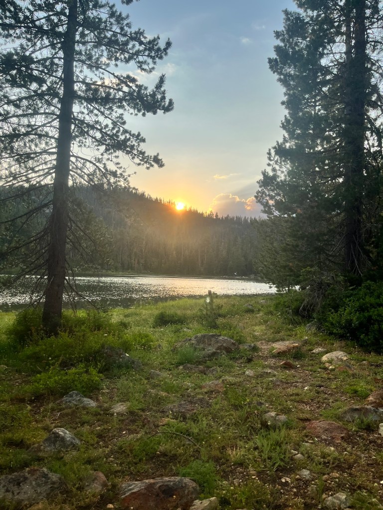
When we got back to camp I fired up the stove to make dinner while Sam took a dip in the lake. We ate on some rocks by the lake and watched the sunset over the lake.
We headed for bed straight away to get ahead on some rest.
Day 40: Up around 5, but lay in my tent until 5:20 because Sam isn’t planning to get up until 6.
I have all my stuff back in the car and am rolling up my tent when he gets out of his.
I boiled some water for my oatmeal and his coffee and by the time I’m finished eating and he’s packed up we are ahead of schedule and on the road before 7.
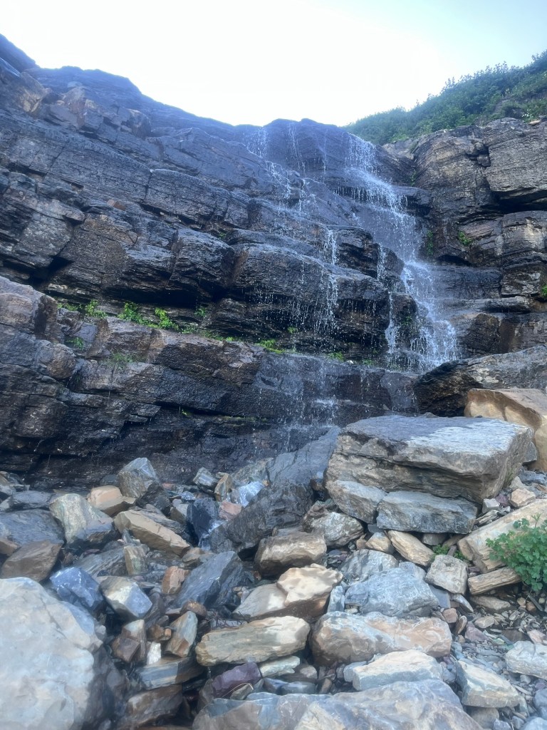
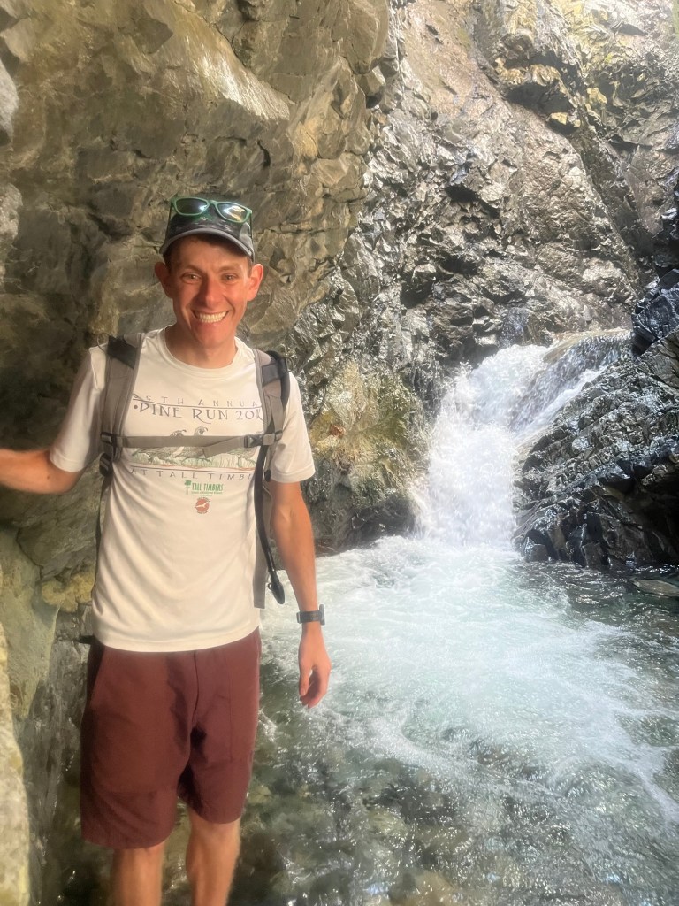
After dropping Stephen off at his dog sitter we dropped into Burney Falls State Park to see the waterfall. It was really impressive.
From there we picked up some groceries in the town of Burney and stopped at an EV charging station that was in the way to Lassen Volcanic National Park.
But the Tesla charger wouldn’t work with Sam’s Chevy and we found ourselves in a bit of a pickle.
The only charging stations we were in range of were in Redding which was about an hour in the wrong direction. So we were forced to head there. While we waited we tried to buy propane for the Coleman camp stove at multiple stores, but they were all out. We did find a different brand at Dick’s Sporting Goods that the internet told us would work. I was also able to buy a sun shirt that I had envied on the Pacific Crest Trail.
With the car nearly fully charged we finally began the hour drive to Lassen just before 1.
As we were now very short on time, we stayed in the car for most of the 30 mile drive through the park. We did get out to see the Cold Boiling Water trail which was just under 2 miles out and back with a lake at the turnaround point. There were some small bubbles in one section, but other than that it was a normal lake.
There were other trails in the park that would’ve been fun, but we had a lot of driving to do and bypassed them all on the way south.
We stopped to charge the car in the tiny town of Portola and grabbed a few additional groceries at the market across the street. We even had some Indian food for dinner. Without fully knowing what I ate, other than it had tofu and naan, it was quite tasty.
After the car was fully charged we began the drive again and stopped briefly at Lake Tahoe and caught the last hint of daylight.
Following the quick stop we followed the road down the east side of the lake and continued south toward the eastern entrance of Yosemite. We did not have a campsite reserved, but planned to find a site at a National Forest campground just outside the park. At this point we knew we would be after the 10pm quiet time, but were committed.
Another couple hours rolled by and we stopped at our final charging station of the day. By the time we left it was nearly midnight, but we were close.
As expected we found a completely quiet and dark campground, but found an open spot in the middle of two other open spots proving a good buffer against any noise we may make setting up camp. We did our best to not direct our headlights at other tents and were finally able to crawl into our separate tents after 12:30 ending a very long day.
Day 35: Up around 5:15. Would have liked a little more after a long day, but I’ll take the 8.5 hours.
Spent the first part of the morning catching up on some writing and icing a couple sore spots from Shasta. My bone bruise by my right knee from my fall at Lake Solitude was re-aggravated, as well as a spot on the inside of my left knee which Dr. Cook informed me was where several tendons met.
Sam got up a little closer to 7 and we started packing for a four day backpacking trip on the PCT.
We had intended to start packing yesterday afternoon, but didn’t have it in us after Shasta. Packing up was slow going, but we were making progress in between eating breakfast (leftover pizza covered in Nutella for me), and making calls to family to let them know we may not have service the next few days.
Finally, we were on our way around 11:30 after a last round on snacks and water. Sam has planned a route that took us on a trail in the National Forest, to the Pacific Crest Trail. There was even a feeder trail from his neighborhood, so we left from the front door and went right by the car.
The feeder trail was narrow at first but opened up by a pedestrian bridge that crossed Lake Siskiyou. We briefly parallel the lake before turning onto a dirt road. The time on the dirt road was brief, and a truck attempted to make it briefer, but Sam saw it coming around a bend and we had time to step off.
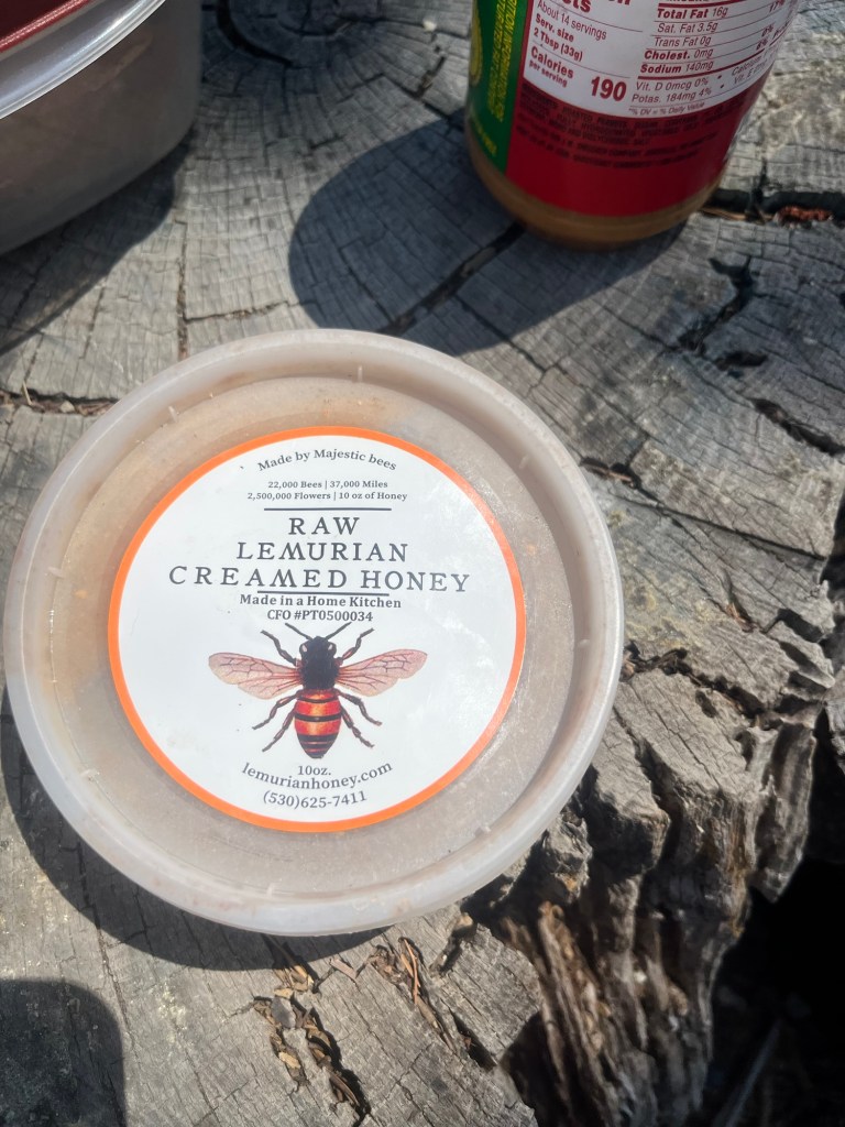
Soon after we arrived at another bride crossing and stopped to eat the peanut butter and Lemurian honey (it’s a reference to a local cult) sandwiches we had packed, and fill up Sam’s water bladder which had leaked some at the house.
We got back moving around 1:30 and soon reached our trail. It was adjacent to the North Fork of the Sacramento River for the rest of our day. We happily traversed the next section chatting about old friends and trips along the way. However, the trail started to climb and my knee injuries from Shasta started to have some discomfort then pain. We stopped around 3 for me to take some ibuprofen to ward off the inflammation.
After the short break we kept moving and the elevation continued. We think the incline caused much of the discomfort and there was no escaping it, at least for today. It was a tolerable amount of pain, but I was more concerned with causing a long term issue. We took another break around 4:15 and Sam told me we had about a mile to go. Sufficiently motivated we got back on the steep trail and found a campsite along the river around 5.
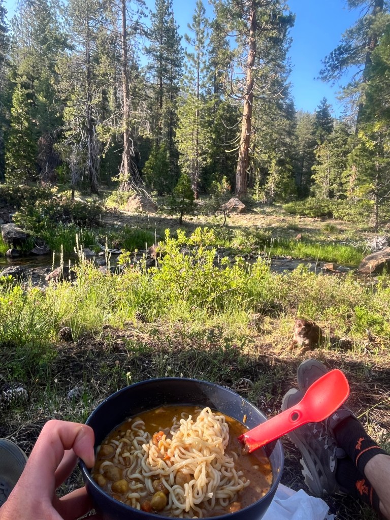
We set up camp and enjoyed a delicious, if not nutritious, dinner of Chickpea Masala on top of some Ramen Noodles.
Following dinner we lounged by the river and I soaked my legs hoping to relieve some inflammation.
After other routine chores including setting up the bear bag I headed for bed.
Day 37: Up around 5:20. Sam isn’t far behind. Not quite sunrise, but light enough to see.
We tag team taking down the bear bag, then Sam starts heating up water for breakfast and I start packing up some of my stuff and filtering water from the river.
We have some oatmeal and dehydrated fruit. I’m definitely more of a breakfast guy and scarf down three packs, while Sam struggles to finish two.
After filtering some more water to get us back to 100%, and packing the tent and all our gear we are in the trail a little after 7:30.
We are close to connecting to the PCT, but the rest of our trail is pretty steep and my left knee started to bother me again. Based on the pain we decided to cut out part of our planned route to Mt. Eddy as the trail is very steep. Fortunately, it took a little less than two hours to reach the PCT, and then trail leveled off and followed the ridge line.
Almost immediately we began to run into PCT thru hikers all headed NOBO (northbound). They were all excited to see Stephen, even when he didn’t return affection.
We had a beautiful view of Mount Shasta in the distance for much of the morning before crossing a mountain pass that put it out of sight.
We lunched on peanut butter and Lemurian honey overlooking one of the lakes. It was a lovely place to dine.
Not long after lunch we passed a thru hiker who asked us unironically if we had seen Daniel the Lion. Many of the thru hikers are given trail names and we assumed he was looking for a person, but he wasn’t. Apparently, there is a lost stuffed lion somewhere on the trail. Not knowing we needed to look for such things we had completely missed it as the last known sighting was at a spring we passed about 1/4 mile earlier. Wishing him luck we continued on our SOBO route.
Pretty soon we reached our trail for Gum Boot Lake, which is less than a mile off the PCT. The campground can be accessed by cars, so there are already a handful of campsites occupied when we reach it around 3. We continued around the lake until we found a suitable location, then dropped our packs to setup camp.
After setting up the tent we walked down to the lake planning to go for a swim but the rocks that surround the lake extend into it making it tough to wade in. Sam still walked out a little past his knees, but based on his negative reaction I stopped at my ankles.
After the aborted swim we chilled in the campsite and I attempted to take a nap an a large, relatively flat rock.
We ate an early dinner around 5 and finished with camp chores before spending the rest of the evening by the lakeshore and watched the sun set over the mountain on the other side.
Day 38: Up off and on throughout the night, but up for good around 4:20. Looking forward to getting back on my larger sleeping pad that was too big to take on the trail. And my pillow, mostly my pillow. I’ll sleep better with it.
I laid in my sleeping bag and Stephen even got in for about an hour, until I got out of the tent around 5:45. I must have woken Sam up, because he is right behind me.
We get the bear bag down and make some breakfast before breaking down camp. It’s around 8 when we hit the trail and it’s a steep climb from the lake back to the PCT. My knees did not like steep inclines the past couple days but fare ok this morning.
We are in sight of Castle Crags within an hour and they stay in sight for much of the morning.
Along the way we decided we were making good enough time to finish our four day hike in three, and set a goal of making it to Castle Crags Lake for lunch.
It was getting hot and we were nearly out of sunscreen. Our remaining bottle had a pump that was not working well so we had to remove it in order to access the sunscreen. It was still not enough. I envied the thru hikers and the sun shirts they all wore. (Mental note to get my own.)
A little after noon we pass by our would be campsite had we planned to spend another day on the trail. Shortly after that we found our trail off the PCT and hiked to the top of the ridge then down to Castle Crag Lake.
It was beautiful and filled with picnickers. It was a very different crowd than the thru hikers we had seen over the last couple days. The bread for our sandwiches had some mild, so we ate peanut butter and honey straight out of the containers.
Our time on trails was over as the hike back to Sam’s house was mostly on the road. Sam had carried Stephen for much of the day already and had to almost the entire 8 miles down the road back to his house. However, on the final stretch that was familiar to him Stephen was willing to walk giving Sam a final reprieve.
After a shower that revealed my high sock tan was really a dirt line we headed into town for dinner. Sam had talked up Pipeline since I arrived and it did not disappoint. We had some fried cauliflower for an appetizer and I had mushroom burger covered in goat cheese. It was a great post trail treat.
After dinner, we returned to the house to start planning and preparing for the next week of travel. Should be fun to live out of a car after living out of a backpack the past few days.
Day 33: Slept all the way until 6am, then hung out around the house before the Wimbledon Finals. Most television I’ve watched in over a month. It’s been great unplugging from the world.
Sam is on call and has to head into the hospital for the first part of the morning, so I’m on my own for the first part of the match. Alcarez is off to good start winning the first set, but Sinner has found his serve and is taking control of the match. Sam returns from work and reminds me that with the time difference the Red Sox game starts at 10:30am, so we’re able to put that on the laptop as Sinner is cruising to the win.
With the match over we make and eat some lunch, and watch the Red Sox win their 10th straight. Afterwards, we head into town to run some errands.
First stop is groceries to load up for for our hiking, and backpacking trips this week. We also stopped at the outdoor store to get permits for our Tuesday hike up Mount Shasta (the volcano for whom the town is named). One of the employees also told us that most of the snow has melted and we will be able to hike around the remaining snow. We also rented some helmets as the route we are taking apparently has some loose rocks.
After dinner, we head to a benefit concert in the park, and take Sam’s dog Stephen. It is mostly bluegrass, but it’s fitting for this small, slightly hippie community.
Day 34: Awake a little after 5, but lie in bed until nearly 6. Stephen even joined me, hopping into the bed and promptly snuggling under the covers.
Sam had to run into the hospital for a few hours giving me some time catch up on some reading. Trying to take another rest day as tomorrow will be a long day. We are hiking up Mount Shasta and all the advice we have received about hiking it in the summer is to start early. The goal is to be off the mountain by early afternoon and it is about a 12 hour hike, which means a 12am-2am start.
Once he gets back we eat leftovers for lunch, then head back to town to grab a couple more items for the PCT and some food for dinner.
We (Sam) made some a delicious Sesame Spinach Stir Fry, and we eat a little after 4:30 to try to get to bed early. Sam is planning to attend his run club at 6pm, then go to bed, but I head to my room around 6 to start winding down.
It’s supposed to take 30 minutes to get to the trailhead, and we want to start by 1am, so we decide on a 12am wakeup.
I manage to coerce myself to fall asleep not long after 7.
Day 35: I wake up to some noise and light. I think I hear my name called, but my alarm has not gone off yet. Stephen is pawing my door. I roll over to check my watch and it is 11:45pm. Not too long before my alarm should go off.
I step out and Sam is already up. Apparently he looked up the drive after I went to bed and it is actually a little over an hour away, so he got up early. I’m on board with heading out earlier, and we load up our gear, grab some food for the car, Sam gets some coffee, and we are on the way by 12:15am.
The trailhead is in the National Forest and fittingly the majority of the drive is down bumpy dirt roads that do a great job of shaking us awake before the hike.
After reaching the trailhead just before 1:30 we grab our stuff, make our final clothing decisions based on the slightly warmer weather and are on our way just after 1:30.
Our headlamps affixed on our heads the trail is not too hard to follow and the excitement of starting the hike has us in good spirits. The moon is bright, and beautiful and we can vaguely make out the silhouette of the mountain in the distance.
The first few miles of the hike are relatively easy, and we are out of the tree line a little over an hour into the hike. From here we cross our first patch of snow. It is flat and not to slick and we cross without issue. From here, the trail begins to steepen and the small switchbacks start. It’s well over 1,000 feet of elevation gain per mile. We slow down partially because of the steepness of the trail, but also to make sure we are following the correct trail as it cuts back and forth every 5-10 feet.
Although, we have slowed down it is very manageable and I’m starting to think about how quickly we can knock out this hike. We stopped for a quick snack and a solo hiker catches up to us. His name is Derek from Central Oregon. He starts back a little before us and we follow his light up the mountain.
Pretty soon we catch up to Derek who is attaching ice spikes to his boots to climb an expanse of snow that blankets a side of the mountain and is too steep for us to climb in normal hiking boots. Sam, at least, has winter boots that have some grip, but mine are not great in the slick snow. We have no chance of climbing up the snow, but make an initial effort to cross to reach what looks like a manageable climb on the other side. But it still dark and we can not find a suitable path with just our headlights and have to turn back and hug a rock wall that abuts the snow. This is our first section of scrambling, and it is tough to manage. However, Sam is pretty adept at finding a path even if there is not a clear one to follow, and leads us above the snow and gets us back on the trail.
Close to 3 hours in and it is still dark out, but at least we are back on a real trail and making our way up the mountain. It is switchback-heavy and I am in my element pushing the pace a little as we have gotten the hang of following the trail with only 5 meters of light in front of us. Sam is starting to fight the altitude and is pacing himself accordingly. I hold up on one of the switchback to wait and we get our first glimpse of light a little after 5am. It is not yet sunrise, but it is surely coming.
About 40 minutes, and a handful of switchbacks later, the sun has crested the horizon to the east. We do not have a full view, but it is beautiful.
Not much later we are able to take off the headlights and see that our trail is now mostly loose skree. We had now caught up to Derek after he took a break and try to space out to not knock loose rock onto each other.
Sam checks AllTrails and notices we are a little off trail. We slowly navigate back and find not good, but better footing. It is still a grind. There is a lot of scrambling on loose rock and is very slow going. It has to be. The terrain is even steeper. I would guess over 1,200 feet of vertical gain per mile at this point, and there is the potential of sliding back on nearly every step in the small, fine rock. Even the sections with larger rocks are a challenge as many of those are loose and I sometimes have to try multiple hand/foot holds before finding a safe combination. Sam is much better at this type of hiking (read: climbing) and waits for me every few minutes, but knows to stay far enough ahead to not hit me with any of the rocks he may knock loose.
Physically I’m fine, but am starting to crack mentally. A few hours ago I thought we would knock out the hike no problem, but now every step feels like a battle against this maniacal mountain. After over an hour and maybe a mile traveled, Sam looks back down and informs me that the trail is going to level out soon. Wanting to turn back, but not wanting to leave Sam, I trudge forward and make it through the gorge.
He’s right, there is an easier section, but not a clear path to the top. I’m frustrated and not willing to attempt anything tougher than what we just completed. However, we follow the trail a little longer and find the path to the summit. It is steep, but much more manageable.
Initially, I’m not even excited when we reach the top. Derek is there and asks how our section of trail was. Apparently the path he took was the most dangerous he has ever been on, and he was worried that he may not make it through. We believed him. As tough as our last mile plus was, his sounded even more menacing. That made me feel a little better.
Derek took our picture at the top, then bid us farewell. He wanted to get a head start on the way down. Staying close to others on those types of paths can lead to injury and he wanted to be in the clear before we headed down.
We hung out at the top a while longer to get eat some food and call parents before heading down. We even signed the log book at the top.
Now came the part I was dreading most on the way up. As challenging as going up a mountain can be, going down a steep path is often just as great of a challenge.
We take the path back down to the gorge and the real descent begins. It’s slow going navigating the safest path to scramble down amongst the larger section of loose rock, but we both make it through.
Now came the most maddening part. The terrain for the next mile was small, not even pebble sized rock, and was a descent of about 1,200 feet. Each step was a bit of a slide as the rocks gave way under our weight. Additionally, my feet often sank into the rocks past my ankle, allowing the rocks to spill into the boot. I could often get into a rhythm and maintain my balance, but every so often I would slide more than expected or not be able to hit the brakes when needed and my feet would come out from beneath me as I fell on my back and slid to a halt. My knees took the worst of the impact in this section and would often twist beneath me as I fell. Physically the effort wasn’t great, as gravity did most of the work, but mentally I cracked a few times throwing a handful of rocks down the side of the mountain out of frustration.
After over an hour we reached the switchback section that was more compact dirt than loose rocks. We took a few minutes to dump rocks out of our shoes then continued the descent. It was much better footing, but far from perfect. I took a few more spills over the next hour as the rocks slid out from beneath me. In the light we were able to find a better path around the snow and followed that down most of the way.
There was a couple glissading down the snow and having a lot more fun than us. But we had neither the equipment or clothing to slide down a snow bank and had to stick to the trail. Eventually, we got to the point where we had to cross. Having lived here for a few years, Sam is much more comfortable on the snow and was able to cross this slick, steep section without issue. I on the other hand could not get more than a few steps without my boots starting to slide. For the most part I was able to use my trekking poles to stay upright, but in a few of the slicker sections I fell over and had to use the poles to catch myself from sliding more than a few feet (there was still a couple hundred feet of snow beneath our crossing point). Incredibly frustrated and now a little cold from the snow, I had no choice but to continue across, finally reaching the other side.
There was one last section of steep switchbacks down to the tree line, but we had navigated the worst of Shasta. It was still a steep descent (600-800 feet per mile) but around half as much as we had just completed and the terrain was much smoother. We cruised the rest of the way taking one more stop to rid our shoes of rocks and made it back to the parking lot about 12 hours after we began.
Exhausted we loaded up the car and drove back to Sam’s house to let Stephen out, then into town to return our helmets and grab a couple pizzas. The 4pm dinner served as our first real meal of a day that had started the night before. We also decided that our planned start of a four day backpacking trip tomorrow may have to be adjusted and we would wait until the morning to figure out what we wanted to do.
Sam, who had not gotten a good night sleep the night before crashed a little after 6, but I stayed up a little longer to ice a couple sore spots on my knees and watch part of the MLB All Star game before heading to bed a little after 8.
Day 31: Up and out of Raineir a little after 5. I stop at a lookout point around 6:30 for breakfast. Headed to Eugene (aka Tracktown) to start the day.
First on the list is Pre’s Trail, in honor of the late, great Steve Prefontaine. I get there about 10 with a plan of getting in a couple loops of the roughly 4.2 mile course.
The trail went by Autzen Stadium, but there is construction near by so only a portion of the area around the stadium is accessible.
The trail also goes by the Willaemete River as well as some grasslands.
The trail is incredibly flat, allowing for some pretty consistent or progression miles, whichever is to your liking.
I’m a little over halfway through the first loop before deciding to finish in under an hour and have to pick up the pace.
There is a headwind the last couple miles, which slows me down but I keep pressing harder and just dip under the 60 minute mark.
After the run I head to Hayward Field. It was renovated a few years ago for the World Championships and has to be the best track specific stadium in the world.
The gates to the track are shut as there are athletes practicing, but there is a museum that runs the length of the homestretch that tells the history of Oregon Track & Field. It is really well done, and I’d recommend it to any running fan.
My last stop is Pre’s Rock. Marking the place he died 50 years ago after a vehicle ran his car off the road. There are shoes, notes, racing bibs, and medals. I wish I had brought something. But, even if I was willing to part with the shoes I have, I’m not gonna leave a pair of Hokas at the memorial of a Nike runner.
After leaving Eugene, I start the drive down to Crater Lake National Park.
It’s not too far and I make it to the park a little after 3. I decided to set up my tent at my camp on the south end of the park before heading to the swimming area, which required some backtracking but I’d rather not have to do it later.
The trail down to the lake is about a mile and I’m not too long into it before I realize that wearing Birkenstocks was a bad move. Too late to turn back I keep going and make it down.
The crowd has thinned which is great. I set my stuff on the rocks and hop in. The water is crystal clear but freezing cold. I’m only a few strokes into swimming before the cold really hits and decide it’d be more comfortable to keep my head out of the water.
I wouldn’t call it swimming, but I float around on my back so my legs can also feel the warmth of the sun.
After about 25 minutes I hop out and air dry on the rocks. The sun feels great and I hang out for about 30 more minutes before heading back up.
I walked back with a couple guys from Knoxville and discussed various trips we’ve taken. They are driving to the coast and are out of water, so I gave them some from my storage container, and wished them a good trip.
By the time I got back to camp it was after 7 and I didn’t even bother cooking opting to eat directly out of some cans before getting ready for bed.
Day 32: Another 4:30 wake up without the aid of an alarm, but I got a lot to do today and I’m happy for the early start.
At the lower latitude the sun comes up a little later and I have time to break down camp and drive up to the Watchman Overlook for sunrise.
It’s gorgeous and a group of us watch it rise over the lake with barely a word spoken. Everyone knew the moment was more special in silence.
I intended to hike part of the Rim Trail to an observation tower, but the trail was closed on both ends due to unsafe trail conditions. Unsure what the conditions were, but trusting the NPS, I started the drive down to Redwoods National Park on the Northern California coast.
I make it to Redwoods and am on the trail a little after 11. It starts with a pedestrian bridge crossing over the road.
The trail started in the Lady Bird Grove which was pretty crowded, but thinned out when I turned down Berry Glenn. This was a smaller out and back trail and I was on a steep descent.
I saw a few hikers who were on the way up and the discomfort on their faces reinforced how tough the climb back up would be.
After hitting the bottom I took a breath and started the climb back up. I really pushed the pace holding around a 17 minute per mile pace for about two miles that included about 1,200 feet of elevation gain. Really fun to put in that type of effort. Finished off the roughly 5.5 mile hike in an hour and 45 minutes and after doing a little car organization was on the road just after 1.
I’m meeting Sam in Redding to drop off the rental car I’ve had for the first portion of the trip. He beat me to Avis and we transfer all my stuff to his car as I say goodbye to the car that got me to the other side of the country.
A total of 8,010 miles over the last 32 days. Not bad.
Sam and I grabbed some dinner at a carnival in Weed, CA before myheading to his place in Mt. Shasta.
Planning to take it easy the next couple days and got the Wimbledon final tomorrow.
Day 27: 4:05 start to the day. Why? Because I want to get to the trail and start the hike by 6, and waking up at 4 is going too far.
I want to start my hike around 6, plus the parking lot is known to fill up by 7am and I don’t want to take any chances. The plan for today is to hike the Highline Trail as well as Glacier Overlook. I’ve had it recommended by a few friends, and it is one of the more popular trails in the park.
I pack up camp and am on the road a little after 4:30 for my hour drive to the trailhead. I’m not the only one who is in a hurry as a group of three cars, including myself, all go around a minivan who refuses to drive above the speed limit.
I make it to the trailhead at 5:30 and after making and eating a bowl of oatmeal and packing some water and snacks, I walk over to the trailhead at 6:05. Maybe I should’ve gotten up at 4.
On the way I met Bailey, who is a metal fabricator originally from Spokane, but soon moving to Alaska. He is a very fast hiker, thanks in part to a long stride, and I spent most of the hike looking at his back.
The trail hugs the side of a few mountains and has a spectacular view of the peaks across the way.
One cool feature of this trail is it crosses over several small waterfalls that I believe are from the snowmelt above. Bailey has hiked the trail before in the rain, and says the waterfalls were more powerful then and very difficult to cross.
After 7 miles of hiking we reached the turn for Glacier Overlook. This is where the real challenge began. It is probably the steepest trail I have ever been on that didn’t require scrambling. So steep, it even slowed Bailey down.
About halfway up we were passed by a trail runner. I noticed a tattoo a the back of his leg that was part man, part mountain goat. It was very fitting. I took the opportunity to bypass Bailey and promised to wait at the top.
As I crested the mountain, I could see the runner chasing an actual mountain goat up the last stretch of trail before the overlook. He stopped to take in the view at the overlook and I was able to catch up to him. His name is Alex and he is an ultramarathoner and sport massage therapist who lives in the area. He also genuinely loves this place, and is almost to the point of tears talking about it.
After Bailey makes it up Alex decides to continue up the side of grandfather mountain and I followed a little after. This section of trail is not maintained by the park and is much tougher to follow, not to mention it’s mostly loose rock and skree scrambling, so I turned around after about 10 minutes and headed back to the overlook.
Bailey was still there finishing his snack of dehydrated mango and beef jerky.
We began our hike back down and the trail was now filled with other hikers making their way up. We were very lucky to have had the overlook to ourselves.
On the hike out we could see a set of buildings that the map told us were lodgings for an old railroad. Upon arrival we found out that they were still a functioning mountain chalet, that was stocked by bi-weekly mule trains.
The hike now turned down Loop Trail, while not as stunning, it was still pretty and a shorter walk back after taking the shuttle back.
It was here that Bailey and I said our goodbyes and wished each other luck on our next adventures.
I began my drive west toward Great Cascade National Park, with a pit stop for lunch on Lake McDonald.
I did not have a firm destination in mind but wanted to at least get halfway, which meant Spokane. The drive wasn’t bad and went pretty quick after I got out of the park, and by the time I got to Spokane I decided it would have the most options plus I could get to bed on time if I stopped.
I pulled over to book a hotel and found the best deal on a LaQuinta via Priceline. The hotel was only a couple blocks away and by the time I arrived the reservation had not come through.
The hotel clerk was Amy, about mid-20’s, heavily tattooed, and small gauge earrings. A very Washingtonian look.
After a pit stop at the restroom and Amy checking in a few more guests we tried again and realized the reservation was for the next day. Cool.
Amy very apologetically explained that she could not do anything until hearing from Priceline as the room was booked through them. But if I called Priceline, they would call the hotel, and give her permission to change the dates.
So I called hoping for a quick resolution as it was already after 6 pacific time and I had been up since nearly 4am mountain time. I got a machine which told me the current wait time was 2 hours and 20 minutes. Just great.
Not wanting to take up residence in a hotel lobby I drove over to Gonzaga and walked around for about an hour to kill some time. Because misery loves company I called a few friends and caught up on the goings on of Tallahassee.
Hoping the call back would come soon I headed back to the hotel, so I could be there when it came in.
When I arrived there was a long line at the desk but Amy handled them all quickly and professionally including one rather difficult couple. It was now 8:15 and 2 hours since I first called Priceline.
I tried out the various furniture while I waited and decided the couch was the most comfortable, but also must dangerous as I did not want to fall asleep and miss the call.
Amy continued to be incredibly kind, and commented a couple times that it looked like I needed the rest a room would provide. Do I look that haggard?
Finally, nearly three hours after I first called, Priceline called me back, then called the hotel. When I heard the front desk phone ring I knew my interminable wait was over.
Amy got me my room in a flash, and wished me a good night. A true angel.
Day 29: Up at 4:30. Body is still on mountain time, but after a shower I’m able to get a little more rest and am up just in time for the 6am breakfast. I down some eggs, waffles and yogurt and am on my way to North Cascades at 6:30.
I’m a little weary on the drive and consider pulling over for a quick nap, but keep putting the decision off and eventually I’m on the doorstep of the park and decide against it and get to the trailhead around 11:30.
Taking on a smaller hike today -The Diablo Lake Trail. There’s very little elevation compared to the mountains I’ve been in.
The trail is very pretty, unfortunately the trees block the view of the turquoise lake.
At the turnaround point I down some lunch then head back to the start. The way back goes quicker and I even run a few of the less rocky sections.
Including some side trails the total hike was about 8 miles and I took some time at the end to soak my feet in the glacial water. It’s cold, less than 50 degrees according to a sign.
After that, I stop by the visitor center before heading for my campsite. I set up camp, and eat dinner before heading down to the lake adjacent to the campground.
All the day users have left and I grab a spot on a large tree that is very well worn. It is an actually quite smooth and I lay down for a few minutes and listen the wind push the water onto shore as if it were a beach. After nearly falling asleep. I head back to my tent to get to bed.
Day 30: Up at 4:30 again, but don’t get up until 4:45 and am out of camp at 5:15.
Got an almost 6 hour drive to the Ozette Triangle Trail in Olympic National Park.
Google maps tells me I have a ferry crossing, and I reach it around 7:45. The man at the booth tells me it’ll be back around 8:30. I must have just missed it.
I poke around the coast line for a bit, then take the opportunity to make and eat my oatmeal.
By the time I’m wrapping up the ferry has arrived and cars are streaming off. I wait my turn and drive onto the ferry. Everyone else appears to have gotten out of their car and headed for the cabin so I follow suit. As I’m walking up the stairs I can feel the ship surge forward and we are on the way. I head for the front (bow?) to watch the crossing. I stand inside and watch from the window for a while before heading out on the deck. It is pretty chilly, so I went back inside and walked around before heading to my car to catch up on some correspondence. Right after I got there the captain announced that we would arrive soon and all passengers should return to their vehicles.
I’m one of the first to disembark and I’m off the ship before my cell service picks back up. Fortunately there are signs and I can at least head in the right direction before the GPS kicks in.
After a couple more hours of driving I get to the trailhead a little after 12. I hurriedly pack a lunch and snacks and am on my way.
It rained for a good chunk of the morning, so I start off in a rain jacket and have waterproof pants packed. My reverse jinx worked and the rain stayed away, so I peeled off the jacket a mile in.
The trail is mostly boardwalk, but the wood has warped so much from the weather that the undulations feel a little closer to a real trail.
After 3 miles the trail reaches the coast and I stop for a moment to take in the beauty. It is very different than our Florida coast, but is pretty in its own rocky, black sand type of way.
I don’t up to the top of sand point and took in the majesty of the Pacific from above. After scarfing down a sandwich I head down and follow the route up the coast. It is a lot of fun at first, but by the end I’m a little tired of the sand and rocks slowing down my pace.
I took one last look back when I reached the end of the beach portion. Although, it was a little frustrating I may never get the chance to walk on that type of beach again and I don’t want to forget it.
The trail back in is similar to the way out and I’m able to move a little quicker.
Back in the car upon my return to the trailhead. It is already after 4, and the drive to my campsite is nearly 2 hours.
I really like Olympic, but it is big, and there are not a lot of roads, so the drive is not very direct.
I finally reach my campsite around 6 and eat dinner before even setting up my tent.
I’m determined to get to bed early tonight to try to get a full night sleep.
Day 30: Up a little after 4:30. A full 8 hours, what a luxury. The drive today isn’t as long, but my hike is longer, so I’m on the road a little after 5.
I skirt by Seattle and go through Tacoma right before rush hour. Set a new personal record at price paid for gas at $4.50. It wasn’t the highest price in town, but still hurts.
I make it to the trailhead for the Kautz Creek to Mirror Lake hike at 9:45. This one was recommended by a Seattle based couple I met in Zion. By the time I make/eat breakfast, and pack some sandwiches I’m on the trail around 10:30.
According to AllTrails there is nearly 4,000 feet of elevation on this roughly 13 mile hike and almost all of it comes on the out portion of the out and back. Should be fun.
I tried the rain jacket trick again after it rained on the drive over, and again took off the jacket about 20 minutes into the hike. It’s still cool out and there is a heavy layer of fog, but moving fast will warm me up.
After a few miles the trail breaks out of the trees, and opens up to a few meadows. The fog has yet to lift, so all I can see is the area directly around me.
I pass the cabin a little over 5 miles in, the last landmark before Mirror Lake. There is a sign informing visitors that the last .6 miles is no maintained by the Park Service and it shows.
The trail is very muddy, and a couple small bridges have collapsed. But the trail is still passable and I reach my turnaround point. The lake is quaint and wanting to eat lunch at the cabin I take a couple pictures and head back.
Once I’m back at the cabin I run into a father and son who I passed on the way up. They are from the area and pretty used to this type of rainy, foggy weather. I am not a fan and having met the challenge of climbing up I am now ready to start the descent.
Not too long into my way down the clouds start to break a little and I can see some blue sky. It continues to peep through the clouds, but I’m back in the trees by the time it’s fully out. A bit of a bummer, as it would have been cool to take in some scenic views, but at least it’s not raining and starting to warm up.
I stride out a few of the downhills, but for the most part the trail is so steep that it’s hard to go much faster on the downhill without risking a nasty fall.
But my mood is better with the sun out and the way down at least feels a little quicker.
After reaching the bottom I drove over to my campsite and get my tent set up. It’s only 4:30 and I decide to head up to the Paradise section of the park. There is still some fog, but I can see some snow capped mountains in the distance.
I get back to camp a little after 6 and eat my dinner. This is the first campground in over a week to have an actual dishwashing station, so that’s really helpful.
Looking forward to getting down to Oregon tomorrow.
Day 24: Woke up a little before 4:30 determined to get out to Lamar and see some wildlife, hopefully wolves, and hopefully at a safe distance.
My phone can’t acquire a signal, so I drive in a silence befitting the serenity of sunrise.
My German friends from Mount Washburn recommended checking out Slough Creek Road. Although it was getting light out I could hardly see the turn and would have missed it had a car in front of me not made the turn.
The road is partially paved, partially loose gravel, and all windy. I’m committed to following the car in front of me. It’s in a hurry and seems to know where it’s going. We dead end at a trailhead. I have cell service now, and a quick AllTrails check tells me that we are at Slough Creek Trail, and that it’s an 18 mile out and back, which is more than enough trail for today. I have a 7 mile hike planned for another part of the valley, but adding a couple extra miles won’t hurt, so I through on my hiking shoes and hit the trail at the same time as the speeding car.
His name is Noah and is from Charlottesville, his wife had just dropped him off before returning to their kids. Noah is determined to fish for Cutthroat Trout, and has the morning off from parent duty. He is a recreational runner, and NCAA Cross Country Nationals took place on his farm a couple years ago. We chat for about 1.5 miles until we reach the creek and the first meadow of the trip. We both come to a standstill at the beauty of the place. The river is now off to the left and Noah takes his leave.
The meadow is one of the most beautiful places I have ever seen, especially with the low fog and light from the sun escaping from the clouds to the east.
My plan to turn back to head to another trail fades away as I spend a few minutes taking in the sights and sounds, before continuing. This will be my trail for the morning.
After another 1/2 mile, I spotted a buffalo about 10 yards to the right of the trail. Much too close for comfort. He looks over at me to make sure I’m not a threat. Not wanting to turn back I veer into the field of shin high grass that is still wet from the morning dew. Willing to trade the cold, wet feet for 20 additional yards of buffer I trudge through the grass and my buffalo friend stays seated convinced I mean him no harm.
Back on the trail my heart rate is a little lower even though I am now walking faster. The air is still cool and can’t be more than 55 degrees with more humidity than I’ve had all trip.
About another mile in I turn the corner out of a small patch trees and see a herd of about a dozen buffalo including calves sitting on the hillside. I approach a little closer to confirm that the trail goes right by them. They are in fact on both sides of the trail and my move forward has drown their attention. The majority are to the right of the trail higher up the hillside with only a couple to the left of the trail. I’m about 30 yards from them, but start to back away and after a few steps one of the buffalo stands alert. Then another. My backward pace quickens, as the rest of the herd now stands prompted by a silent communication that only they understand.
Before I have time to consider my options, the first Buffalo begins to run followed by the rest. A microsecond of fear hits before I realize they are running perpendicular to the trail down the hillside and away from me. Sweet relief followed by awe at how effortlessly these 1,000 pound behemoths glide down the hill much faster than I or anyone else could run.
My path now clear I start walking forward scanning the area to make sure no one was left behind. I’m about 3 miles in and could stay on this trail all day if I could, but time only permits me about two more miles out then five back for a total of ten.
Although it is not matched by the beauty of the first meadow, this trail is still the prettiest part of Yellowstone I have been and one my favorite trails of the trip. It’s also much less traveled than anywhere else I have been in the park and I feel very lucky to experience this place without the disruption of large groups of people.
Around the 4.4 mile mark I see a couple bison in the trail. I approach to about 35 yards off before deciding there is not an easy way around them and that my hike must now turn around. Before I make my 180 one of the bison looks toward me as if to say that they are not moving and that I should continue to vacate their space. Happy to oblige I turn back and hope for no more close encounters.
The way back is nowhere near as eventful. There are more buffalo, likely the same ones I saw earlier, but they are now over 100 yards away and unaware or unbothered by my presence.
It may not be as beautiful as walking east toward the rising sun, but this place is still special and I savor every step.
A couple miles out I begin to see more people making their way into the trail. The first couple groups are out there to fish, but the last is a mother with her young children. They are on their way back to the parking lot too. Seeing the binoculars around my neck she ask if I saw any wildlife. Relaying my experiences with the bison, her eyes widen, and she tells me how cool it is that I got to see them so close on foot as opposed to in a vehicle.
I get back to the trailhead around 8:30 and take a few minutes to change shoes, grab some snacks before starting my drive. I’m headed up through Montana to Glacier National Park.
The first hour of the drive is through Yellowstone and as I exit the park there are a dozen cars entering for each one leaving. Happy to have avoided the crowds I stop at the Roosevelt Arch on the way out. The text at the top reads “For the benefit and enjoyment of the people”. A lot of those taking pictures do so from the back side and don’t see the words that helped preserve this land as well as so many of the places I’m visiting this summer. Can’t help but feel appreciative of Teddy for helping promote the idea that our best lands should belong to the people and not a single person or corporation.
My heart a little fuller, I continue the drive through Montana. As I near the east entrance of Glacier, I receive a text from my friend Gabby inviting me to stay with her and her husband’s family who are vacationing in Whitefish. As rainy weather looms I accept the offer and drive the extra hour instead of spending another night in the rain. They are visiting family who live in the area when I teach the cabin, so I have the place to myself the first part of the evening. We chat for a few minutes when they got back, but we are all ready for bed.
Day 25: Woke up in a real bed, after sleeping until nearly 6.
None of us are in a hurry to do anything in the cold rainy weather. Gabby and I eventually get out the door for a 40 minute run around the neighborhood. First time running in 3 weeks and felt pretty good, despite the weather.
After eating some delicious pancakes, we spent the rest of the morning lounging around the house. Close to noon we headed out for lunch and I had a delicious salad with a side of mac n cheese, courtesy of the Smith family.
From there we part ways and I drive into Glacier as it refuses to stop raining as the forecast had predicted. I stopped by the visitor center to kill some time before heading to my campsite. By now the rain had subsided and I was able to start setting up by 4. Everything was still wet from when it rained in Yellowstone, but at least the weather should improve tomorrow!
Day 26: One of the few times I’ve used alarm on the trip, but still felt pretty well rested getting up at 4:45. Break down camp in a hurry and put off eating breakfast for when I reach the trailhead. Got a 1 hour 20 minute drive to the other side of Glacier, and the fastest route actually takes me out of the park, but I did catch a very vivid sunrise.
I reached the trailhead for the Pitamaken-Dawson loop around 6:40 and talked to some guys (“Travis” and “Ben”) who were about to start. They looked pretty fit, but could not wait for me to start. I went as fast as I could but had to make a couple sandwiches, make and eat some oatmeal, pack my bag, and hit the restroom, so it was nearly 7:30 by the time I got going.
I intended to do the loop clockwise to get the elevation out of the way early, but in my haste turned right at the start instead of left and did not realize my error until the first mile. Too late turn back now I focus on enjoying the trail in the counterclockwise direction. Four groups of hikers started before me including Travis and Ben, and I was starting to reel them in. I had passed three groups by mile 4, and knew they would be the last as Travis and Ben were hiking clockwise.
Around mile 6 I reached the lake and the beginning of my ascent of Pitamaken Pass.
It was switchback heavy at first and I was sweating even though I had already shed my jacket, hat, and gloves. But, I was determined not to stop and lose my forward momentum. As I neared the top the wind picked up and I put my gloves back on. I also saw a couple coming down the pass, they must have started very early to already be close to 11 miles in. Finally, I reached the top and used picture taking as an excuse for a couple minute break.
From here, the trail surged forward up the ridge of the mountain. I tightened the adjustable strap on the back of my hat and trudged into the wind.
Near the last section of this ascent I came across a snow drift that covered the trail. Without a clear path through I followed some footprints down and around the impasse and completed the climb to the top of the ridge where I was rewarded with a view off both sides of Pitamaken pass.
The trail now hugged the side of the mountain that was accompanied by even greater winds. This is one of my favorite types of hiking.
A little over 8 miles in I reached an outcropping in the rock that was a natural resting point. It was here I reconnected with Travis and Ben who were a little farther ahead of me. I discovered that they were both runners and former college teammates.
Knowing that we had all done the majority of our climbing, I jokingly challenged them to a race down the mountain.
We bid each other good luck on the rest of the hike and went headed in opposite directions. Shortly thereafter, I reached Dawson Pass and my rather steep descent began.
I had originally intended to hike clockwise to avoid the pounding of this steep descent and was now paying for my earlier error. Gravity was pulling down and sometimes the wind was pushing me as well, but it was too steep to run for more than short sections.
After reaching the tree line I cane across a mother bird (not sure what type) and her chicks. The mother refused to let me pass for several minutes and repeatedly ruffled her feathers at me despite my repeated assurances that I meant her no harm. Finally, she let me pass and I bounded down the trail happy to no longer be beholden by a worried mother.
I stopped by Hidden Lake on the way down, which was a very pretty mountain lake.
By this time I had a little more than 3 miles remaining and was eager to finish, especially since I was now in the trees and not on a mountain pass.
The trail was also starting to get crowded with hikers who were only doing out and back hikes and not the full loop. I was consistently asked at which point I had turned around at or if I had stopped at whichever landmark they were trying to reach. But, on the bright side, with so many people my bear exposure as a solo hiker was now much lower.
The campground adjacent to my parking lot was now in sight. Whether my GPS or the AllTrails distance was off, I’m not sure, but I was now at the bridge a little less than a mile shy of the 18.8 that was advertised. Happy to be done, I crossed the bridge and saw Travis and Ben who had just completed their hike.
Now a little after 1:30 and nine of us had stopped for lunch, so we sat by the river and I washed down my peanut butter, banana, and, Nutella sandwich with of their NA Citrus IPA’s, as we discussed various races and hiking trips we had done.
By the time I finished my sandwich, but before I downed the drink, it was time for us all to head out. I searched for an open campsite closer to the east side, but known were available. Despite that setback, I decided to take the shorter but more crowded drive through the park on the Going to the Sun Road, by far the most popular attraction in the park. A timed entry reservation is required to travel east on the road (the west end of the park is where most visitors stay), and now all of those people had turned back and were headed the same direction as me, slowing down what was already a 2+ hour drive. Oh well. I stopped by Wild Goose Lake and waited patiently for a tour group to leave so I could take in the view peacefully.
After a lot of driving behind a line of cars at 15-20mph in a 35mph zone, I made it to my campsite a little after 5. I hustled to get set up, eat, and get to bed.
Planning for an earlier start tomorrow as the parking lot at the trailhead is known to fill up early.
Day 21: I may be on a sleeping pad, but I could get used to sleeping indoors. It’s nice getting up and getting ready in a temperature controlled environment.
First on the agenda today is whitewater rafting on the Snake River. We head over to Jackson, before the company shuttles out to the start about 30 minutes away.
Our guide is a Billy, a 40 something originally from Wisconsin, who has guided for 17 years while working at a ski resort in the winter. We decided he is at least part hippie, based off his gauge earrings and long hair. All around a very cool dude.
Jonathan and I end up as the front of the boat. I’ve whitewater rafted before, but this is the first time in the front, and I am excited for what should be a better ride. It did not disappoint.
We went through around a dozen sets of rapids with the largest being Kahuna Falls. Jonathan and I took a lot of water to the face, but it is exhilarating.
A few of us even hopped in at a calmer section of the river (thank God for wetsuits), including Adam who was on his first whitewater rafting trip and was initially a little nervous.
After rafting we began the drive to the Yellowstone. The drive took us back through Grand Tetons, which was a great way to see those mountains again. We even passed by a herd of a buffalo.
Our first destination was Old Faithful, which we made it to a little before 4. A stop by the visitor center tells us the next show should be at 4:27, give or take 10 minutes, so we make our way out to the boardwalk to grab a spot.
There are not many seats left, but we secured a great standing room spot and she goes off right on schedule. We cheered her on as she sprayed forth water and steam for several minutes in a show a commercial fountain could only hope to replicate.
Following the display put on by Old Faithful, we checked out one of Yellowstone’s many waterfalls then drove up to Grand Prismatic.
Although I fail to understand the science behind the geothermal features, it is not difficult to interpret the beauty of this place.
Following Prismatic, we started the drive out of the park, but ran into some major traffic on the way out.
I joined everyone for dinner this time, even though I have some food of my own I’m planning to eat later.
After we get to the hotel everyone else heads down to the hot tub, while I eat and start prepping for tomorrow. By the time I make it down, they are on the way back up. After all of them shower it is past 11 and sufficiently past my bed time, and I’m starting to look ahead to tomorrow night when I can catch up on some sleep.
Day 22: I can see light peaking through the curtains, hoping I was able to sleep in, I check my watch to see it’s only 4:30. Great. I toss and turn for about 30 minutes, but get up a little after 5 and go for a walk around town before the hotel breakfast opens at 6:30.
I down a couple plates of food, before Jonathan arrives, then I eat a couple more. By the time everyone is up and has eaten, we are on the way back to the park at 8:30.
Our planned first stop is Grand Canyon of the Yellowstone, but we stop by a separate waterfall on the way, whose name I can’t recall (seriously, there are so many here, I’m not sure how they named them all).
On the way to the canyon we saw a buffalo walking by the road and stop to take a quick picture. We are mere yards away and closer than we should be as Jordan reminded us, but could not resist the temptation.
The Grand Canyon of the Yellowstone includes a couple waterfalls as well as the canyon, and there are multiple viewpoints. We hiked around to about all of them covering roughly 4 miles in the process.
The final viewpoint is the best if them all and with the wind blowing we can feel a hint of spray from the falls.
Following the canyon, we lunched on peanut butter sandwiches before heading to Lamar. Known as America’s Serengeti, it is the best part of the park to see wildlife.
We drive an out and back stretch of road through Lamar Valley and are able to see multiple bison herds, including one crossing a river through the rain, as well as pronghorns. We wanted to see some wolves, but those are mostly out at dawn, so maybe next time.
From there we have a one hour drive to Mammoth Hot Springs. The springs are not too dissimilar from Grand Prismatic. There is a lot of steam coming out of the ground and a boardwalk that claims the hill taking us to various overlooks.
Following the springs the group heads to their AirBnB in Gardiner and I head to my campsite. After 5 nights indoors, I’m ready to get back to the simplicity of camp life.
I’m able to set up pretty quickly and am in bed before 9. All feels right in the world.
Day 23: After a good night sleep, I packed up and head for Mt. Washburn. It’s a pretty moderate 7 mile hike and I do the majority of it with a couple from Germany (Mo and Jazelle) who are currently living in Canada, and are doing a 3 week trip through the western US.
It is really windy at the top, but there is a weather station that has an indoor space for hikers.
On the way down we talk a lot about sports and the different models in the US and Germany. Jazelle actually majored in Sport Management and worked the Climbing World Championships a few years ago. It was really cool to hear about her experiences in the sport industry, as I am about to renter it.
Following the hike, I start driving down to Lake Yellowstone to meet the rest of the guys for lunch. Along the way I stopped to see a Black Wolf that was off in the distance then a Grizzly Bear that was foraging near a buffalo. From the road the animals were mere dots, but could be seen with a pair of binoculars.
Finally, I made it down to Lake Yellowstone and we all ate lunch at Gull Point.
It was fun seeing everyone before they return home. They even left me with a bag of leftover food.
From there, I drove up to my campsite at Tower Fall and set up camp early. Some wind ripped my tent stakes out and my tent blew over a few feet, but I was able to re-stake it plus add some rocks to the corners of the tent. The wind died down as it started to rain and a hush fell over the campground.
I’m planning to go to Lamar Valley at dawn tomorrow and hope to see more wildlife.
Day 18: I’m about 15 minutes before the alarm and headed to the car before 5 pacific time. As I get off the elevator there is a large group of friends who look like they are just starting their night. Vegas is wild.
Got a 9.5 hour drive to my cousin’s house in Pinedale, Wyoming. It’s on Mountain time, so my 5am start is really 6am.
It’s already light out, which makes the drive much easier. The first couple hours went by quickly, and I decided to stop at Wal-Mart near St. George Utah to resupply on some food.
The drive through Utah was broken up by talking to a few friends/family members, plus stopping to get some bear spray that I hope to never use.
I get to Pinedale a little after 5, and visited with Kelley and Mark before a delightful dinner. Following dinner we drove up to see the mountain range. Mark is an expert in the local area, and can name each of the mountains with greater accuracy than the informational sign. It is absolutely beautiful. Afterwards we headed back to their place and got to bed early. Definitely related. Also, I get to sleep in a real bed tonight!
Day 19: Slept gloriously. Don’t think I even moved.
The day started with a fantastic breakfast of eggs, yogurt, and a scone.
Then Kelley and I continued to catch each other up on various family members, while Mark got the horses out of the corral. They’re taking me horseback riding to show me their property.
Once the horses were ready we saddled up and rode around the property. It’s an absolutely beautiful place, and I feel so lucky to have received a glimpse into their world.
Following the ride we went into town for lunch and after we decided the night before that I needed a better pair of hiking shoes, Kelley insisted on buying me a pair.
After returning from town we said our good byes and I drove up to the condo a group of friends had rented near Grand Tetons. I’m the first one there, but not by much, and soon my friends Adam, and Jonathan, as well as Jonathan’s brothers: Michael, and Landon are there.
W briefly discussed plans for the next day, before they headed out to see a Gabby Petito memorial. I’m in the middle of doing laundry for the first time all trip and want to cook dinner in a real kitchen, so I opt to stay in and get some more prep done for tomorrow.
Hopefully they’re not back too much after my bedtime.
Day 20: First one up and start packing, partially out of habit, but also in case I decide to camp tonight.
Around 6 the everyone else starts to get up. We’re all packed and out the door by 7 to head to Grand Tetons.
Adam and I ride together and get a call from Curtis who is finishing up a night in Vegas. Sounds like he’s having a great time and I hope we can be as happy at the end of our day.
We beat the other car to the lot and I pack a couple extra bottles of water as a precaution. The plan is to hike to Cascade Canyon and the trailhead begins on the other side of Jenny Lake, fortunately there is a boat that shuttles visitors. While standing in line 2 of us read separate texts recommending Lake Solitude, which is about a 14 mile round trip. We put off deciding until we are on the trail, but I already know what I want to do.
The first waypoint is Hidden Falls, and it doesn’t disappoint. It is one of the larger waterfalls I have ever seen.
Shortly thereafter is Inspiration Point, which looks out over Jenny Lake. It is just shy of a mile from the boat drop off, and the turnaround point for many on the trail.
Cascades Canyon is still over 3 miles away, so we press on. Not too long after we are told by other hikers that a bear is on the trail moving in the same direction as us. Simultaneously excited and nervous, we eventually catch up to a group of hikers who are directly behind the grizzly. While large, he is not a big grizzly, and most importantly shows no sign of aggression.
A few more minutes he wanders off the trail and we can all relax a little.
It’s a little after 11 when we reach Cascade Canyon. By now, Adam and Jordan have decided to head back to pick up the 6th member of the group from the airport, while Landon, Jonathan, and I will head to Lake Solitude.
As good as the view were the first part of the hike, they are even better now.
However, the there is now some snow on the trail and the path has gotten rockier, and Landon is in a pair of tennis shoes that offer little support or traction.
But like a champ he doesn’t complain and we make it to Lake Solitude.
It is beautiful and partially frozen. Like a child, I must find out if the ice is possible to walk on. While Jonathan and Landon take a well deserved break, I scamper over to a part that looks like it has been walked on recently (there is still snow on the ice). I pick up a stick and lean over to press the stick into the ice to gauge it’s weight bearing potential, but I lean a little too far and slip into a shallow pool of water. It’s not a small slip, and I am completely submerged in water that has only recently melted from its frozen state. I pull myself out and rush back to Landon and Jonathan, eager to shed my wet clothes, particularly the shoes and socks. Fortunately, it is nearly 70, and I’m at no risk of hypothermia, just a scraped knee and severely damaged pride.
After wringing out my socks and shirt, we turnaround a start walking back down. The way down is quicker than the way up, but no less beautiful.
Just before we make it back to Cascade Canyon, the group in front of us points out a couple moose.
Absolutely delighted. Wish it could have been an adult male, so I could see one with antlers, but I love moose and am so lucky to have seen them from the trail.
We continue down and I shared some of the extra water, as Landon and Jonathan had packed for a 9 mile hike, not a 14 mile. When we got back down to the boat dock there was a long line. Lacking the patience to wait, I hiked around the short part of the lake while the others, more than satisfied with the days effort, took the boat. Totally mileage for the hike came in a little over 17, a new longest day for the trip. Looking forward to finding a way to top it.
Day 15.5: Woke up to use the bathroom and took a minute to look up at the starts on the way back. I’m usually sleeping and miss seeing the night sky. I’m rewarded handsomely with a shooting star streaking across the sky. Life doesn’t get much better than this.
Day 15.75: It is very windy and the ground was too rocky to stake my tent down well earlier. I’ve heard the wind howl during a hurricane before, but this is more of a roar. Like a freight train coming down Zion Canyon every 10 seconds. The sound enough could have woken me, but I think it was the wind crashing into the walls of my tent and blowing them inward. I rush out to make to tighten down the rain fly a little more and even place a couple large rocks in corners of my tent, if only there was one for each corner. Nothing left to do but try to fall asleep, and listen to the rushing wind relentlessly pound my tent in a steady rhythm like some form of Chinese Water Torture (the Zion Wind Torture?).
Day 16: It’s still windy. Packing up is going to be a pain. It’s just after 5 and I try to wait the wind out until the sun comes up, but eventually give in and start the laborious process of moving my gear to the car and breaking down the tent without it blowing away. The poles were bending more than I am comfortable with so I remove them to collapse the tent and have to wiggle my stuff out of a tent that’s no longer standing. Nothing blew away, but I do notice my neighbors have several large rocks anchored to their tent which has not budged through the storm. I was working with 5 pounders, theirs look to be 20 each. I’m jealous, but their shade canopy blew over, so I can’t get too mad.
I don’t bother breaking out the stove to boil water for oatmeal, and eat it cold, while using my vehicle as a wind shield. Despite the wind, Zion at sunrise is beautiful, with the first rays of sun reflecting off the red rock creating a color palette that can’t be found anywhere else. I’d endure it again any day if I got to wake up in such a special place,
It feels like I’ve already had a full morning when I get in the car to drive to Great Basin National Park. But I take a call from a former coworker, then talk to my mother, and my buddy James, and 3.5 hours flys by.
I picked out the Lehman Creek Trail while planning the trip, and make it to the trailhead around 9:30 pacific time. I debate whether to make the dive up to the Wheeler Mountain Summit trailhead and tackle that route instead, but I have a 1:30 cave tour booked, and decide I don’t have the time. AllTrails has the Lehman Creek rated as a hard hike that takes an average of 4 hours to complete, so this should be enough of a challenge.
There’s an actual path and trees, which is incredibly simple to follow after a week of desert hikes.
Despite the elevation gain (2,000 feet over 3.5 miles), I move up the mountain quickly. This is the fastest I’ve moved all trip. Maybe I’m starting to gain some hiking fitness.
The trail is mostly in the woods but cuts through a few meadows. It is really cool to see so much green again. I should stop and enjoying it, but realize I could finish the hike in less than two hours of I keep my current pace then pick it up a little on the downhill. Forever trying to impress Strava, I keep pressing and reach the trailhead in about an hour. As happy as I am with the pace, I’m a little annoyed I didn’t opt for the Wheeler Summit hike. The shorter 6.5 mile route was the safer option if I was gonna make the tour, but leaving a summit unconquered and unattempted eats at me.
I lengthen my stride on the descent, and make it back just under the two hour mark. It’s a short drive down to the Visitor Center and I eat a runny peanut better sandwich at one of the picnic tables like a real adult, and don’t spill a drop.
It’s supposed to be in the 50’s in the cave, so like a true Floridian, I dressed in a jacket and sweats. The park ranger is an older gentleman with a dry sense of humor and a slow, steady voice. (“Rule #1 is don’t touch the cave. Rule #2 you may touch the cave if you’re about to fall. Blood is worse for the cave than the oils in your skin.) He’s equipped with at least three flashlight, one on each hip and one in his hand.
The tour begins at the end, quite literally. There is a lighting issue at the entrance, so we enter the cave through the exit tunnel.
The tour went well. We went through a few rooms of the cave, with the most interesting being the Inscription room. So named because over 100 years ago cave visitors used the smoke from candles to mark their initials onto the roof. Once the caves fell under direction of the park service attempts to remove the graffiti were not successful. However, per NPS regulations rule, anything over 50 years old must be preserved. So the Inscription room is not a considered historical and part of the tour.
Afterwards, I drive up to my campsite. It’s just below 10,000 feet with a view of an adjacent mountain. I’m meeting some friends in Vegas tomorrow, and trying to leave early, so I make no attempt to adjust to Pacific time and fall am in bed before 8.
Day 17: First time I’ve used an alarm on the trip. Probably could’ve gotten away without it, but have a nearly 5 hour drive to make and want to have as much time with Curt and Cass as possible. I just missed a text from Curt. He was just getting back to the hotel and wishing me a good morning/night. I responded with that I was up and would see him soon.
I skipped breakfast and got on the road by 4:45. It’s nearly a 5 hour drive, but through the desert, so pretty easy. There are only a couple other cars on the road for the first couple hours, making for a quick drive.
Curt and Cass were planning to go to fan fest for UFC, so I met them at the convention center. They have VIP tickets, so we got to skip the line that was already hundreds of people long and entered through a curiously unguarded door adjacent to the main entrance, then up an escalator, where a new line to get through security had formed. We asked one of the event staff who told us are tickets weren’t actually VIP and we needed to get in the line for security. Realizing our good fortune to have avoided the much longer line outside we happily complied and made it through pretty quickly.
The space for fan fest was huge, but we mostly stayed near the main event stage where there were interviews with past and current fighters, but also took pictures in a ring they had set up.
After that we returned to their hotel and I had was able to showers for the first time since Mesa Verde. It was glorious.
From there we grabbed some lunch at In-n-Out Burger, and they took me through various casinos. The Word Series of Poker was going on, so we strolled through that exhibit hall where the sound of players fiddling with their chips was audible.
I enjoyed seeing Paris and we even got to ride the roller later in New York, thanks to a lucky pick at the roulette table.
My final activity for the evening was riding the monorail up and down the strip. Although it was early, especially by Vegas standards, I have a long drive in the morning and need an early start.
Day 14: Not as cold, but still chilly. Probably in the 40’s at wake up.
Broke down camp and was on the road a little after 7. I’ve definitely lost my bowl and spoon. I thought I’d left them at my last campsite, but finding my unwashed plate from last night on top of the car pretty much confirms it. Oh well, I’ll get new ones. Just can’t eat soup until then.
Made it to Zion a little before 9 and the parking lot for the shuttle a little after 9. It was full. But if I learned anything at State, its persistence in parking lots pays off. Finally found a couple guys who were headed out but unsure where their car was. I followed them down the line of cars until we came upon their vehicle. I grabbed my stuff then headed to the line for the shuttle.
Took the shuttle to stop 6 – the Grotto, starting point for the famed Angel’s Landing hike. I was fortunate enough to win the permit lottery for the five mile hike. It’s supposed to be strenuous and is recommended to start early to avoid the heat. I care more about avoiding crowds than heat, so hopefully the later start will solve that.
As I got to the trailhead, I stroke up a conversation with another hiker – Sean, from Galway. He is on a cycling tour of the US from San Francisco to New York. He got a permit through the night before lottery. We talked about different places we have traveled and the logistics of biking in America. He did a similar trip through Europe last year.
The hike up to Scout’s Point was smooth. From there those of us who had a permit could continue the climb to Angel’s Landing.
The ascent was steep, up a narrow staircase carved into the rock. There was also a chain that served as a railing.
We became friends with a group of guys in front of us who were all early 40’s and had met in seminary.
There were quite a few people coming down and less going up, so the climb was able to progress quicker as we got higher. The trail is narrow and only one person wide throughout, with a steep drop off in certain parts. Although none of the hikes I’ve done the past couple weeks included such a harrowing ascent, collectively they gave me a great sense of confidence that carried me up Angel’s Landing.
A 360 view of the park was our reward. A lot of the guys called their families at the top, but my cell service wasn’t great and selfishly I wanted to savor the experience myself.
We lingered at the top for 15-20 minutes before heading back down. Sean was insistent on talking to his mother while he had service, as it is her birthday. We bid each other luck on our respective journeys and I started on the descent with the seminary squad.
The trip down was even less crowded but no less challenging than the ascent, but just as fun. This was the longest period of the trip that I had a group to hike with and I thoroughly enjoyed their camaraderie.
We went out separate ways at the bottom, and I took the shuttle to the Emerald Pools trails. This was a short 3 mile trail, whose ascents were not as steep, and views not as grand. It was nice, but a bit of a let down after Angel’s Landing.
Starting to look ahead to tomorrow, I rented some water booties and neoprene socks for the Narrows Hike, before setting up camp.
Day 15: Low 50’s to start the day. Do I really want to hike in water that is close to 60 right now?
Not entirely, but it’s better than fighting the crowds later. I hustle through camp breakdown and drive over to the shuttle parking. I get on one of the first shuttles at about 6:20. It’s not too crowded and you can spot the rest of the Narrows hikers by their rented booties, and walking sticks.
On the walk down to the start a group of us forms including a family of four from Michigan (“Brian”, Lauren”, “Jessica”, and “Brett”) and a young couple from Seattle (“Adam and Kristin).
We started the hike together and the first few steps were absolutely frigid. I felt really good about the investment in the boots and socks.
There were only a handful of other hikers at this point, and the quiet made it easier to appreciate just how special the place is. I. spent a lot of time looking down to keep from falling, but the moments I took to look up were breathtaking. We all felt so lucky to be in that canyon and witness its beauty up close.
As much fun as I was having, the Michigander kids absolutely loved the water and insisted it wasn’t that cold. Their spirit was infectious and paired with the sun peaking over the canyon walls, I was no longer feeling quite so cold.
Brett, rising 5th grader, was the most spirited and really enjoyed talking to Adam and I. He is particularly fond of fishing and was on the lookout the entire hike.
However, all good things must come to an end. Brett and Jessica were tiring and the hike was an out and back affair, so they were forced to turn around the 2.5 hour mark.
Adam, Kristin, and I continued the hike. I was committed to making it to Big Spring, which is as far as you can go without a permit. The various GPS devices were completely thrown off by the canyon. Mine had us at 8 miles, for an 8.9 mile round trip, when we were only 3 hours in. We were unsure how far we had come and how far we had to go. A hiker coming down from Big Spring told us we had an hour to go, so we all continued for another 30 minutes when Adam, and Kristin decided to turn around.
I bid my second farewell of the morning and trudged on. After 30 minutes, I came upon a few hikers lounging by some water that was trickling from the rock face. This was it, the final waypoint on the journey up. I hung out for a few minutes to get some food in me, and talk to a park ranger about the spring and the Narrows.
(Fun fact: the water pouring out of the rock is snow melt from 1,000 years ago. No so fun fact: during the summer months, multiple people a week and sometimes an average of one per day are rescued from the canyon following an injury.)
My stomach and mind now somewhat full, I began hiking back down. I was by myself for about an hour but at various other points joining a group of friends from Colorado and Chicago, respectively. However. none of them could replace the gang from the journey up.
About halfway down I found my friends first seen at Great Sand Dunes. They had gotten a later start, but were planning to complete the whole hike. We took a picture together, and wished each other good luck on each other’s trips. We’re going to some of the same places, but are not likely to overlap again.
The closer I got to the finish, the larger the crowds. Most had no expectations of reaching Big Spring and were content to walk in only an hour or two. The crowds slowed the hike down considerably. I wish there was a lane for all of them and one for those of us coming from farther up, who were much more efficient water hikers, after a trip up the Narrows.
Almost 8 hours in, I could now see the end of the river. The walk back to the shuttle was about a mile on mostly dry concrete, a cakewalk. I talked to a couple from Eugene, who had biked for about 4 hours, but were also impatient with those walking slowly on the path back. We blamed hunger and agreed the shuttle ride back would be a good chance to snack. Unfortunately, it was standing room only and the 45 minute ride back just prolonged the hanger. Finally, we arrived at the Visitor Center and I devoured my remaining snacks, before returning my rented equipment and setting up camp.
Dinner was couscous, pinto beans, and a can of peppers, which proved to be way too spicy for me. The “hot” descriptor on the can should have warned me.
Besides poor attention to detail on food prep, Zion was really good to me, especially the people I met here. 10 parks down now. Looking forward to number 11 and another state tomorrow.
Day 12: Awake off and on throughout the night with the heat, but slept until 5:30. Still groggy, but needed to start packing up.
The drive from Moab to Capitol Reef was pretty easy. Made it there around 10 and was on the trail by 10:30.
I started with the Rim Overlook trail, which was rated as moderate, but felt pretty easy compared to Syncline Loop yesterday.
The terrain wasn’t too dissimilar, and the trail was also well marked, didn’t even need to look at AllTrails, which is a confidence booster.
I saw a couple groups coming down when I was on my way up, but had the overlook to myself. It was nice, but I enjoyed the views from the trails more and turned around after a couple minutes.
Gravity makes the return journey a simpler task and I broke into a trot in a couple places.
About a half mile from the end I heard voices coming up the trail. As I got closer, I realized they were not on the trail and had wandered into a dead end in the canyon after missing a turn. I scurried after them, and confirmed they were a little lost. Fortunately, they were truly just a little off the trail, and I was able to lead them back in just a couple minutes.
I bid them good luck, and finished off the rest of Rim Overlook. I also decided to add on the other trail that started from the same trailhead, Hickman’s Bridge. It was a short 1.5 mile loop with a natural bridge at the end.
After completing the hike, I drove around other parts of the park, but the majority of the scenic drive was closed (I think because of a rock slide). All things considered, it was probably for the best, as I was able to start the drive down to Bryce Canyon sooner.
As I got closer to the park, I saw smoke from a wildfire that had blown in due to strong winds. I was really looking forward to hiking here, so hopefully that doesn’t get in the way. The campground is fully booked, but about half the spots are empty. I wonder if they know something I don’t?
Hopefully this blows out of here quickly.
Day 13: It did not blow through overnight. It also dipped into the 30’s, so I double upped on sleeping bags part of the way through the night. All things considered, I got a great night of sleep.
There’s some ash on the tent, but the air quality isn’t too bad. Even though I’m in the same campground tonight, I have to pack up because I wasn’t able to get one sight for two nights.
I spent last night trying to decide between two of the top rated hikes on AllTrails. I decided to start with Fairyland Loop, because there is a connecting trail from my campground.
Still a chilly 40 degrees at the start, but I’m sufficiently layered and get on my way at 7:30. Although there is a little smoke, I don’t think it is slowing me down too much. The worst part is it clouds some of the pictures.
It warmed up quickly and I’m shedding the long pants a mile in, and the jacket less than a mile later. The gloves and hat came off before mile 3. I have a small day pack, and had to tie the jacket onto it to make everything fit.
There is no one else on the trail until mile 4, and I was beginning to think that I wouldn’t see anyone else.
The smoke started to clear the last couple miles and a few more hikers came from the other direction. Once I got up to the rim there were even more people, and clearer sky’s.
I made good time on the hike, and decided on the way up to double up with Figure 8.
Stopping briefly for an early lunch, I drove over to the trailhead, that was crammed with people. There are multiple trails and observation points by this parking lot and I was lucky to get a spot.
I was on the trail again a little after 11, and this one had a cool start with some switchbacks that brought hikers into the canyon.
It was much more crowded, as the first loop, the Navajo Loop, is only a few miles and accessible to families and retirees. Even Peekaboo Loop was crowded. But the Hoodoos were even better than those on Fairyland.
I finished off Figure 8 and my watch had me just over 6 miles. Wanting to get a few more on the day, I hiked up to Inspiration Point along the Rim Overlook trail. This portion was much quieter, and I learned why as I approached Inspiration Point and saw a parking lot with folks streaming off a bus. I guess people won’t work hard to achieve Inspiration if they don’t have to.
Not yet 2pm and 16 miles down, I called it a day. Stopping by the visitor center then heading to my campsite which is approximately 35 yards from where I stayed last night.
I caught up with a few friends, then started on dinner. I’ve made pancakes exactly once in my life, but one of my goals going into the trip was to make pancakes for dinner a few times. As it was the earliest I had set up camp, it seemed like the right time.
I’m sure you’re imagining the attempt went poorly, but I’m happy to report it was a smashing success. I definitely did not slightly burn every single pancake in the first batch. The centers were cooked to perfection, not undercooked in the slightest. After such a great first attempt, I didn’t double down on a second batch. And if I had they would have come out even better. My propane tank had enough fuel too. Didn’t have to change that midway through. Yep, it was a success, clean-up too! If it had gone poorly, then it would have taken a long time to scrub burn marks off the pan. Yes, it was a success. If it wasn’t, I would have ended my day with instant mashed potatoes and canned peas.
Day 9: Slept beautifully. Had to adjust from no sleeping bag (and a personal cooling fan), to a 60 degree bag, then to a 30 degree bag, and finally added a blanket at the end.
Got about 10 hours, which is a rarity, then stayed in bed for an extra hour which absolutely never happens. But feeling a lot better even if I’m not 100%.
Stopped off at campsite registration desk around 8:15 to ask directions for the 9am Pueblo cliff dwellings tour I had booked and was told it was 45 minute drive. Cool, no problem at all. Barely made it over in time after a transit van with a trailer refused to use one of the turnouts to let the line of cars behind him pass. I guess he was running late too.
Made it just in time for the tour. I was still a little sick on the tour and probably a little more impatient. After setting my own pace for the past week it was hard to slow down as we bottle necked at a few ladders and crawl spaces.
Nonetheless, the dwellings were awe inspiring. It’s so impressive that a civilization could flourish here for hundreds of years, and that some of their structures would still be standing 800 years after they left.
After the tour I drove back to the campground and was able to take a shower for the first time this week. There was even hot water!
Made another peanut butter and banana sandwich that may need a straw to eat next time, but at least there were no children around to take pity on me.
Started the drive to Black Canyon of the Gunnison National Park and took the scenic route to drive through the town of Ouray, which had been recommended by Alex at Sky Pond. Like most of the drives in Colorado, the were plenty of great views from the highway. But not many gas stations, or any for about 30 miles. And I needed gas. My range finder went from 40 miles left to “low” and I still had about 15 miles to go. Unsure if I’d get down to town or not all I could do was hope and pray. But the good news was that we were in fact headed down into the valley. I barely had to touch the gas pedal the last 10 miles as we descended into the charming town with a bustling main street. I coasted through town and made it to a gas station that charged like it was the only one for 50 miles.
After refueling I only had less than an hour to get to Black Canyon. The campground was before the canyon, so I set up camp then headed out to see the park. This place is overshadowed by the canyon in Arizona, but it is breathtaking.
Only stayed out for about an hour so I could eat dinner and get to bed early again. Trying to kick this illness in Colorado before heading to Arches National Park in Utah tomorrow.
Day 10: Woke up unsure of the time, and couldn’t fall back asleep. The sounds of birds chirping told me sunrise was approaching, so I may as well get up. It was shortly before 5, and I decided to pack up my stuff and try to check out the canyon at sunrise. I ate breakfast in the car and was on my way before 6.
I made it to the first lookout point and pulled over. Although there were a few cars, there was no one else in sight, they must have been farther down in the canyon. Got to take in a solo sunrise, that was much prettier than my amateur photographer skills would have you believe.
Continued down to the end of the park and hiked Watchman’s Trail, which was a short 1.5 mile out and back with the best view of the canyon at the end.
Drove to Moab from Black Canyon of the Gunnison. I caught up with my good friend and former coworker, Mason, on the drive and was in Moab in no time. I got to the private campground I had booked in Moab around 11:30 and hastily set-up my tent so I could get to Arches National Park by 12 for my 1-hour timed entry.
Made it to Arches and the line to get in was not even 10 minutes. My plan was to hike Devil’s Garden, and the trailhead was near the back of the park, so I got to enjoy the scenic drive through what essentially felt like Mars.
Made it to the trailhead around 1 and started packing some water, Body Armor, and snacks. I decided to bring an extra liter of water at the last second, so that I would have some margin for error.
This is one of the highest rated hikes in Arches, but it is not well traveled in the summer, especially the afternoon. From mile 1 to 2, I did not see anyone else, but when I did it was my friends from Great Sand Dunes National Park. I was hiking counter-clockwise on the loop and they were moving clockwise, and were near the end of their day.
Shortly after we bid adieu, I noticed what looked like a sightseeing helicopter in the sky above. I guess that’s how the 1% tours the park. Around the next turn, there was a young lady staring up and waving at the helicopter. That’s strange, why would she wave at a sightseeing helicopter. I said hello, but she didn’t even acknowledge I was there. I continued down the next hill and noticed another lady, who was similar age to the first, hunched over underneath one of the few trees. Oh shoot, that’s not a sightseeing helicopter.
I stopped to ask if she needed any help, which seemed more than a little obvious. She relayed that she had a bout of food poisoning occur on the trail and would not have the energy to complete the hike, even though she had plenty of water left under normal circumstances. We changed the subject for a few minutes and discussed where we were from, and what we did for a living. She, “Lisa”, is a doctor in Baltimore and her friend, “Mary”, is an ICU nurse.
Mary came back down from the hill and told us the helicopter had spotted her and was currently looking for a spot to land. I asked if she needed any water and she drank almost a liter of water in a matter of seconds (good thing I wanted some margin for error). Apparently, she had run ahead on the trail several miles to alert search and rescue, then run back to make sure they found Lisa. I offered to stay and wait, but they both insisted they did not need anymore help from me and I got back on the trail knowing that Lisa was in more capable hands with Mary, than if I had stayed.
Shortly after I left Lisa and Mary, I reached the primitive section of the trail, that included a lot of hiking on and over large rocks. I had never hiked long sections on this type of terrain before and the trail could be difficult to follow, but whenever I wandered off a little I could find my way back thanks to AllTrails.
There was over an hour stretch near the out and back to Dark Angel, when I did not see another hiker.
Although, it was over 90 degrees, there was a steady 20 mph wind with gusts up to 30 or 40 mph, that kept me cool, and maybe a little off balance at times. It also kicked up a good bit of dust that got in my eyes despite wearing sunglasses.
I got to see quite a few arches on the back section of the trail, all of which by myself, as there were only a couple other hikers this far out. I enjoyed getting to take in these impressive rock features without distraction, as if I was the only one to know of their existence.
As I got off the primitive loop there were a lot more people doing the out and back sections to a few of the closer arches and I was able to get an older lady to take a picture for me, well, really for my mother (you’re welcome mom!).
There was about a mile left, and it was very manageable compared to the primitive section of trail. Near the end I could see search and rescue vehicles in the parking lot. As I got closer, I could see Mary sitting near the trailhead. I stopped to ask how Lisa was doing and was told the helicopter was eventually able to land, and that she had been airlifted to a hospital.
Happy to confirm she was doing well, I got in the car and headed back into the main part of the park to see some of the sights that required less of a walk.
I stopped first, at Balancing Rock, and lingered for about 30 minutes admiring its resilience.
Next, I went to Double Arch and and the Windows, where I downed a 24oz jar of sliced peaches, which was the most satisfying snack/meal of the trip so far (shoutout Costco).
As I was nearing the end of the hike around Windows my eyes started bothering me, so much so that it was tough to look into the light. Not good timing considering I had about a 45 minute drive and the sun was yet to set. I pulled over several times, my eyes bloodshot and burning. Thinking it may be sunscreen that had ran into my eyes from perspiration, I wiped my face down with baby wipes, and flushed my eyes with water at the Visitor Center. All to no avail.
While I was driving back, I received a call from a Utah number. Because I am actually in Utah, I answered. It was “Terry”, the owner/manager of the campground I am staying at. Apparently, he had found my tent on top of the roof of the bath house. It was blown there by the strong winds I had experienced in the park. By this point he had already returned it to the ground and only found one small hole in the bottom. Frustrated with myself for not properly staking it down, I thanked Terry and continued my tearful drive back to camp.
After safely returning to the campsite, I headed straight for the bathroom and continued flushing my eyes with cold water. About five minutes later one of the other campers entered and we began discussing possible causes and remedies. He grabbed some eye drops and as I clumsily applied them he introduced himself as Nathan, an intern with the US Forrest Service based in Colorado, but originally from the Cleveland area. Waiting to see if the eye drops would work, he insisted that I see Delicate Arch in Arches National Park before leaving and I agreed to go in the morning, if I was feeling better. At this point Nathan had offered to take me to a clinic to make sure that it was not something more serious, but to proud to seek medical attention, I decided to hop in the shower and see if that would flush my eyes better than splashing water in them from the sink. Whether this worked, or simply that it had gotten dark, and I no longer had to look into the light, my eyes felt better.
I crawled into my tent, which was now firmly staked, and fell asleep quickly, even though it was still close to 80 degrees, ending what had been the longest day of the trip.
Day 11: I am awake, not for the first time. My eyes feel better, but it is warm, and I can’t cool down by getting out of the sleeping bag, because I did not use on to begin with. I feel alert, hopefully, it’s not that early. Shoot, not even 4am. I need a reverse alarm clock. One that keeps me asleep until at least a designated time.
I waited about 30 minutes before getting up and finally shaving, which I had intended to do the night before. It had been over three days, and my facial hair, while still barely noticeable had never been so long. It felt better than a long bath would.
Unsure whether my eyes genuinely felt better or were just doing well in the absence of light, I decided to head to Delicate Arch for sunrise and find out there instead of wallowing in my tent.
It was about a 30 minute drive, plus the 1.5 mile hike and I had a little less than an hour to sunrise. Good thing there’s no one else on the road at 5am.
I made it to the parking lot at 5:30am. With 25 minutes to go I bounded up the trail reeling in a handful of hikers who had started before me. My racing instincts never turn off.
I made it with minutes to spare and witnessed one of my favorite sunrises. The viewing area for Delicate Arch faces west, so the assembled crowd all faced east to watch the sun crest over a distant rock formation, then turned west to watch the shadow disappear from the arch, with light slowly taking its place.
For the first 45 minutes, no one moved closer to the arch to take a picture underneath it. There was a silent agreement that to do so would break the serenity of the moment. It was beautiful.
But, was not to last. New hikers showed up, and headed straight down to the arch, as if they were the first to ever have the idea. Slowly other followed and a crowd formed beneath it. I stayed until the light was almost to the bottom of Delicate Arch, then headed back down the trail, smiling at how lucky I was to start my day in such a magical place.
While planning the trip, I selected at least one potential hike for almost every place I would visit. This time, it was Syncline Loop in Canyonlands National Park, which is adjacent to Arches National Park. Without checking the details of the hike I plugged the trailhead into the GPS, and only had an hour drive.
I was so focused on making it to sunrise, that I had yet to eat anything. Eager to start the hike earlier to avoid the worst of the heat, I concentrated more on the road and only ate a Cliff Bar before making it to the parking lot. Knowing that I should stop and eat more, I instead packed some extra food telling myself I would eat on the move.
At the start of the hike there was a sign emphasizing the difficulty of the Syncline Loop. Thanks for the extra motivation, sign gods.
The first mile, was pretty flat and the trail was not difficult to follow, then I got to the side of the cliff and saw that it was rocky switch backs all the way down.
Here’s where the hike really began. Still fresh, and aided by gravity, I scrambled down, navigating the trail with all four limbs as the terrain required. About halfway down, I saw a group of four other hikers who were headed up. I encouraged them that the end was near, and kept following the cairns (small rocks piled on each other, that serve as trail markers) down to the bottom.
For the next few miles the trail was mostly in or around the riverbed. There were a few spots where I lost it, but was always able to pick it up or double back.
Eventually the trail started meandering up, but it would always level off for stretch following a steep scramble up some rocks.
It had warmed up to nearly 90 at this point with intermittent gusts of wind. My plan to stop and eat on the trail had never materialized. I had decided not to stop for longer than it took to take a picture or adjust my pack, fearing I would only slow down after an extended break. Including the three mile round trip to Delicate Arch, I had nearly 10 miles on the day and my stomach let me know. In my mind I started counting down the miles until the end of the trail.
As my GPS hit 8.3 (the length of the trail), the end was still not in sight. Not a huge problem, I had tacked on extra mileage when I had veered off trail. Finally, to my left, I saw the road, then the parking lot. While still not the end of the trail, I knew I had made it and a triumphant smile crept across my face.
Seeing others coming down from Upheaval Dome overlook, which is either a 1/4 mile or mile out and back, that shares the same start point as Syncline, I decided to take a victory lap.
The trail was smoother and easier to follow, so I grabbed an apple out of my bag and munched on it all the way up the trail. A gentleman coming down, warned me to be careful on the top because of strong winds. I thanked him for his concern, fully confident that nothing on the trail ahead would be as challenging as the trail behind.
While it was windy, the footing was sure, and the lookout point wide. I took in the view and felt like the king of the canyon.
Not wanting to break out the stove when I returned to my car, I made the large bowl of oatmeal I should have had at the start of the day (afternoon oats), then did a driving tour of the rest of the park.
Made it back to camp and took the rest of the day to catch up on journaling and chatted with Nathan before heading to bed.
Day 7: Slept terribly. Forecast called for a low of 45, so I got in my 30 degree mummy bag, but was too warm for much of the night, then a little chilly at the end.
Finally gave in around 5, and started getting ready. Felt like packing up went smoother today, so hopefully that continues.
As I was driving away from the campground I saw a couple Elk grazing and slowed down to admire them and take a picture. As I was pulling away I noticed a couple other animals and slowed down again to see them. And they were young moose! I was so excited to see my favorite animal for the first time!
Only a 4.5 hour drive today, which felt pretty light compared to some of the other drives I’ve made so far. Drove through Leadville (sight of the famous Leadville 100 Ultramarathon), which was pretty cool after hearing about the race for so many years.
Made it to Mosca (just outside of Great Sand Dunes National Park) with the intent of renting a sand board from a local outfit, but the shop was closed, and I had no back up. However, I lucked out as there was another rental place just outside the park. I pulled a U-turn and equipped myself for an afternoon of sledding.
The dunes themselves are an impressive sight and can be seen for miles on the way into the park. Fortunately, the park is small and the dunes access was only a few minutes past the entrance gate.
I put on some sun screen, loaded up the camelback, grabbed the sled, and joined the other visitors on the hike out to the dunes.
I got in a handful of rides on one dune, but then headed over to one further back. Here I made friends with Brock who is starting med school in the fall and his girlfriend. They are on their own road trip, and going to some of the same places I am over the next week. We exchanged contacts to try to meet up later then continued sledding. Brock had rented a sand board, and I tried riding down with limited success (read: I fell every time).
I spent a lot of time marveling at the dunes. They may not be near as tall as the mountains behind them but they are unique and their existence in Colorado of all places boggles my mind.
After plenty of rides, and falls we decided to call it a day and promised to keep in touch. I returned the rented sled, and got to camp around 4:30. Wind steered picking up shortly after I arrived, which was great because it chased the bugs away. Ate an early dinner, so I could at least try to fall asleep and catch up on some much needed z’s.
Day 7.5: Did I mention it was windy? Shortly after falling asleep I looked up and could see the night sky. How beautiful. Wait. Why can I see the sky? Where is my rain fly? Fully awake at this point I hopped out of the tent and saw the rain fly was hanging onto one remaining hook. I reattached it as best I could in the wind (guessing it was around 30+ mph), and got back in my tent.
Day 8: The wind had faded by the time I got up, but it was still pretty chilly, so I stayed in my tent a little longer than I had planned before heading over to the sand dunes for a morning hike.
The interwebs had recommended starting early to avoid the heat, but I had the heat and seat warmer turned on for the drive over, and was quite chilly as I started.
Fortunately, the sun had crested the mountains and the temps were on the rise. I hiked up to the High Dune with my feet sinking into the sand with every step. It was a slow walk, but one that I could not experience anywhere else outside of Arabia (I kept looking for a lamp, but Aladdin must have beat me to it).
On the way up I mostly followed in the footsteps of others, but on the way at back down ventured over to some dunes that had not been touched that day. At a couple points, I lined myself up to run down the dune, letting gravity carry me down faster and faster. I glanced at my watch and could see I was descending at about a 4 minute mile pace.
Per the recommendation of a family I met on the dunes, I headed over to Zapata Falls after leaving the park and it did not disappoint!
The trek was short and culminated with hopping from one partially submerged rock to another to avoid getting my feet wet (I had not been warned to wear waterproof shoes). The waterfall itself was spectacular.
Before hitting the road I prepared a peanut butter sandwich that was so runny I had to eat it outside the car to avoid spilling it on myself. Adding to the humiliation was the offer of baby wipes by a couple girls who did not look old enough to drive the car they were in. Like any good man I refused the help of a woman and finished my sandwich.
Another short 4 hour drive today. Got to talk to my brother and roommate which was pretty fun (if anyone needs an excuse to take a break from work, let me know and we can hop on the phone next time I’m in the car).
A sinus cold has been building the past couple days so I grabbed some NyQuil and will hopefully get some good sleep tonight, although the temperatures are supposed to drop by about 35 degrees over night, so I may be up to switch sleeping bags.
Day 5: Woke up and got on the road at 5:30. I put off breakfast, so I could get a few hours of windshield time in before most other cars were on the road.
Stopped in Lincoln to see the University of Nebraska, specifically the football stadium (site of several FSU victories). Wanted to go inside, but they had it locked down tight and I was content to walk a lap then get back on the road.
Another day and another drive through part of the country I hadn’t been to before. I’m sure I would get pretty tired of seeing rolling fields of farm land if I lived there, it was still neat to drive through. However, it can not compare to seeing the Rockies from a distance (over 50 miles out). Driving through the narrow mountain passes was one of the coolest drives I have ever done.
The traffic to get into the park was fairly backed up, but the Rangers moved us through quickly and my campsite was near the entrance to the park (fortunately I had a site reserved as only those with a campsite or timed entry permit were allowed down that road).
I quickly set up camp then headed out for a short hike from my campground. I hadn’t planned to hike from there and did not have a route planned (a cardinal sin), but was able to get service about 10 minutes in and used the All Trails app to find a loop that was just shy of 4 miles.
Less than a mile in was a pretty mountain lake with a view of the Continental Divide in the background. I walked most of the way around the lake, then doubled back to pick up the trail I was supposed to take. I didn’t see anyone for about a mile and enjoyed hiking through the pine forest and over a small stream.
The first people I saw were on a horseback tour and I had to wait a few minutes until we got to a wide enough section for me to go around them. Bounded through the rest of the hike with the pent up energy of someone who spent nine hours of the day in a motor vehicle.
Made it back to camp a little before 5, and organized some of my gear before cooking a lovely camp meal of instant mashed potatoes covers with a red beans and lentil combo (shoutout to Costco for providing such a delicacy).
Read about LBJ for a little, then started getting ready for bed to try to catch up on sleep (time zones are rough adjustment when your body is programmed to wake up at a certain time no matter how much or little you’ve slept). But all things considered, I couldn’t pick a much better place to sleep.
Day 6: Pretty chilly night (low 40’s), but had enough gear to be comfortable. Woke up a few times, but got pretty good sleep for the most part.
I’m looking forward to when I’m a little more efficient at breaking down camp (should get a lot of practice).
Drove over to Sprague Lake to start my hike to Sky Pond. Filled up some water, packed some lunch and snacks, then gave my mother a call to check-in and let her know I have yet to starve to death or get mauled by a bear.
Got started around 8. The first part of the trail was fairly easy without a lot of elevation gain and fewer people. I didn’t see anyone else for about 40 minutes, but then started to see more and more.
Made it to an Alberta Falls about an hour in. The trail was definitely getting steeper at this point and so were the crowds, particularly at the vistas and waterfall. For a lot of families, or older couples this was the terminus of their hike, and they were proud to have made it.
Alberta Falls
The trail continued to climb and the switchbacks were abundant. The crowds had thinned, and snow drifts started to appear on the sides of the trails. I felt close. Especially when I made it to The Loch, which was a large Alpine lake. I expected to finish at any moment as my mileage was near the halfway point, but the trail continued and I obediently followed.
The snow drifts had reached the trail at this point, and progress slowed a little. A little over two hours and nearly 6 miles in I reached a drift that was slick and slipped a little. A gentleman coming down was concerned at my lack of ice cleats and trekking poles as the rest of the path was similarly slick, and steeper. With the bull headedness of youth I trudged on and came upon an open expanse of snow that had to be crossed. I could see a few people ahead completing the journey and was not to be deterred (sorry Mom).
Progress slowed significantly at this point as the path was not as clear and the penalty for a misstep was more severe. I took my time and eventually found a steady rhythm and make it to Timberline Falls, which was still not the end.
Timberline Falls
There were a couple groups congregated here sizing up the route forward. This was no longer a trail but a small climb up some rocks that paralleled the waterfall. It reminded me of some portions of Devil’s Ladder in Ireland, fortunately I had waterproof boots this time, making for an easier scramble.
And then, there was a beautiful lake. This had to be it. I smiled triumphantly only to see some hikers continuing to the other side of the lake. Maybe the view was better on that side? I followed their lead and began walking around the lake. The reward was Sky Pond.
Sky Pond
The first lake (Lake of Glass) was a false summit. This was the end of the road (or trail). I took a seat across from a guide (Alex) who had led a father and daughter up. We chatted over lunch, then I began the descent.
The beauty of a trail is never as great as the first time you see it, but I enjoyed the trek down nonetheless. I was ready to get down and start the drive to my campsite and took no time to stop off at all the places I stopped on the way up. Momentum is a powerful force (and gravity, frankly) and it carried me down from which I had climbed mere hours before. The ease of the last few miles were a welcome chance to reminisce on what is one if my all time favorite hikes, and one that will seldom be topped.
I took a few minutes to eat the rest of my lunch as I watched an older gentleman fly fish in Sprague Lake. I then began the 1.5 hour drive to the Timber Creek campground. The route was mostly on Highway 34 and it might be the most impressive drive I’ve ever taken. The views were spectacular as the road meandered up and over a few mountain passes, but the guardrails were almost nonexistent, so my gaze could not shift for very long. There were multiple turnoffs to take pictures, but the crowds were incredibly thick and my patience thin. I drove past all but the Alpine Visitor Center situated at well over 11,000 feet. It included a short trail that brought me to 12,000 feet, which was pretty neat, but it was a much more touristy crowd than the one at Sky Pond and the view was less stunning, so I headed back down.
Made it to camp a little before 5 and had a bowl of Couscous with black beans. Nothing to write home about, but it required little clean up, making it a great meal in my book.
Even though RMNP is one of the most popular national parks, I had not anticipated it as much as other parks in the itinerary. But after spending almost two days here, it holds a special place in my heart and I would love to return again.
Day 3: Really enjoyed sleeping by the creek. It rained at a few points throughout the night too, so it was like a double dose of white noise.
Body is still on eastern time, so I could only sleep until about 5am, but I was able to pack up most of my stuff before starting the Gulpha Gorge to Hot Springs Mountain Trail hike. It was a pretty easy hike, and there was no one else on the trail yet.
A second 9 hour drive was not ideal, but this one was better than the first, as I had not driven through Arkansas, Missouri, or Iowa, and really enjoyed watching the landscape change from small mountains, to hilly farmland.
Made it to Omaha a little after six. Staying with Chris and Maria, who are close with my friend James. Incredibly hospitable of them to let a stranger stay with them. I really enjoyed meeting them and their kids.
Day 4: I woke up and drove down to a trail system that included a pedestrian bridge from Omaha to Council Bluffs, Iowa.
I ran on both sides, including a loop around the stadium. There were already a lot of LSU and Arkansas fans in line to get into the tailgate lots at 8:30. I both admire their dedication and shake my head at the foolishness of getting there so early when their game isn’t until 6pm.
Went back to the house and was treated to a breakfast of eggs and waffles by the Hilgers. I only stayed for a little as I wanted to get back to the stadium to make sure I could get a parking spot.
Ended up parking on the same street I did for running, then started walking toward the stadium and immediately went by the hotel my Dad and I stayed at when he brought me to watch FSU play 17 years ago. I made it down to the stadium and took in the bar and tailgate scene. It’s really cool being here opening weekend when there are eight fan bases represented. Reaching Omaha is an accomplishment and you can feel the pride of making it this far and the optimism to go all the way emanating off all the fans.
The seat I bought was in the sun, so I opted for a standing room seat in the shade. Most of the fans in the stadium were not fans of either team so naturally we all rooted for Murray State to upset UCLA.
It was to no avail as the Bruins jumped out to an early lead and held off the Racers to win 6-4.
I grabbed some ice cream afterwards from Zesto’s, which is an Omaha staple and directly across from the stadium.
I ate my dessert before dinner, then headed downtown for Zio’s Pizzeria, where my dad and I ate back in 2008.
It’s been really special spending Father’s Day weekend in a place that brings back so many good memories of him.
Day 1: The trip got off to a good start when Mason and I went to Avis and received an upgrade to a full size SUV, because there were no more intermediate SUV’s. From there, we consolidated all my gear and food to fit in the back of the vehicle (seriously, thank God for the upgrade).
Had lunch with my family as both a send off for myself and a welcome home for my mom who got back to Tallahassee around 11 following a four week trip to Europe.
I left straight from lunch to head to David and Megan’s house, with a pit stop to see Cheri in Marianna. After getting there, I got to play some blocks with their son (they make magnetic blocks now; so cool), and build “big tower”. It was great catching up with old friends and meeting their daughter for the first time.
Day 2: Hung out at the house for a little bit to say goodbye to the Rice family, then stopped by Pensacola Beach to see the Gulf of America(?) before venturing into landlocked states for the next few weeks.
A nine hour drive through Alabama, Mississippi, Louisiana, and Arkansas is about as exciting as one could imagine, but on the bright side I finally upgraded to Spotify Premium and could skip songs with impunity without the interruption of ads. On the not so bright side, it rained for a few hours in the afternoon and the forecast for Hot Springs had a chance of rain for the next 12 hours.
Made it to camp around a little before 6, and was very grateful the rain had stopped. Worried about the potential for more weather I skipped breaking out the stove, and had a simple meal of black beans and peas (this may become a trend), as it began to drizzle.