Day 24: Woke up a little before 4:30 determined to get out to Lamar and see some wildlife, hopefully wolves, and hopefully at a safe distance.
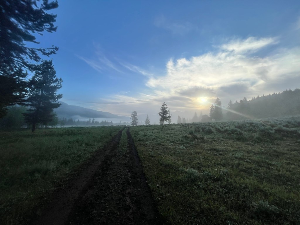
My phone can’t acquire a signal, so I drive in a silence befitting the serenity of sunrise.
My German friends from Mount Washburn recommended checking out Slough Creek Road. Although it was getting light out I could hardly see the turn and would have missed it had a car in front of me not made the turn.
The road is partially paved, partially loose gravel, and all windy. I’m committed to following the car in front of me. It’s in a hurry and seems to know where it’s going. We dead end at a trailhead. I have cell service now, and a quick AllTrails check tells me that we are at Slough Creek Trail, and that it’s an 18 mile out and back, which is more than enough trail for today. I have a 7 mile hike planned for another part of the valley, but adding a couple extra miles won’t hurt, so I through on my hiking shoes and hit the trail at the same time as the speeding car.
His name is Noah and is from Charlottesville, his wife had just dropped him off before returning to their kids. Noah is determined to fish for Cutthroat Trout, and has the morning off from parent duty. He is a recreational runner, and NCAA Cross Country Nationals took place on his farm a couple years ago. We chat for about 1.5 miles until we reach the creek and the first meadow of the trip. We both come to a standstill at the beauty of the place. The river is now off to the left and Noah takes his leave.
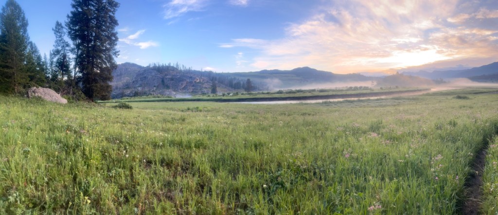
The meadow is one of the most beautiful places I have ever seen, especially with the low fog and light from the sun escaping from the clouds to the east.
My plan to turn back to head to another trail fades away as I spend a few minutes taking in the sights and sounds, before continuing. This will be my trail for the morning.
After another 1/2 mile, I spotted a buffalo about 10 yards to the right of the trail. Much too close for comfort. He looks over at me to make sure I’m not a threat. Not wanting to turn back I veer into the field of shin high grass that is still wet from the morning dew. Willing to trade the cold, wet feet for 20 additional yards of buffer I trudge through the grass and my buffalo friend stays seated convinced I mean him no harm.
Back on the trail my heart rate is a little lower even though I am now walking faster. The air is still cool and can’t be more than 55 degrees with more humidity than I’ve had all trip.
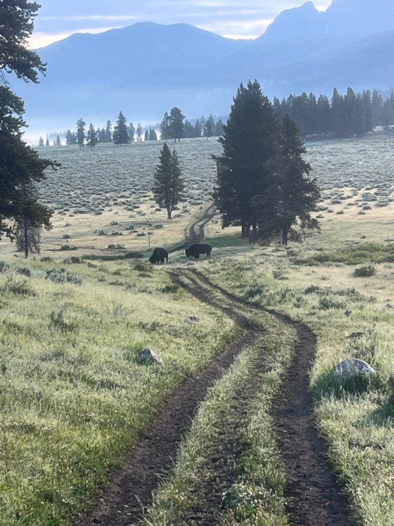
About another mile in I turn the corner out of a small patch trees and see a herd of about a dozen buffalo including calves sitting on the hillside. I approach a little closer to confirm that the trail goes right by them. They are in fact on both sides of the trail and my move forward has drown their attention. The majority are to the right of the trail higher up the hillside with only a couple to the left of the trail. I’m about 30 yards from them, but start to back away and after a few steps one of the buffalo stands alert. Then another. My backward pace quickens, as the rest of the herd now stands prompted by a silent communication that only they understand.
Before I have time to consider my options, the first Buffalo begins to run followed by the rest. A microsecond of fear hits before I realize they are running perpendicular to the trail down the hillside and away from me. Sweet relief followed by awe at how effortlessly these 1,000 pound behemoths glide down the hill much faster than I or anyone else could run.
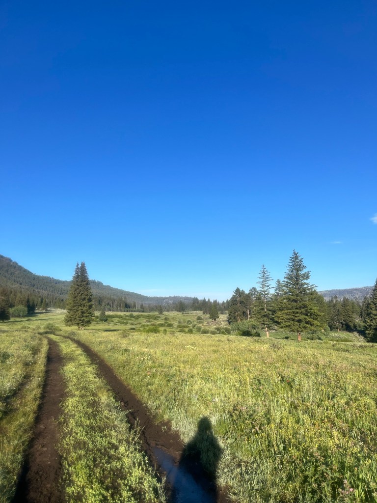
My path now clear I start walking forward scanning the area to make sure no one was left behind. I’m about 3 miles in and could stay on this trail all day if I could, but time only permits me about two more miles out then five back for a total of ten.
Although it is not matched by the beauty of the first meadow, this trail is still the prettiest part of Yellowstone I have been and one my favorite trails of the trip. It’s also much less traveled than anywhere else I have been in the park and I feel very lucky to experience this place without the disruption of large groups of people.
Around the 4.4 mile mark I see a couple bison in the trail. I approach to about 35 yards off before deciding there is not an easy way around them and that my hike must now turn around. Before I make my 180 one of the bison looks toward me as if to say that they are not moving and that I should continue to vacate their space. Happy to oblige I turn back and hope for no more close encounters.
The way back is nowhere near as eventful. There are more buffalo, likely the same ones I saw earlier, but they are now over 100 yards away and unaware or unbothered by my presence.
It may not be as beautiful as walking east toward the rising sun, but this place is still special and I savor every step.
A couple miles out I begin to see more people making their way into the trail. The first couple groups are out there to fish, but the last is a mother with her young children. They are on their way back to the parking lot too. Seeing the binoculars around my neck she ask if I saw any wildlife. Relaying my experiences with the bison, her eyes widen, and she tells me how cool it is that I got to see them so close on foot as opposed to in a vehicle.
I get back to the trailhead around 8:30 and take a few minutes to change shoes, grab some snacks before starting my drive. I’m headed up through Montana to Glacier National Park.
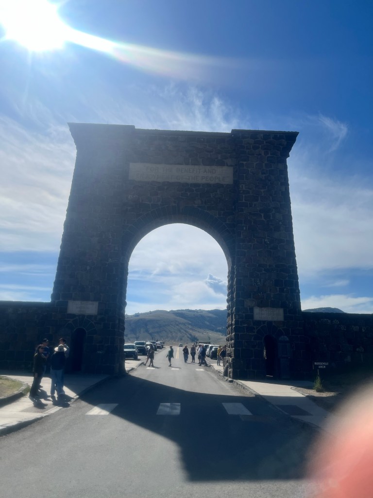
The first hour of the drive is through Yellowstone and as I exit the park there are a dozen cars entering for each one leaving. Happy to have avoided the crowds I stop at the Roosevelt Arch on the way out. The text at the top reads “For the benefit and enjoyment of the people”. A lot of those taking pictures do so from the back side and don’t see the words that helped preserve this land as well as so many of the places I’m visiting this summer. Can’t help but feel appreciative of Teddy for helping promote the idea that our best lands should belong to the people and not a single person or corporation.
My heart a little fuller, I continue the drive through Montana. As I near the east entrance of Glacier, I receive a text from my friend Gabby inviting me to stay with her and her husband’s family who are vacationing in Whitefish. As rainy weather looms I accept the offer and drive the extra hour instead of spending another night in the rain. They are visiting family who live in the area when I teach the cabin, so I have the place to myself the first part of the evening. We chat for a few minutes when they got back, but we are all ready for bed.
Day 25: Woke up in a real bed, after sleeping until nearly 6.
None of us are in a hurry to do anything in the cold rainy weather. Gabby and I eventually get out the door for a 40 minute run around the neighborhood. First time running in 3 weeks and felt pretty good, despite the weather.
After eating some delicious pancakes, we spent the rest of the morning lounging around the house. Close to noon we headed out for lunch and I had a delicious salad with a side of mac n cheese, courtesy of the Smith family.
From there we part ways and I drive into Glacier as it refuses to stop raining as the forecast had predicted. I stopped by the visitor center to kill some time before heading to my campsite. By now the rain had subsided and I was able to start setting up by 4. Everything was still wet from when it rained in Yellowstone, but at least the weather should improve tomorrow!
Day 26: One of the few times I’ve used alarm on the trip, but still felt pretty well rested getting up at 4:45. Break down camp in a hurry and put off eating breakfast for when I reach the trailhead. Got a 1 hour 20 minute drive to the other side of Glacier, and the fastest route actually takes me out of the park, but I did catch a very vivid sunrise.

I reached the trailhead for the Pitamaken-Dawson loop around 6:40 and talked to some guys (“Travis” and “Ben”) who were about to start. They looked pretty fit, but could not wait for me to start. I went as fast as I could but had to make a couple sandwiches, make and eat some oatmeal, pack my bag, and hit the restroom, so it was nearly 7:30 by the time I got going.

I intended to do the loop clockwise to get the elevation out of the way early, but in my haste turned right at the start instead of left and did not realize my error until the first mile. Too late turn back now I focus on enjoying the trail in the counterclockwise direction. Four groups of hikers started before me including Travis and Ben, and I was starting to reel them in. I had passed three groups by mile 4, and knew they would be the last as Travis and Ben were hiking clockwise.

Around mile 6 I reached the lake and the beginning of my ascent of Pitamaken Pass.

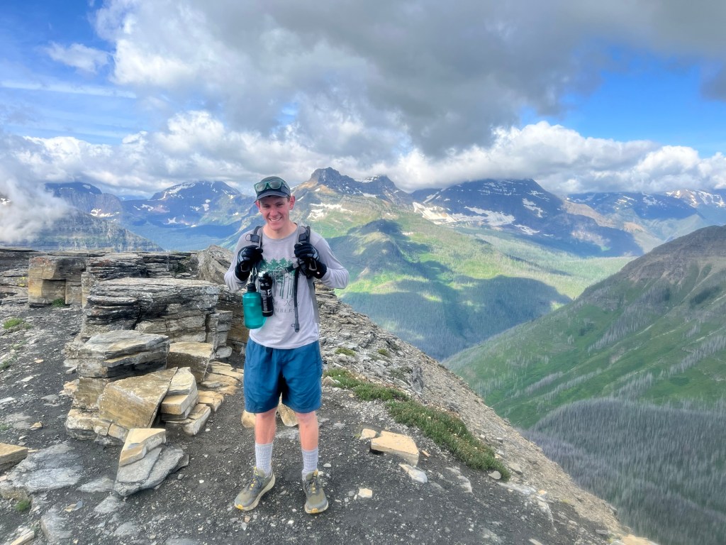
It was switchback heavy at first and I was sweating even though I had already shed my jacket, hat, and gloves. But, I was determined not to stop and lose my forward momentum. As I neared the top the wind picked up and I put my gloves back on. I also saw a couple coming down the pass, they must have started very early to already be close to 11 miles in. Finally, I reached the top and used picture taking as an excuse for a couple minute break.
From here, the trail surged forward up the ridge of the mountain. I tightened the adjustable strap on the back of my hat and trudged into the wind.
Near the last section of this ascent I came across a snow drift that covered the trail. Without a clear path through I followed some footprints down and around the impasse and completed the climb to the top of the ridge where I was rewarded with a view off both sides of Pitamaken pass.
The trail now hugged the side of the mountain that was accompanied by even greater winds. This is one of my favorite types of hiking.

A little over 8 miles in I reached an outcropping in the rock that was a natural resting point. It was here I reconnected with Travis and Ben who were a little farther ahead of me. I discovered that they were both runners and former college teammates.
Knowing that we had all done the majority of our climbing, I jokingly challenged them to a race down the mountain.
We bid each other good luck on the rest of the hike and went headed in opposite directions. Shortly thereafter, I reached Dawson Pass and my rather steep descent began.
I had originally intended to hike clockwise to avoid the pounding of this steep descent and was now paying for my earlier error. Gravity was pulling down and sometimes the wind was pushing me as well, but it was too steep to run for more than short sections.

After reaching the tree line I cane across a mother bird (not sure what type) and her chicks. The mother refused to let me pass for several minutes and repeatedly ruffled her feathers at me despite my repeated assurances that I meant her no harm. Finally, she let me pass and I bounded down the trail happy to no longer be beholden by a worried mother.
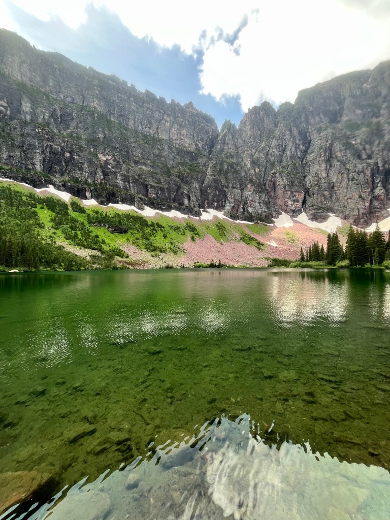
I stopped by Hidden Lake on the way down, which was a very pretty mountain lake.
By this time I had a little more than 3 miles remaining and was eager to finish, especially since I was now in the trees and not on a mountain pass.
The trail was also starting to get crowded with hikers who were only doing out and back hikes and not the full loop. I was consistently asked at which point I had turned around at or if I had stopped at whichever landmark they were trying to reach. But, on the bright side, with so many people my bear exposure as a solo hiker was now much lower.
The campground adjacent to my parking lot was now in sight. Whether my GPS or the AllTrails distance was off, I’m not sure, but I was now at the bridge a little less than a mile shy of the 18.8 that was advertised. Happy to be done, I crossed the bridge and saw Travis and Ben who had just completed their hike.

Now a little after 1:30 and nine of us had stopped for lunch, so we sat by the river and I washed down my peanut butter, banana, and, Nutella sandwich with of their NA Citrus IPA’s, as we discussed various races and hiking trips we had done.
By the time I finished my sandwich, but before I downed the drink, it was time for us all to head out. I searched for an open campsite closer to the east side, but known were available. Despite that setback, I decided to take the shorter but more crowded drive through the park on the Going to the Sun Road, by far the most popular attraction in the park. A timed entry reservation is required to travel east on the road (the west end of the park is where most visitors stay), and now all of those people had turned back and were headed the same direction as me, slowing down what was already a 2+ hour drive. Oh well. I stopped by Wild Goose Lake and waited patiently for a tour group to leave so I could take in the view peacefully.
After a lot of driving behind a line of cars at 15-20mph in a 35mph zone, I made it to my campsite a little after 5. I hustled to get set up, eat, and get to bed.

Planning for an earlier start tomorrow as the parking lot at the trailhead is known to fill up early.

Leave a comment