Day 41: The sun is coming up, so I’m up a little after 5. Almost 4 hours of sleep. Not ideal.
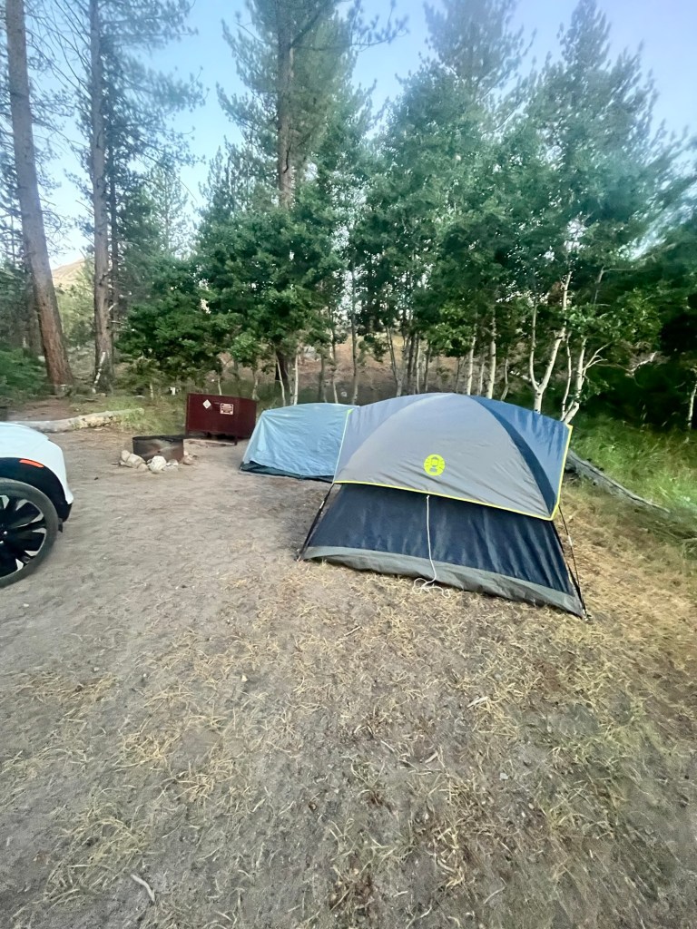
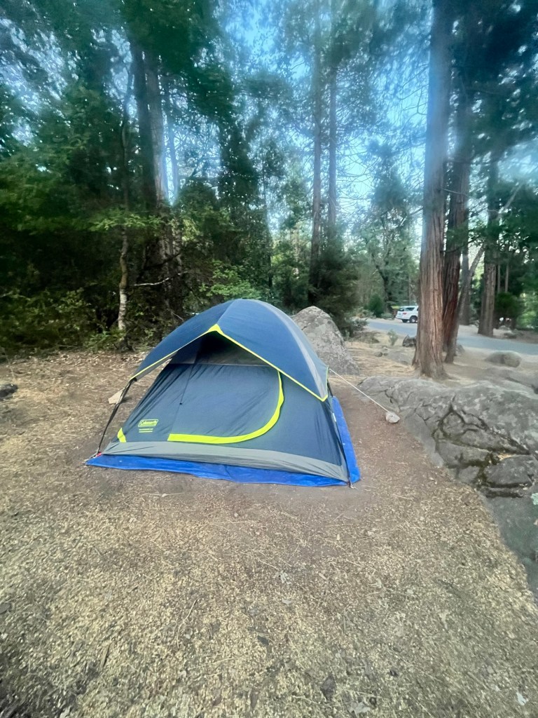
Sam is getting up at 7, so I hang in the tent for a while before getting up breaking down, paying for our campsite, and eating breakfast in time to help him break down his tent when he gets up.
We head out a little before 7:30 and get to the trailhead about 45 minutes later and are on the trail just after 8:30.
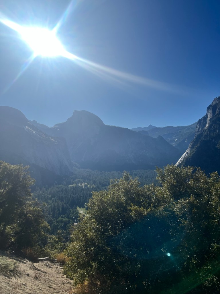
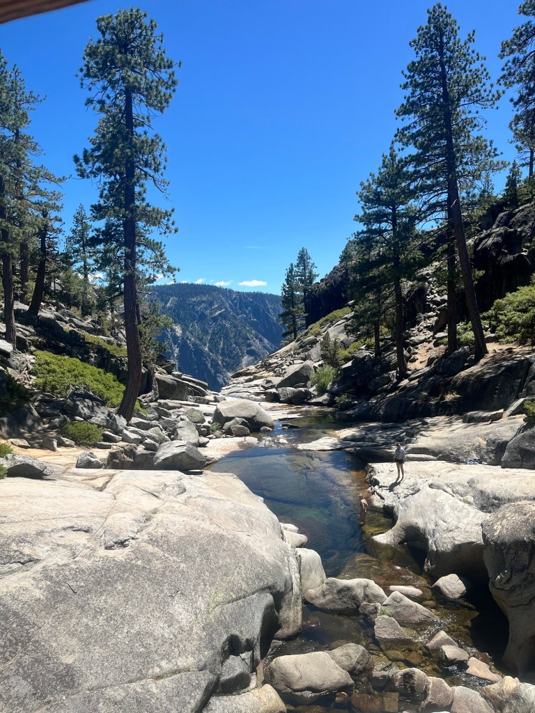
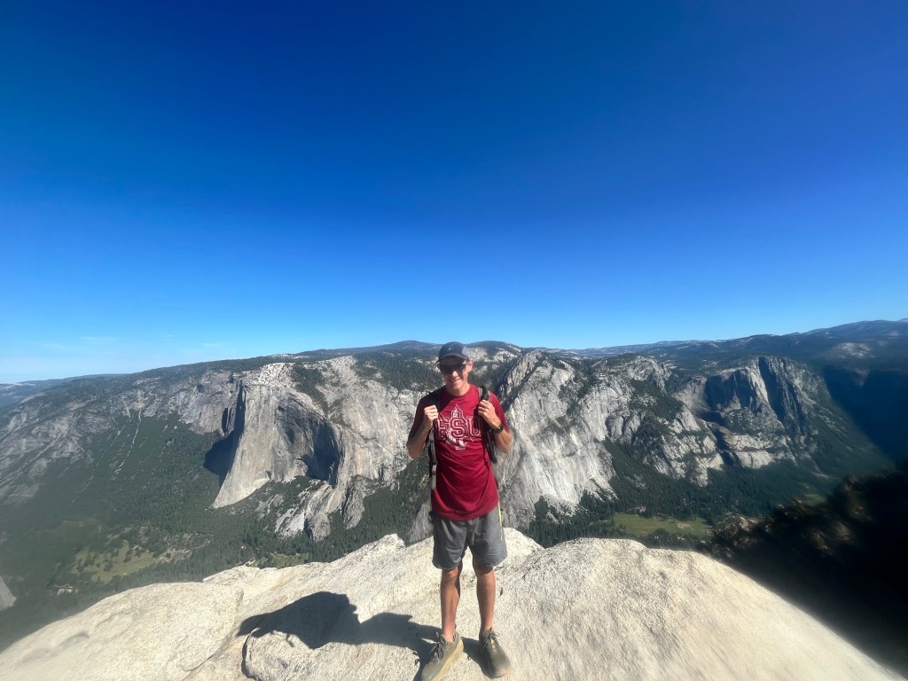
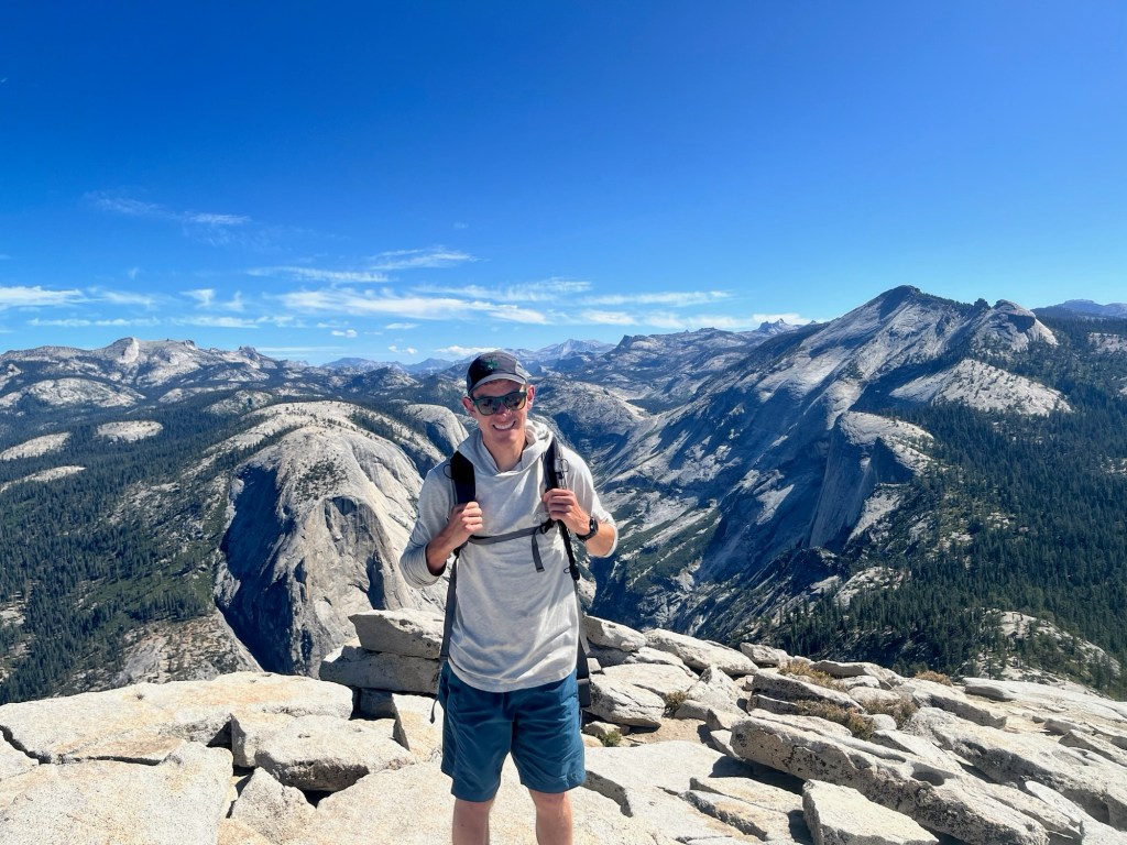
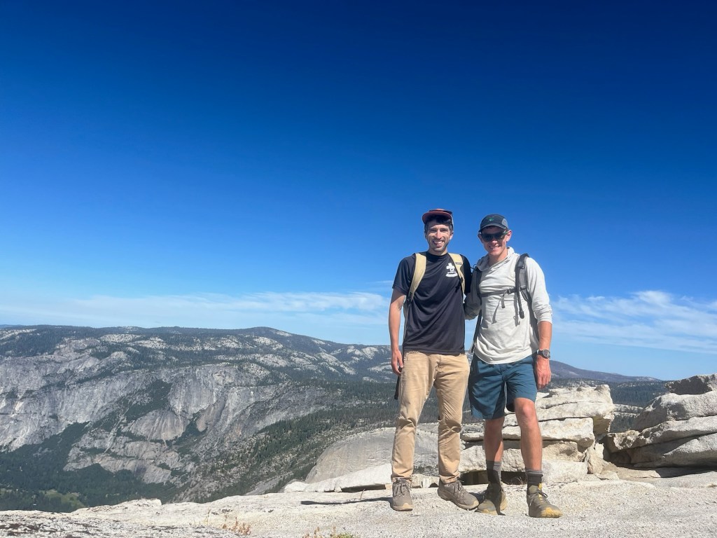
We are hiking Cloud’s Rest which is a hike I tried to do six years ago, but the road was closed, and I could not do it. The hike is about 12 miles with 3,000 feet of elevation and is popular because it finishes by walking out to the edge of a ridge that has a 360 degree view of the surrounding area including the side of Half Dome.
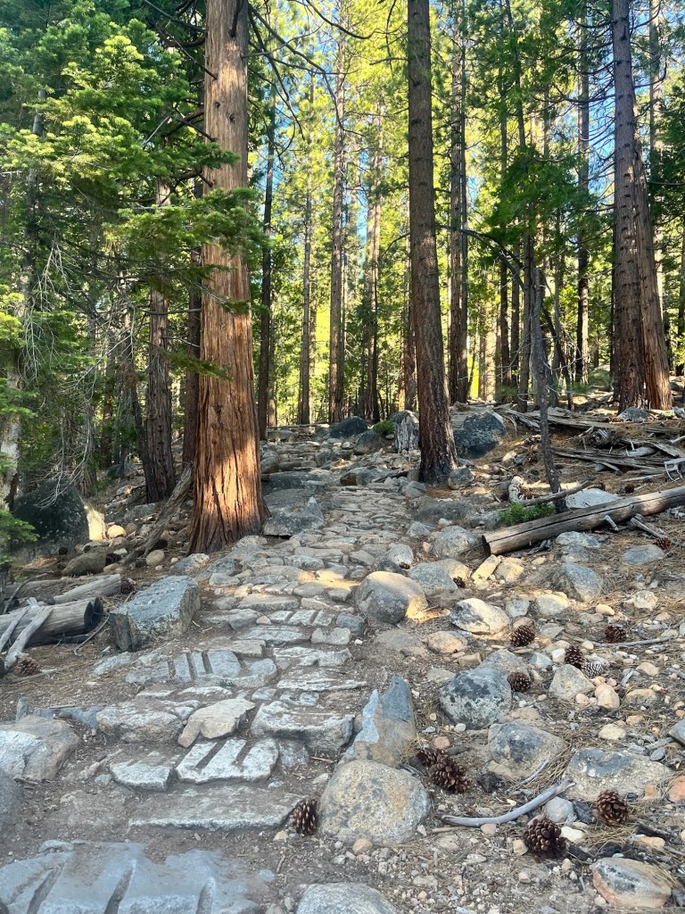
Although we are both tired, we are excited for the hike and in good spirits. The hike begins in the tree line and has a lot of switchbacks on the way up. There are plenty of other hikers many of which are backpacking down after spending the night in the backcountry.

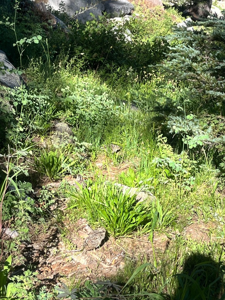
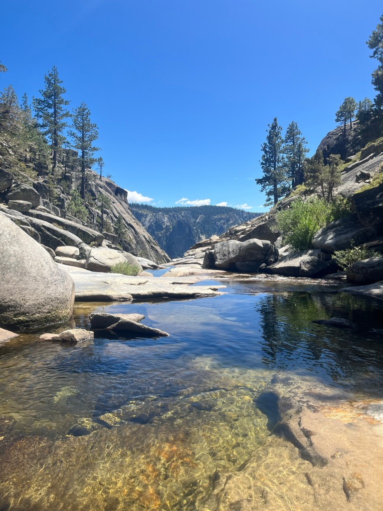
A little over an hour in we passed a pretty mountain lake as well as a Partridge and her young chicks.
Not long after that we caught up to a hiker who we met in the parking lot. Her name was “Lauren” and she was from Modesto a couple hours to the west. Although her family comes to Yosemite frequently it is her first time on this trail. We also found out that she opened up a coffee shop (Penny University) about a year ago. As we neared the top she wanted to take a break and told us that she’d catch up at the top.

The topdid not come much later and it was everything I dreamed of.
The hike up the final ridge line was about five minutes along a rocky path. Although it looked intimidating, the footing was good and the drop off was not that steep, so there was nothing to worry about.
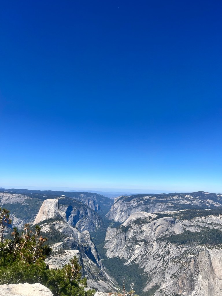
The final view at the top was a spectacular. Yosemite Valley was beneath us and it we spent about 30 minutes admiring it.
Lauren made it up shortly thereafter and gave us some additional recommendations on hikes. She even took a picture of a half scone with Half Dome in the background. Very cool.

After taking the obligatory pictures Sam and I headed back down. The trip down was certainly easier, but took the same amount of time as the way up as we had to watch our footing.
We make it back to the car just before 2 and take off as soon as we get to the car because we are trying to apply for the 48 hour Half Dome lottery by 4pm and need service. We know there is a lodge in the Valley and head that way as our campsite is in the valley.
On the way down a coupe texts come through letting us know there is service, so we pull over to apply. Fingers crossed.
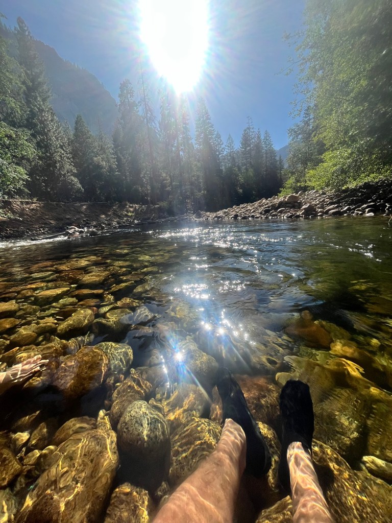
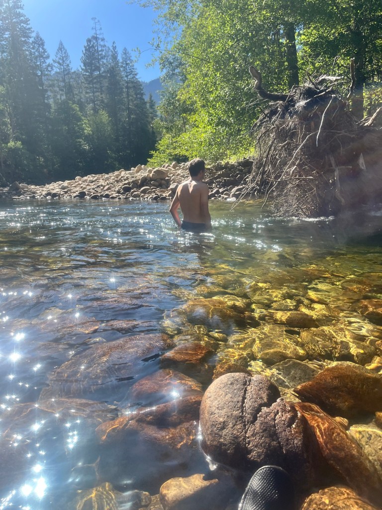
We continued the drive down to the valley and get to our campsite a little after 4. After setting up our respective tents we headed for a dip in the Merced River. As a true Floridian I despise the cold and only intend to soak my legs. Sam is far more adventurous and swims around in a calm section for a few minutes.
A little before 6 we headed back to the campsite to cook dinner, but our propane was out, so we walked over to the general store to buy a new bottle. It was well above market rate.
Gas acquired we prepared and ate some dinner and planned out the hike for tomorrow.
We both tried to get to bed early to catch up on sleep. The campsites were pretty close together, and the campers next to us (three elderly gentlemen and their respective teenage grandchildren) were having a conversation about electrical engineering while listening to classic rock about 10 feet from where I lay. I appreciated the music more than the loud conversation.
Day 42: Slept in until 5:20, then get up to start getting ready. Sam isn’t far behind and we’re pulling away from the campsite shortly after 6.
It’s not a long drive to the trailhead and I eat my breakfast in the way. Once there we make some sandwiches, pack up our bags and hit the trail at 7:20.
We are only 1/4 mile in when we realize we forgot sunscreen and have to turn around.
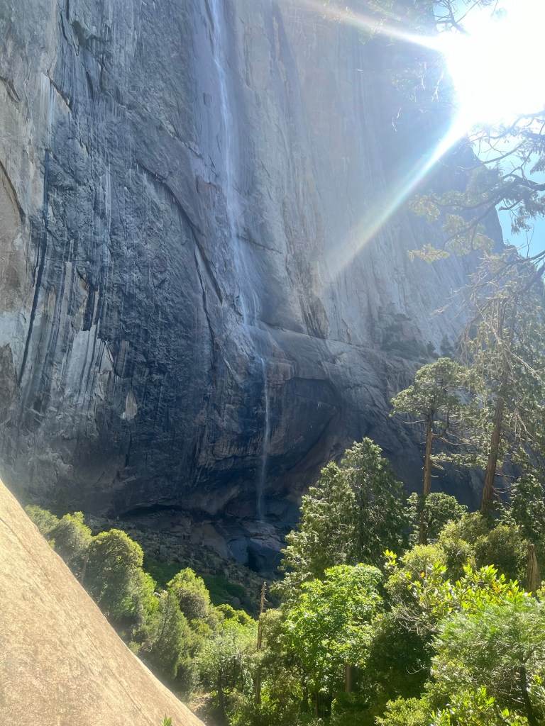
Sunscreen applied we are back on the trail that is mostly switchbacks on the way up with views of Half Dome and Yosemite Falls.
It about 3.5 miles to the top and the trail levels out after that, and stays within the tree line for a few miles keeping us cool after hiking up about 2,000 feet.
The trail wraps through the trees for a few miles and we are able to pick up the pace. We only encounter one group of backpackers in this section as most of the day hikers on the way up only go another mile in the other direction to Yosemite point. Our trail is about 5 miles to the top of El Cap.
After a few miles we enter a more exposed section on the rock. We are getting close. About a mile later the route on AllTrails ends. There is still a section of rock sloping toward the valley. It’s not too steep to walk down and we carefully walk down until we get to the edge. There are some rocks that are about waist high near the edge creating a natural safety barrier between us and the edge.
It’s a phenomenal view of the valley and we were the only ones there at that moment.

We savored the moment and stayed comfortably away from the edge. After spending some time enjoying the view we headed back up the slope and to the trail.

On the way back we stopped at Eagle’s Point which arguably has an even better view of the valley.

From there we continued the walk back, and made some time to stop by Yosemite Falls. The flow was not as strong as last time I was here, but it was still beautiful. The slower current allowed hikers to take a dip in the water without fear of being swept away.
Neither of us was keen to get in before hiking down, but we went close enough to put our hands in and wash our faces with the cool water.
Going down switchbacks is certainly easier than going up, but you can only go so fast down the steep, rocky sections. Fortunately, the crowds were pretty thin and we made it down a little before 4 to complete our 18 mile hike.
We began the drive to our next campsite, Wawona, in the southern part of the park (we tried to get all three nights in the valley, but they sold out in about 30 seconds).

On the way we stopped to look up at El Cap and it was a sight to behold. 3,000 feet of sheer granite. We used some binoculars to look for climbers but were unsuccessful.
After that, we completed the drive to Wawona and set up camp, and eat some dinner.

Taking advantage of camping by another river we headed down to to chill for 30 minutes before bed. I checked my phone as we were headed back and found out that we (finally) won the Half Dome Permit Lottery! After trying in the initial lottery a few months ago and the 48 hour lottery four times we got the permit for our last day in the park on Thursday.
We adjusted our plans to make tomorrow’s hike a little less strenuous and headed to bed.
Day 43: Woke up around 5:20, but with a shorter hike I laid in my sleeping bag for over an hour enjoying my warm cacoon before heading out into the cooler weather.
Sam is up shortly after me and we enjoy a breakfast in camp before heading to the trailhead.
Our hike for today is a loop trail with a couple out and backs totaling 7.5 miles. We don’t get started until a little after 9. As we started near the top of the south side of the valley there is very little elevation gain and we mostly take it easy.
It’s a hike I did six years ago but in the opposite direction, and given the company I enjoyed it even more the second time.
Our first lookout is Taft Point that is across from El Capitan giving us the opportunity to reflect on yesterday’s hike. Following Taft on the trail, if not ascension to the presidency, is Roosevelt point. The trail followed the rim giving us a great view of the valley.
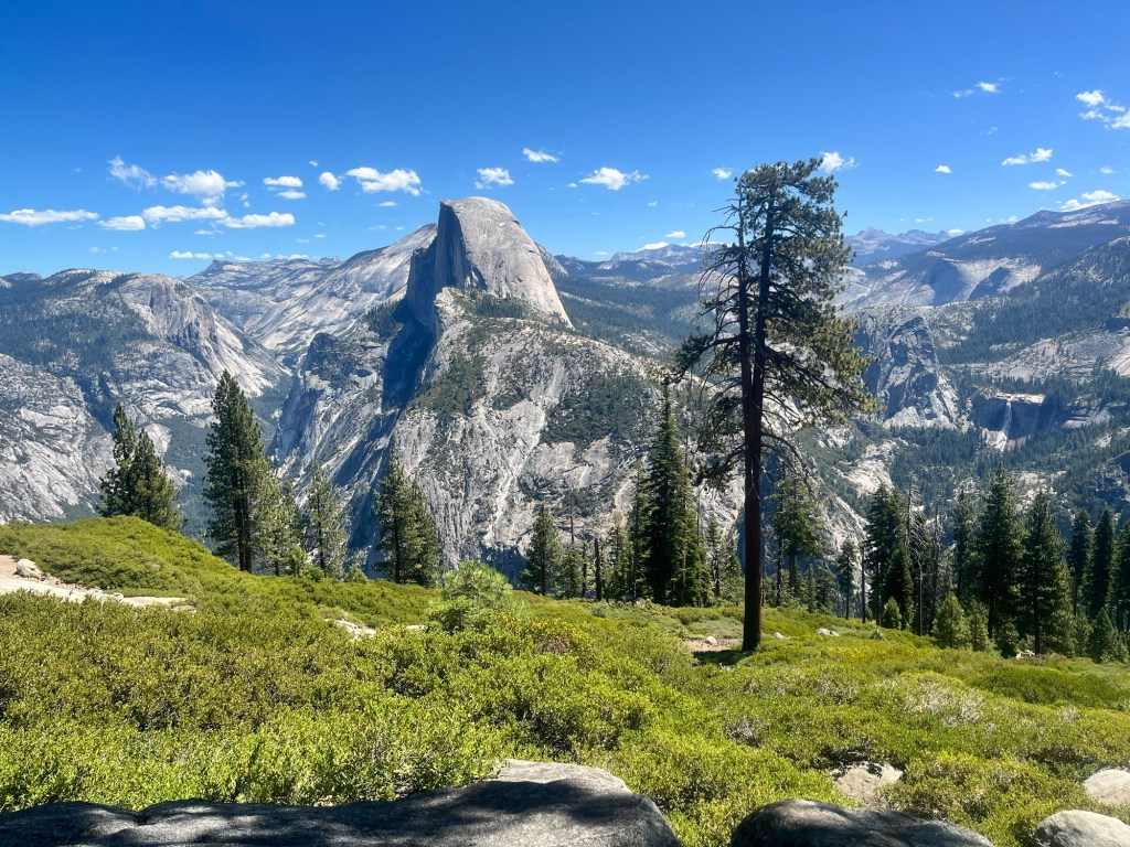
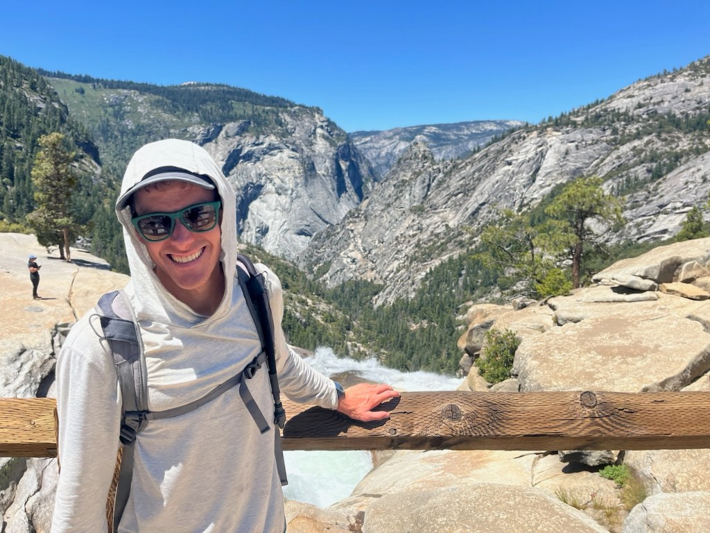
After Roosevelt, we took an out and back to Glacier Point, which gives a great side view of Half Dome. Glacier Point is drivable and overrun with people, but we found a spot off to the side to eat a snack and admire the rock we wanted to stand on top of.
From there we hiked back to our loop and continued to Sentinel Dome, which felt like a good warm up for tomorrow as it is a domed rock with a semi-steep surface on the way up. We ate our lunch on top of the dome before heading down and competing the trail back to our car. Although it wasn’t as fun a challenge as the previous two days it was still great to see the valley, El Cap, and Half Dome from a different perspective.
Finishing the hike a little after 1 we still had plenty of afternoon left and drive to the southern part of the park to the Mariposa Grove of Sequoias.
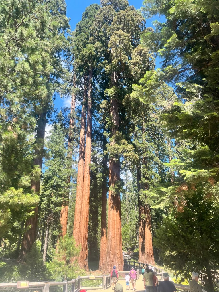
We skipped the two mile trail to the grove and took the shuttle that let us out right at the grove.
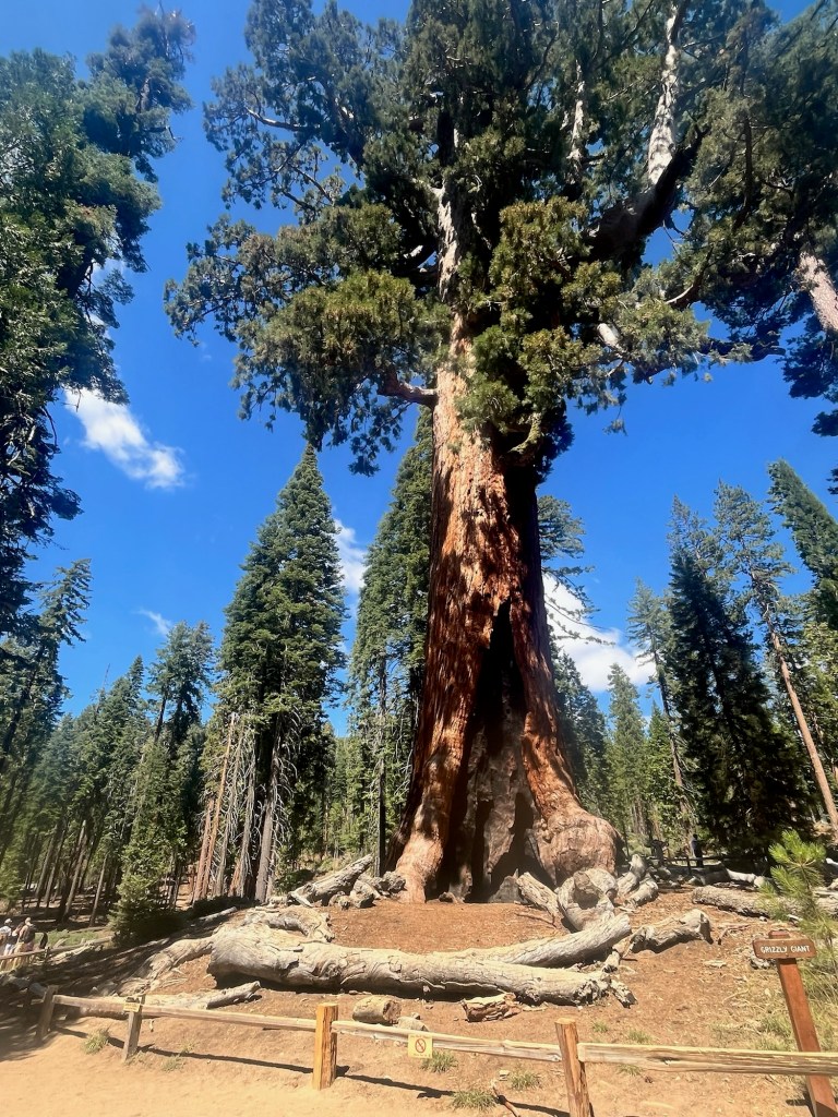
We opted to walk the two mile Grizzly Grove Loop, which included the Grizzly Giant Sequoia which John Muir and Teddy Roosevelt camped under. Story goes that John Muir convinced Teddy to make Yosemite a national park that night. For that I am thankful.
We made it back to our campsite around 4:30, and began prepping dinner and our day packs for tomorrow in order to get an early start in the morning. As we were about to eat a park ranger drove by and invited us to his campfire talk at 7 down the road from our campsite.
After finishing all our chores for the evening we walked over to campground amphitheater. Ranger Eric – late-20’s, slight build, sandy hair underneath his ranger hat – took us through a brief overview of the founding of Yosemite, then the impact hippies had on the park in the late 60’s and early 70’s. Ranger Eric was an excellent story teller and even played a few songs on the guitar. It was a really fun way to spend our last night here.
Day 44: Today is the day. It is the day. Half Dome. HALF. DOME. We are hiking Half Dome today!
After entering the lottery six years ago and failing to get a permit. After entering the permit lottery a few months ago for any date in a two week period and coming up empty. After entering the 48 hour lottery for our first three days in the park and almost giving up. After all that we got the permit to hike today on our last possible chance.
Yes, today is the day we are doing one of the most popular day hikes in the country.
It’s over 18 miles including the walk from the Curry Village parking lot in the valley and we have a four hour drive afterwards, so we’re up a little before 4:30 to break down camp and start the drive a little after 5.
We found a parking lot with an EV charging station and parked there even though it was a little farther from the trailhead than the main lot.
It doesn’t take long to get ready as we packed our lunch and snacks for the hike last night and we are able to start at 6:15.
The first mile is paved trail in the valley that goes by a Curry Village where there are multiple dining options and a general store, as well as several campgrounds including the one we stayed in a few nights ago. It doesn’t take too long and we are on the actual trail.
Sam recently took part in an ultra relay race where his team kept track of the number of people they passed throughout the race. With a long, popular hike in front of us it felt like a great time to count the “passes”, especially because there were a couple shorter out-and-back trails on our route.
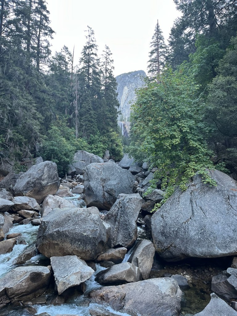
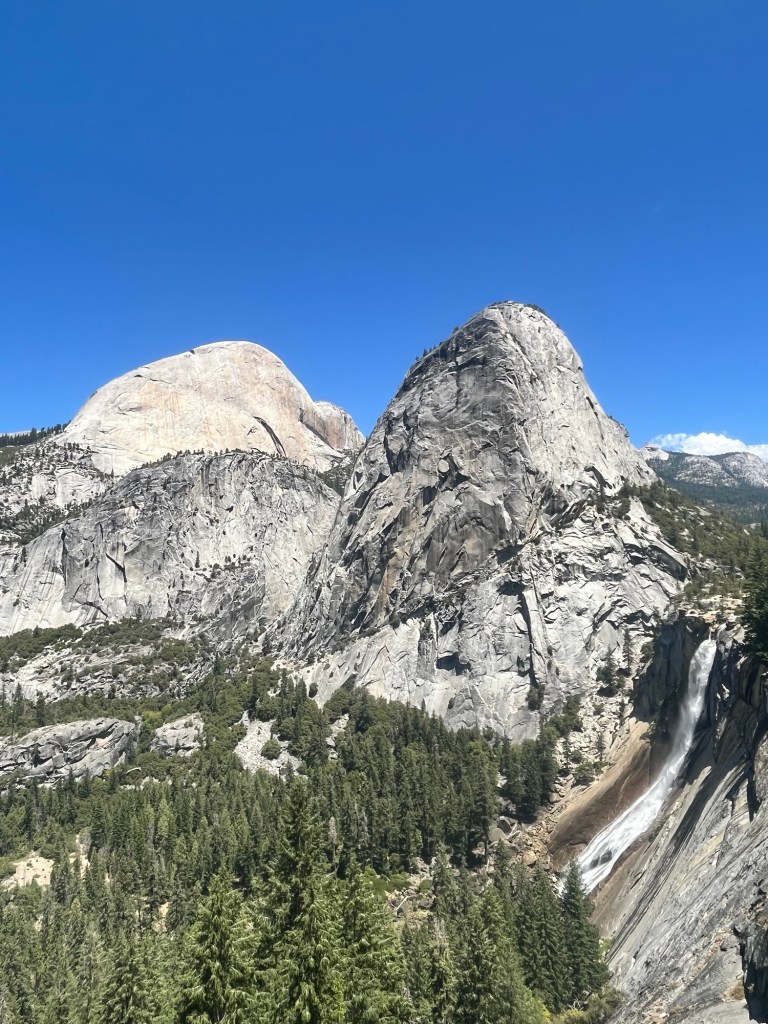
We are at 20 before the first mile, and the trail is starting to get steep as it climbed up to a couple waterfalls, the first being Vernal Falls.
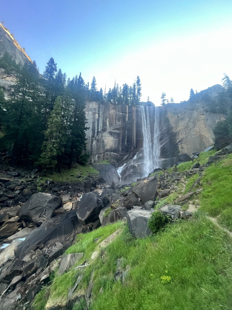
The next section of our route is the Mist Trail which is under construction from 7-3:30, so we have to get there quickly to not take the longer detour. 34, 35, 36.
We make it with about 10 minutes to spare, passing the barricades on the side of the trail and are relieved to have made it. It’s still steep, more of a meandering staircase than a traditional trail. But, we have hiked many steep trails the past few weeks and continue to pass those in front of us. 43,44.
The Mist Trail culminates in Nevada Falls. There are a few larger groups taking a break at the top. There is a short conversation over whether they count as passes as they likely are not going any farther, but we’re walking past them so they count. 88, 89, 90.
We are now on the John Muir Trail which runs from Mt. Whitney by Death Valley National Park 220 miles to Yosemite Valley. The crowds have thinned after the falls. There are no other major destinations for day hikers on this route other than Half Dome and that is still 4.5 miles away. But the trail is now a trail again and almost all my competitive juices are flowing with Sam keeping pace behind me. 99, 100, 101.
We passed Lower Yosemite Falls campground which is a backpacking campground that you must have a permit for. By this time must of the backpackers have left and there are a few on the trail. 106, 107.
The trail turns upward again and we are now only a few miles away. A couple hikers are on their way down having already been to the top and back. I wonder how early they started, and they tell us that the experience of getting to the top was incredible. The switchbacks and hours already spent on the trail are slowing the other trailer goers down, but we’re still feeling good. Actually, I’m thriving. 126, 127, 128.
There are more hikers coming down the trail, but not down from the high they received at the top. Feeding off their energy we make it up the final push to Sub-Dome. 135, 136.
This is where we show a couple rangers our permit, receive some instructions that went in one ear and out the other and are allowed to continue. I let out a sigh of relief as if I expected the permit to not work. Such was the disbelief at how close we now were. 144, 145, 146.
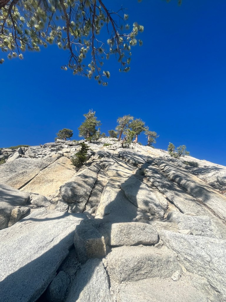
Sub-Dome by itself was quite the challenge. Narrow steps were cut into the rock and sometimes we hiked up the sloped rock face. 157, 158, 159.
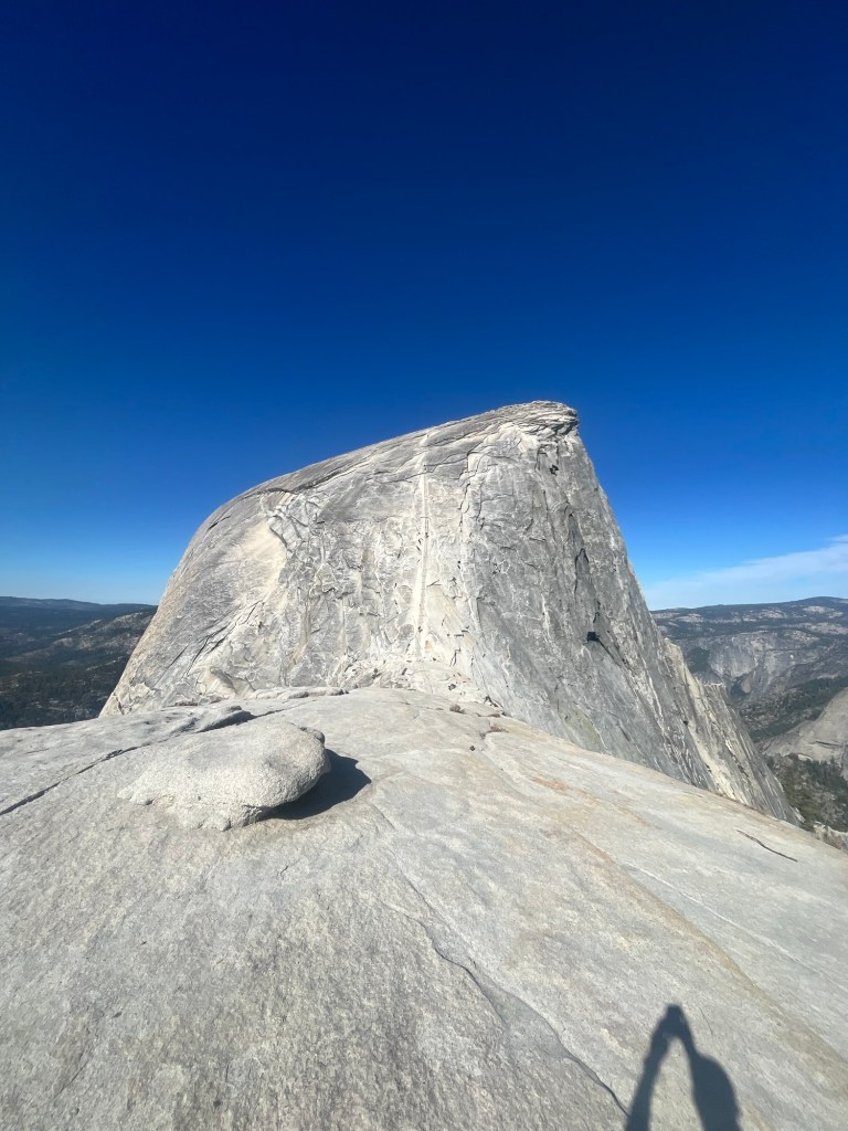
The top was now in sight, and so were the cables. The route to the top. This is the reason the park limits the number of hikers. The final couple hundred yards involved climbing up the rock face via a set of cables. They were as intimidating as the pictures. But, without them getting to the top would be impossible for a non-rock climber.
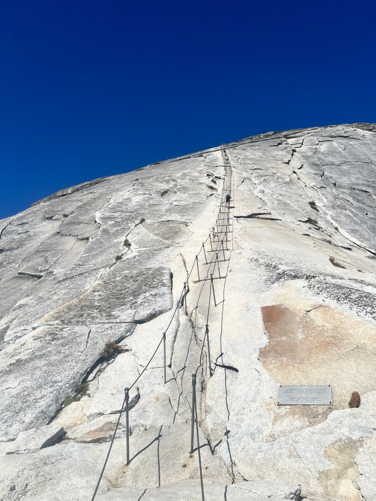
We took a few minutes to size up the challenge and give another hiker in front of us a head start.
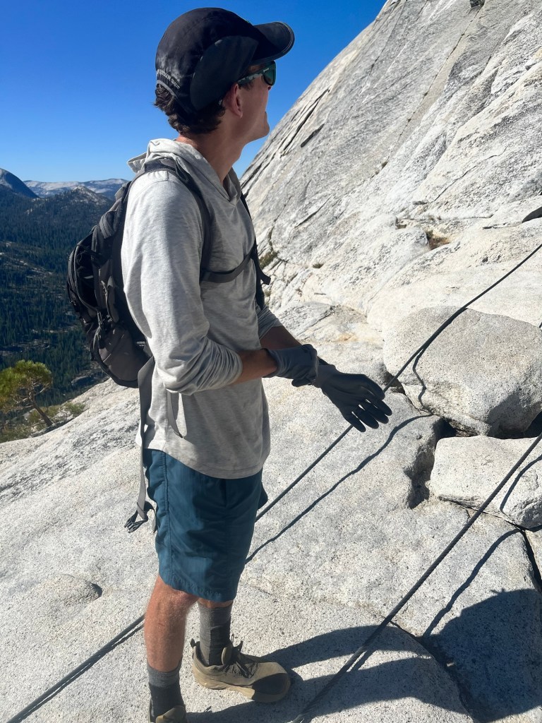
I was definitely nervous. A wrong move could result in disaster, and I slowed my breathing to try to stay calm. I had brought my own set of gloves, but there was a pile of gloves with more grip than mine, so I put mine back in the pack and got a better one from the pile.

Sam starts up and I give him a few minutes to before I follow. My strategy for dealing with nerves is to focus only on the next set of posts and a steady rhythm of one foot forward, opposite hand forward, and so on. Moving steadily and keeping my momentum in the forward direction gives a feel of equilibrium as gravity tugs down. It also keeps my mind clear of doubt.
However, there are slower climbers ahead of Sam and others on the way down. This is the toughest part for me. There are 2×4’s on each set of posts allowing a sturdy, firm place to stop and allow others to pass down or for us to go around others. We even pass a young lady who had a climbing harness and clips that she moved up the cables as a safety precaution. It slowed her significantly, but I was a little envious.

Finally, there was no longer anyone in front of us and we were able to finish out the climb, which got significantly easier (read safer) near the top.
Relief. Elation. Disbelief. I was happy to be on more level ground, excited to be on top of this hallowed piece of rock, and couldn’t believe how lucky I was to be here.
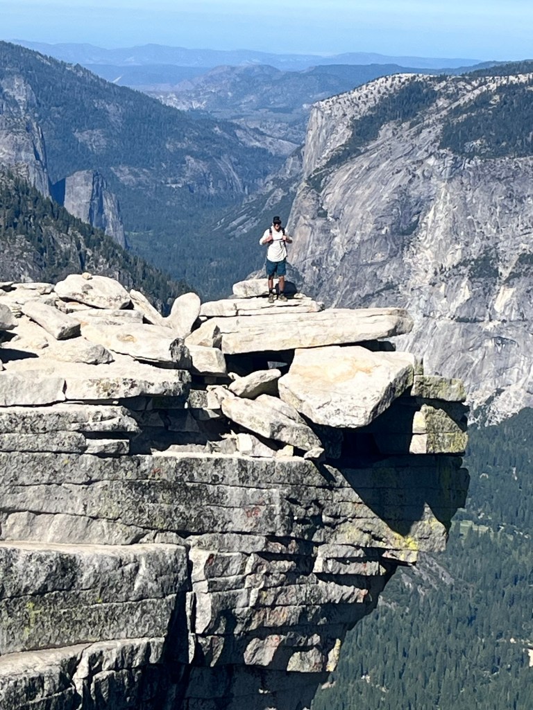
The view from the top was breathtaking, but simply being on top was surreal. There was a group of hikers at the first overlook, and we stayed with them for a little before continuing to the other side, which provided an even better view of the valley.
This was my new favorite spot in Yosemite.
After admiring this piece of granite from other parts of the park we now imagined other people using binoculars to look at us on top, as if we were the stars of Yosemite and I sure felt like it.
Nothing was going to bring me down from this high, except that set of cables we were now headed back to. It was more crowded and we discussed with those around us which direction to walk on the way down. Some favored walking down backwards as it allowed for a better grip on the cables. Others favored looking forward to better watch each step.
I started backwards, but even on a more gradual slope I was uncomfortable and had to turn around. I leaned back to keep my weight over my feet and found a rhythm again. There were more people in front of us and we moved slowly. Sam loved the additional time on the cables, but I was ready to be off them. About halfway down there was one section where the cable had been repaired and I had to lower myself into a full squat in order to maintain my grip on the cables that were now knee instead of chest height. I was certainly afraid, but tried not to panic, as I navigated through this short section.

One of the guys in front of us, Michael, encouraged all those going up to take their time and generously allowed others to pass on their way up. He was doing the right thing, but I would have preferred if he kept moving forward.
Finally, we passed the last group and could go down at our own pace uninterrupted. I took the gloves off and returned them to their pile, grateful for whoever left them there.
On the walk down Sub-Dome I enjoyed the best apple of my life and we made a friends with a solo hiker, “Ryan”, who had come down the cables a little in front of us.
Now it was our turn to encourage others on the way up, and we all did so enthusiastically.
We walked down the entire way with Ryan, who is an engineer in Huntsville, and has completed a lot of hikes throughout many of the National Parks.
We have to take the detour instead of the Mist Trail on the way down and get a different perspective of Nevada Falls which we passed on the way up.
The rest of the trail down is clogged with other hikers on their way to or from the falls and being the biggest jerk in the group I took the lead to blaze and occasionally bully our way through.
We made it back to the car a little after 2 still buzzing from the trip to the top. We still had to drive to Pinnacles National Park about four hours to the southwest, so we got in the car and started our drive. I had saved a jar of peaches for several weeks to celebrate a successful summit of Half Dome and happily ate the entire 24oz jar on the way out of Yosemite.

The drive to Pinnacles took us through the Central Valley and some agricultural communities before we made it to the park.
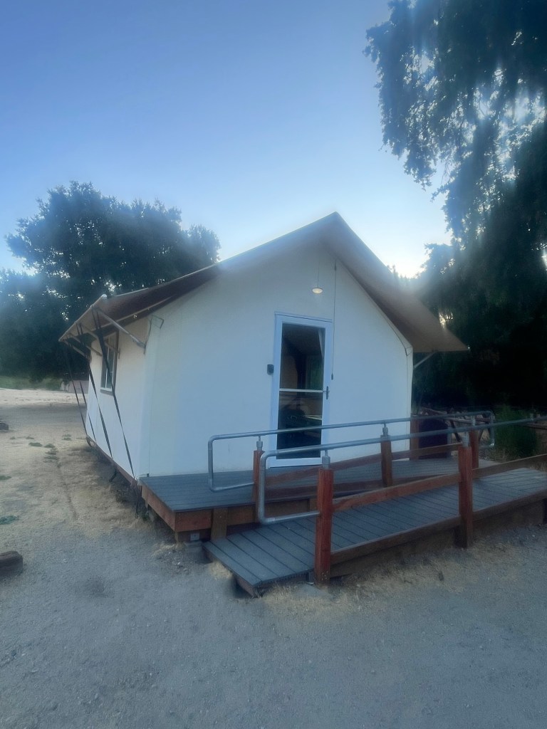
Instead of a normal campsite we had reserved a tent cabin, which Sam had forgotten about and was very surprised to see when we pulled up. It even had cots for us to sleep on and was a nice change from setting up and breaking down our own tents.
Feeling like a king of Half Dome earlier in the day, such a setup for the night felt appropriate.

Leave a comment