From 53: Up around 5 to make it to the dunes before the sun. Out of the house before 5:30. It’s really convenient to not have to pack up a tent.
I’m at the entrance by 5:45, but the gate is shut and a sign informs me that the park does not open until 7am. I debate waiting, but sunrise is at 6:20, so I’d miss it anyway.
Instead, I begin the drive down to El Paso. Carter is flying in at 9am, so I’ll have a few hours to kill, but I’d rather wait there than in the car.

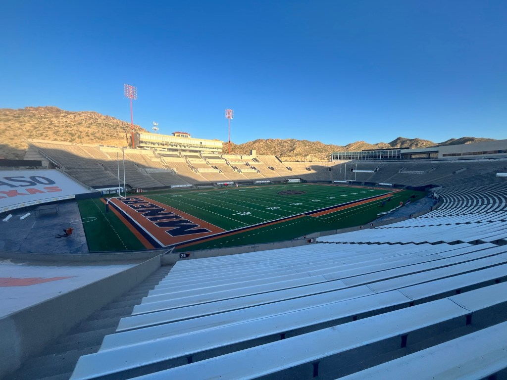
It’s only 1.5 hours to El Paso and my first stop is the Sun Bowl. The gates are open so I start walking down the tunnel and the field quickly comes into view. At first I think I have the place to myself, but soon hear people talking and a golf cart with some athletic trainers comes into view. They had just set up some coolers of sport drink for practice. Although, I wanted to go out on the field I decided not to push my luck and looked at it from the stands.
After seeing the stadium I drove around the rest of UTEP’s campus before heading for the Fort Bliss Museum. Unfortunately, as I got to within a mile of the museum I encountered a Department of Defense checkpoint that restricted access to military personnel. While nothing was going terribly wrong, it certainly wasn’t going according to plan.
With about an hour until Carter’s flight arriving, I decided to just wait in a hotel parking lot near the airport.
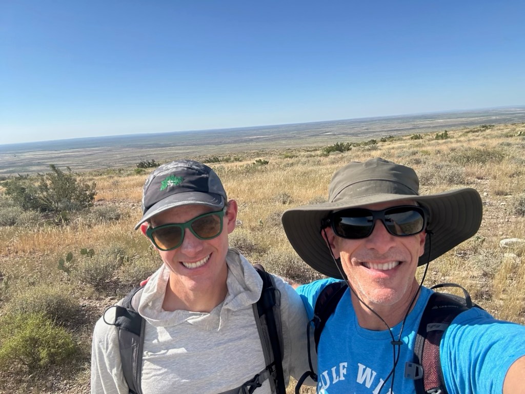
Once he arrived we set out for Guadalupe Mountains National Park about 1.5 hours away.
We make it to the campground around 11:15 and because the previous guest has already left and our check-in time is noon we are comfortable claiming the spot a little early.
Our hike for the day is Guadalupe Peak, one Carter did with some college buddies back in the 90’s. The start is within walking distance of the campsite, so we pack some sandwiches and hit the trail a little after 11:30.
The hike begins with some exposed switchbacks going up the side of the mountain. About a mile in we stop in one of the few shady spots to eat our lunch. It’s already in the mid-80’s and getting warmer.
We get a brief reprieve after a couple miles with a stretch of tree cover as we round the mountain pass. There is a wooden bridge Carter remembers as a marker for being near the summit. The GPS has us at 3 miles, so it seems a little early, but we’re both excited to be close to the top.
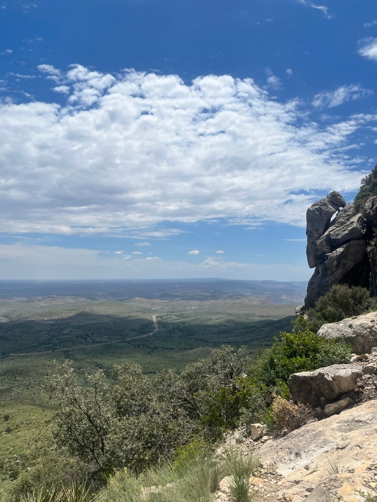
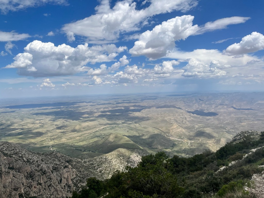
There is a brief downhill that takes us off the first mountain and onto Guadalupe Peak. We are welcomed with another set of exposed switchbacks. The views from the top of this section of switchbacks provide a great view of the valley below. It stretches for miles and we can clearly see the shade of each individual cloud covering portions of the valley.

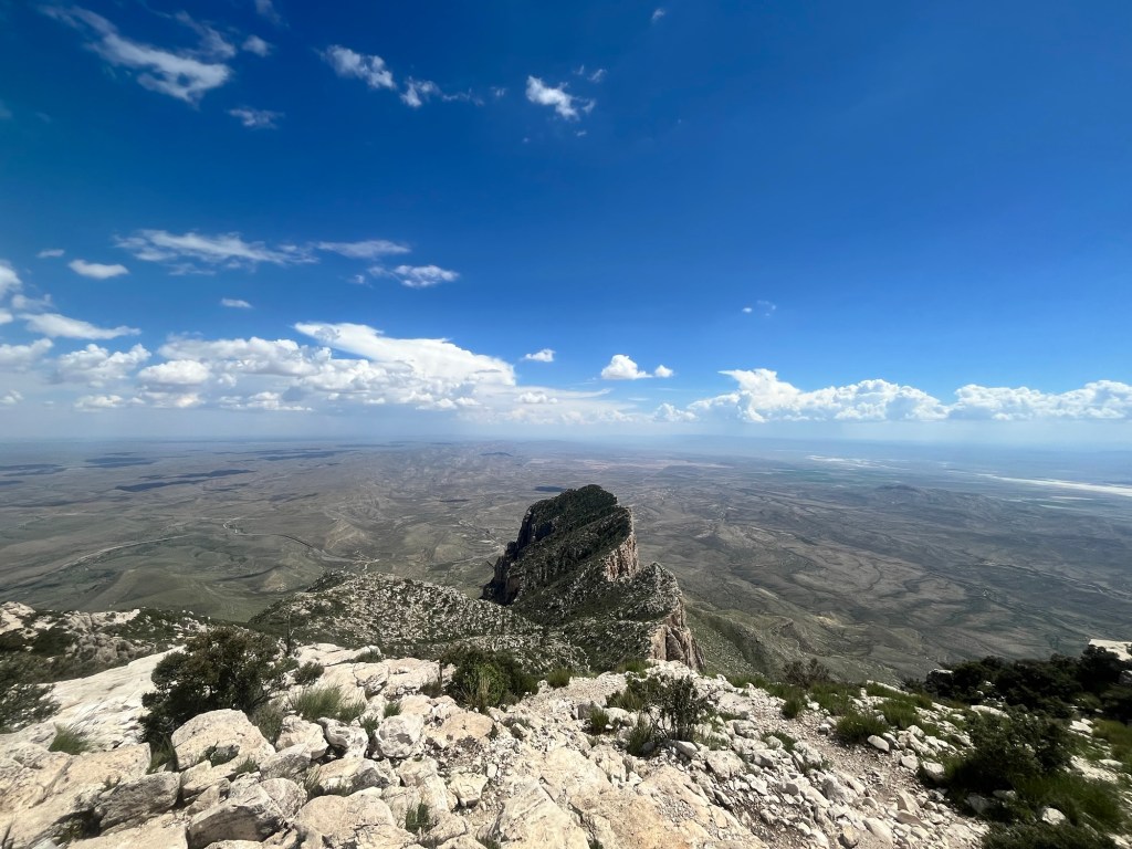
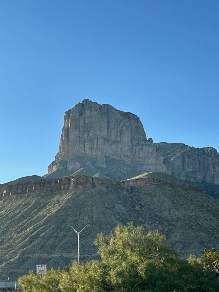
Following the switchbacks we round to the far side of Guadalupe peak and can see the El Capitan formation. In appearance it could never be confused with the granite wall in Yosemite that shares the same name, but is impressive nonetheless.
We are now nearing four miles, almost a mile past the bridge, and the peak must certainly come soon. Following some sections of bouldering and relying heavily on AllTrails to stay on the correct path we spot a partially turn down wooden structure just off the trail. It must be the bridge Carter remembers. Even though it is no longer part of the designated trail it is still an encouraging sight.
A few minutes later Carter asks for a quick break. He doesn’t have a water bladder like I do and can only drink when we stop. If I weren’t able to sip water with ease throughout the hike I would’ve needed many more breaks.
As he drinks some water I can hear some voices above us. I walk down the trail about 15 yards and realize the voices are at the top and it is just around the corner. Carter is right behind me and after a few more steps we congratulate each other for summiting.
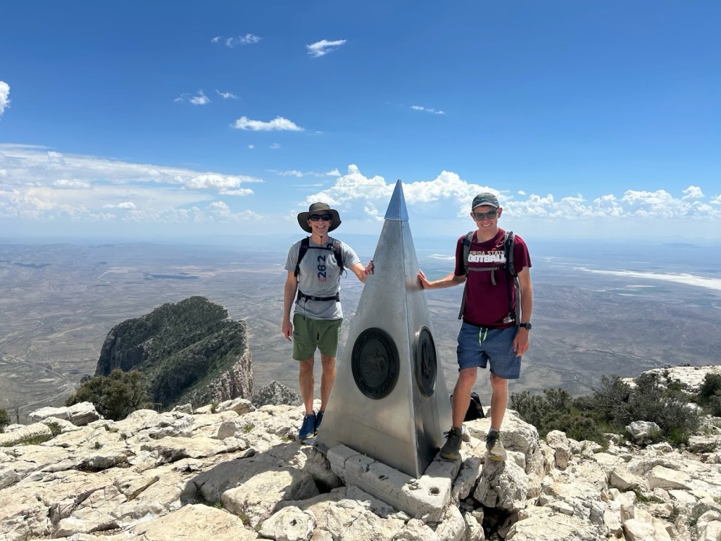
Last time Carter was up here, he and his friends buried a bottle of Tequila with the expectation that they would all hike to the top again and enjoy a celebratory shot from their past selves. The planned reunion never took place and the memory of where exactly the bottle is buried has since faded. With zero expectation of actually finding it we spent about five minute looking around the rock covered mountain top and decided that it could have a bush on top of it at this point.
Despite the unsuccessful search our spirits were still lifted and we began the hike back down.
As with most hikes the descent may be easier on the heart and lungs, but with the steep descent we have to watch our footing and do not move any quicker on the way down.
With the later start, we do not finish until after 4:30 and immediately get to work setting up camp. I could nearly set up the tent and my sleeping pad blindfolded, but Carter has a new sleeping pad and takes a little longer.
Following dinner and clean up we start get to bed fairly quickly.
Day 54: Up around 5:15. Carter is about 30 minutes behind me. He must be tired after a long day of travel and hiking yesterday, but doesn’t show it.
The plan for today is hike McKittrick Canyon in the morning then drive over to Carlsbad Caverns in the afternoon.
After finishing breakfast and the 15 minute drive we reach the road to the canyon at 7:20, however there is a locked gate across the road and a sign informing us that the road opens at 8am.
Unwilling to wait we decide to switch the order and drive over to Carlsbad Caverns. The place is all but deserted. The main attraction are the ranger led, and self-guided tours into the caverns. However, they do not open until 9am and we are not terribly interested in venturing into the caves. Instead we decide on hiking part of Old Guano Trail. It is a seven mile out and back, but we decide to only spend an hour on this trail as our big hike for the day is the canyon.
After about 30 minutes we turn around and begin the walk back to the parking lot. On the way out we see the bat amphitheater which is by the natural entrance to the cave. The bats are already inside for the day but dozens of cave sparrow are flying around at the mouth of the cave.
We stop by the now open visitor center and it’s teeming with park guests who are anxious to see the caves. Having had our fill we enjoy a few moments of a/c then drive back to Guadalupe. Although, they are a n different states (Guadalupe in Texas, and Carlsbad in New Mexico) they are only 30 minutes from each other, so the drive back is brief.
There are not many people at the trailhead when we get there around 11. The hike into McKittrick Canyon can be about as long as we could want it to be, but our chosen destination is the Grotto, which is a 7.5 mile out and back hike that follows a mostly dried river bed.
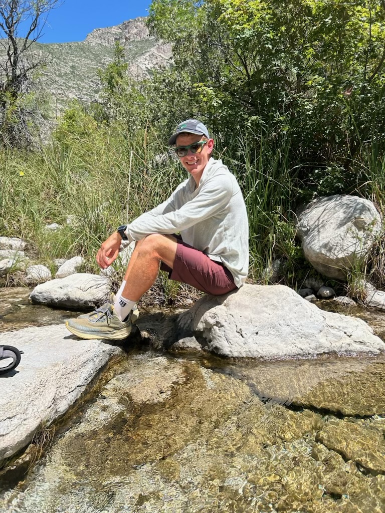
It is a fairly easy hike with minimal elevation gain and about two miles in we encounter some running water in a small creek. It’s a great spot for a break and Carter even soaks his feet for a few minutes.
Less than a mile after the creek we reach the side trail for Pratt Cabin. It’s the site of an almost 100 year old homestead of a geologist who was enamored with the canyon, and subsequently donated large tracts of land for the formation of the National Park. Much of the original structures still stand, but are closed off. There is shade and picnic tables making it a great spot for lunch.
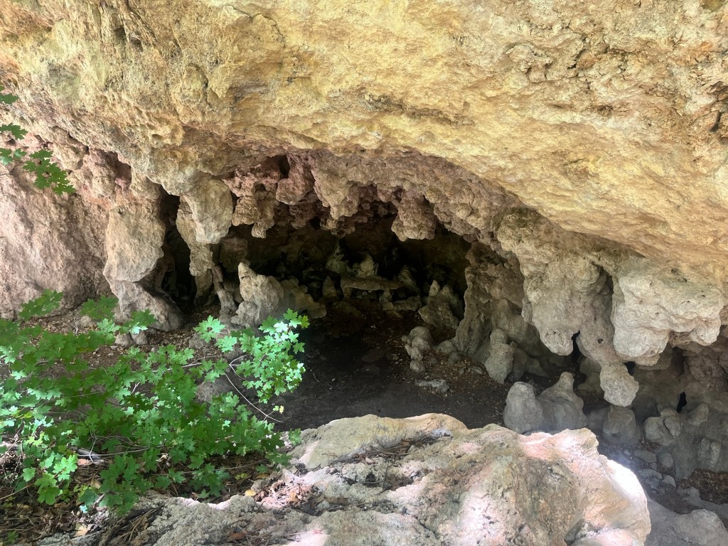
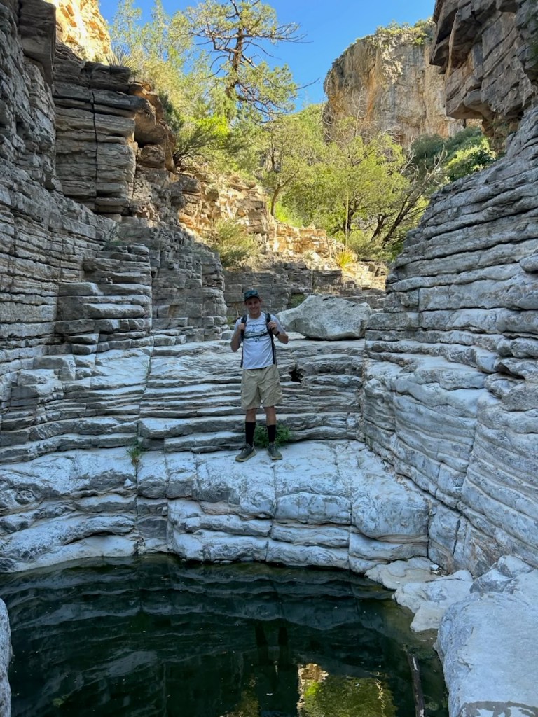
Following lunch we continue hiking out to the grotto and reach it in less than a mile. It’s a cool semi-cave like rock formation with dripping water and stalactites hanging from the roof and dripping water on the stalagmites beneath them.
With the end goal reached, and an earlier hike already under our belts we begin the return trip.
It goes fairly smooth including another break at the creek. This time I run my hat under the cool water and Carter soaks his shirt. It provides some relief from the 90 degree heat, but can not last the rest of the hike.
After the stop we finish out the rest of the trail admiring the West Texas flora along the way. Carter is particularly impressed with the Sotol Cactus which grows a large stem up to 10 feet in the air to capture pollen.
We wrap up the hike around 3 then head to the Visitor Center to get some advice on tomorrow’s hike, but mostly to enjoy some air conditioning before it closes at 4.
After the visitor center closed we hung out around camp for a while before eating dinner. Following dinner we went on a short drive to see El Capitan from a different vantage point. It is even more impressive when looking up at it from the valley than looking down from Guadalupe Peak.
Once we returned to camp we started getting ready for bed and were asleep shortly after the sunset.
Day 55: Woke up a few times in the night, but up for good shortly after 5:30. Carter wasn’t far behind and after breaking down camp and eating breakfast we are able to hit the trail by 7:30.
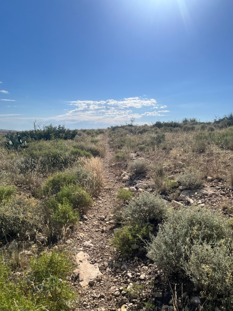
We are hiking Devil’s Hall Trail which starts not too far from the campsite and we opt to hike from there instead of driving 100 yards to the trailhead parking lot.
The hike is about 4.5 miles round trip and is an out and back hike with miles 1.5-3.5 in the “wash” (bottom point in between two ridges that becomes a river during heavy rains but is normally dry).

With the early start we are the first people in the trail and are also ahead of the heat for now.
I’m walking in front and a little over a mile in I hear a shrill hiss, and a rattle to my left. As I’m turning to see where the sound is coming from it registers just what I’ve heard. It’s a rattle snake. I begin to run before I even see it, catching only a glimpse underneath a prickly desert plant. Carter also takes a quick look as he runs out of striking distance.
We briefly stop to confirm that the other heard and saw the same thing and conclude that it was definitely a rattlesnake coiled and potentially ready to strike. I throw a rock in its general direction to see if it’s still there but hear no response. It was likely just as scared as us and slithered away. Hopefully far away.
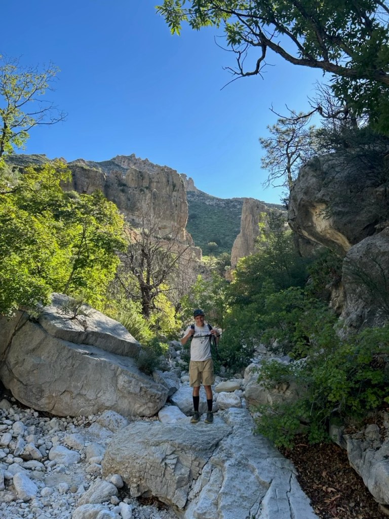
We continued the hike and soon reached the wash. As advertised the bouldering began. It was challenging, but not too challenging and was a fun change of pace.
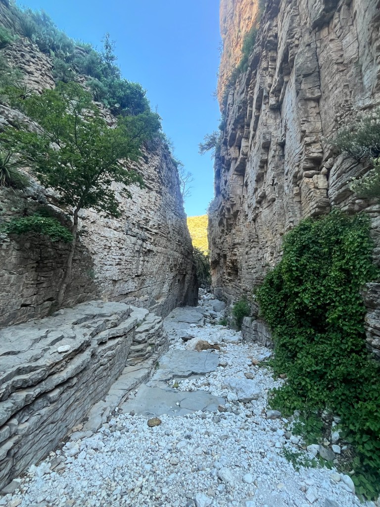
There was one section where the canyon narrowed to about 15 feet across reminding me of the Narrow hike I did in Zion back in June.
About a mile into the wash we reached the end of the trail and turned around.
For much of the hike back Carter, who is a professor in the Criminology department at FSU, gave me advice for my PhD program. I was very appreciative, but it also served as a reminder that I would soon return to the real world.
We finished out the hike before 10, and with camp already broken down prepared to go our separate ways. Carter was returning to El Paso for a flight home tomorrow, while I was driving down to Big Bend National Park.
Before leaving I refilled on water and made a sandwich to eat on the drive down. It’s about a five hour drive, plus a switch into Central Time and I was underway around 10:30.
The trip down is all highways and I’m able to continue catching up on FSU football podcasts as well as respond to some texts from friends that I hadn’t gotten to over the weekend.
By the time I get to my campsite it’s 4:30 central time. I’m situated a stone’s throw from the Rio Grande River, but can’t see it from the campsite due to heavy vegetation around it.
After setting up camp I spend some additional time in the car to take advantage of the air conditioning. My car thermostat reads close to 110, but I think it’s likely closer to 95.
I get out to make and eat some dinner, but continue to take advantage at least once ab hour before heading to bed.
It thundered earlier but the storm never came and likely never made it past the mountains, so I feel comfortable enough to sleep with the rain fly off. Hopefully it’ll continue to get cooler throughout the night and stay cool tomorrow morning for my hike.

Leave a comment